Download
1 / 3

E N D
MAPA CONCEPTUAL TOPOGRAFIA ALUMNA: ANGELICA RAMIREZ TAMANIS CATEDRATICO: ORBELIN PEREZ VAZQUEZ IIAS 3° D MODULAR
- Visitar terreno - Buscar planos existenciales - Preguntar a lugareños - Métodos y estrategias a usar en el campo RECONOCIMIENTO Y RECONOCIMIENTO Y PLAN DE TRABAJO PLAN DE TRABAJO DIVISION BASICA * Planimetria * Alquimetria * Integral - Medir distancias - Medir ángulos - Medir desniveles - Anotación dibujo, croquis en libreta de campo TRABAJO DE TRABAJO DE CAMPO CAMPO TOPOGRAFIA PRACTICA LEVANTAMIENTOS COMUNES * Catastrales * Construcción * Vías de comunicación * Trabajos subterráneos * Hidrográficos * Propiamente dicho TRABAJO DE GABINETE - Cálculos matemáticos - Decisión proseguir o regresar - Dibujar plano
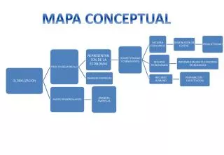
Topografía La topografía surgió como consecuencia de nuestros antepasados ante la necesidad de realizar mediciones sobre la superficie de la tierra. su división básica son tres esto para su mejor estudio Planimetría: Representa gráficamente una porción de tierra sin tener en cuenta desniveles o alturas . Altimetría: Representa gráficamente las diferentes altitudes de los puntos de la superficie terrestre respecto a una superficie de referencia. Integral: Representa gráficamente los puntos sobre la superficie terrestre tomando en cuenta posición planimétrica y altitud. PUNTO DE CONTROL EN LA TOPOGRAFIA Punto de control es aquel a partir del cual se realizan mediciones lineales o angulares y se clasifican en dos que son: Permanentes: Son creados antes y al margen del levantamiento topográfico Temporales: Son creados para la realización de un proyecto y deben desaparecer finalizado el levantamiento