Download
1 / 14

E N D
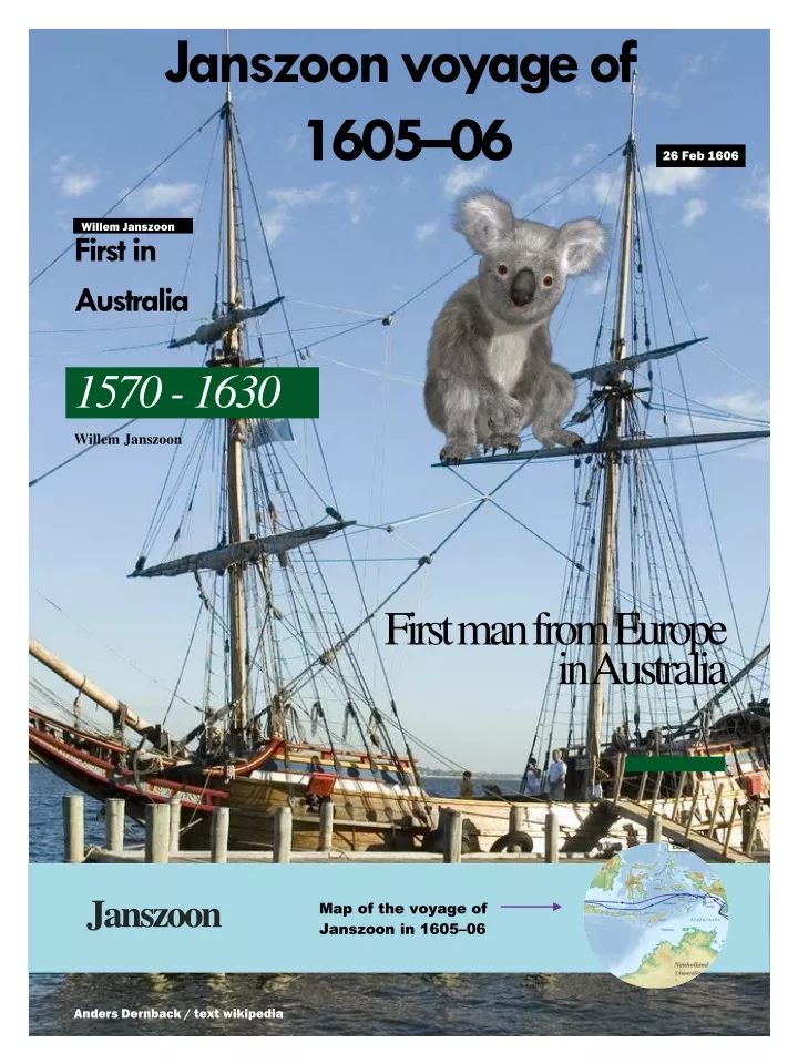
Janszoon voyageof 1605–06 26 Feb 1606 Willem Janszoon Firstin Australia 1570 -1630 Willem Janszoon Firstman from Europe in Australia Janszoon Map of the voyage of Janszoon in 1605–06 Anders Dernback / text wikipedia
Janszoon voyageof 1605–06 Willem Janszoon made the first recorded European landing on the Australian continent in 1606, sailing from Bantam, Java, in the Duyfken. As an employee of the Dutch East India Company (Dutch: Vereenigde Oostindische Compagnie or VOC), Janszoon had been instructed to explore the coast of New Guinea in search of economic opportunities. He had originally arrived in Dutch East Indies from the Netherlands in 1598 and became an officer of the VOC on its establishment in 1602. In 1606, he sailed from Bantam to the south coast of New Guinea, and continued down what he thought was a southern extension of that coast, but was in fact the western coast of the Cape York Peninsula of northern Queensland.
In 1606, he sailed from Bantam to the south coast of New Guinea He travelled south as far as Cape Keerweer, where he battled with the local Aboriginal people and several of his men were killed. As a consequence, he was obliged to retrace his route up the coast towards Cape York and then returned to Banda. Janszoon did not detect the existence of Torres Strait, which separates Australia and New Guinea. Unknown to the Dutch, the Spanish or Portuguese explorer Luis Váez de Torres, working for the Spanish Crown, sailed through the strait only four months later. However, Torres did not report seeing the coast of a major land mass to his south and is therefore presumed not to have seen Australia. Because the two separate observations of Janszoon and Torres were not matched, Dutch maps did not include the strait until after James Cook's 1770 passage through the Torres Strait, while early Spanish maps showed the coast of New Guinea correctly, but omitted Australia. Duyfken (Dutch pronunciation: also spelled Duifje, Duifken or Duijfken, was a small ship built in the Dutch Republic. She was a fast, lightly armed ship probably intended for shallow water, small valuable cargoes, bringing messages, sending provisions, or privateering.
The Duyfkenwassent to the east The Duyfken was then sent on a voyage of exploration to the east when the newly formed United Dutch East India Company (VOC) was granted a monopoly on trade to the Spice Islands by the Dutch government. On the voyage home from the Indies the Duyfken was separated from the larger ships in a storm off Cape Agulhas, southern Africa and reached Flushing in April 1603, two months ahead of the larger ships. A 1670 copy of a map drawn on board the Duyfken during her voyage of discovery along the Australian coast in 1606 from the Atlas Van der Hem
Map of Cape York Peninsula, Queensland, Australia.
Duyfkenreplica The 1999 replica of Duyfken under sail in c. 2006. A full size reproduction of the Duyfken was built by the "Duyfken 1606 Replica Foundation" jointly with the Maritime Museum of Western Australia and launched on 24 January 1999 in Fremantle.
Voyage Janszoon travelled to the Dutch East Indies in 1598 for the Oude compagnies and became an officer of the Dutch East India Company (Vereenigde Oost-Indische Compagnie (VOC) in Dutch) when it was established in 1602. After two trips back to the Netherlands, he returned to the East Indies for the third time in 1603 as captain of all the Duyfken. In 1605, he was at Banda in the Banda Islands, when—according to an account given to Abel Jansen Tasman, issued in Batavia on 29 January 1644—he was ordered by VOC President Jan Willemsz Verschoor to explore the coast of New Guinea. In September 1605, he left for Bantam in west Java—which the VOC had established as its first permanent trading in 1603—so that the Duyfken could be fitted out and supplied for its voyage. On 18 November 1605, the Duyfken sailed from Bantam to the coast of western New Guinea. Although all records of the voyage have been lost, Janszoon’s departure was reported by Captain John Saris. He recorded that on 18 November 1605 "a small Dutch pinnace departed here for the discovery of the land called New Guinea, which, it is said, may yield a great amount of wealth. Group of Natives of Tasmania
IndigenousAustralians Indigenous Australians are people who are descended from groups that lived in Australia and surrounding islands before British colonisation. They include the Aboriginal and Torres Strait Islander peoples of Australia. The term Aboriginal and Torres Strait Islander people is preferred by many First Nations of Australia, First Peoples of Australia and First Australians are also increasingly common terms. The time of arrival of the first peoples on the continent and nearby islands is a matter of debate among researchers. The earliest conclusively human remains found in Australia are those of Mungo Man LM3 and Mungo Lady, which have been dated to around 50,000 years BP. Recent archaeological evidence from the analysis of charcoal and artefacts revealing human use suggests a date as early as 65,000 BP. Luminescence dating has suggested habitation in Arnhem Land as far back as 60,000 years BP. Several settlements of humans in Australia have been dated around 49,000 years ago.
Gerritsz, Nueva Guinea, 1622, showing Janszoon'sdiscoveries Willem Janszoon returned to the Netherlands apparently in the belief that the south coast of New Guinea was joined to the land along which he sailed, although his own chart did not verify his claim to have continuously followed the coastline where the Torres Strait is found. In 1622, prior to Jan Carstenszoon’s 1623 exploration of the Gulf of Carpentaria, Hessel Gerritsz published a map, which included the coastline of part of the west coast of Cape York. Although this map shows this coast as an extension of New Guinea, it includes a note that refers to Spanish maps that differed from the Dutch understanding of the area.
Turnback According to the VOC’s Instructions to Tasman in 1644, Janszoon discovered 220 miles (350 km) of coast from 5 to 13 3⁄4 degrees southern latitude, but found "that vast regions were for the greater part uncultivated, and certain parts inhabited by savage, cruel black barbarians who slew some of our sailors, so that no information was obtained touching the exact situation of the country and regarding the commodities obtainable and in demand there". He found the land to be swampy and infertile, forcing the explorers eventually to give up and return to Bantam due to their lack of "provisions and other necessaries". Nevertheless, it appears that the killing of some of his men on various shore expeditions was the main reason for their return—he turned back where his party had its greatest conflict with aboriginals, which he subsequently called Cape Keerweer, Dutch for "Cape Turnback"
Cape Keerweer Cape Keerweer is on the lands of the Wik-Mungkan Aboriginal people, who today live in various outstations and in the nearby Aurukun Mission station. The book Mapoon, written by members of the Wik-Mungkan people and edited by Janine Roberts, contains an account of this landing passed down in Aboriginal oral history. The Europeans sailed along from overseas and put up a building at Cape Keerweer. A crowd of Keerweer people saw their boat sail up and went to talk with them. They said they wanted to put up a city. Well the Keerweer people said that was all right. They allowed them sink a well and put up huts. They were at first happy there and worked together. The Europeans gave them tobacco. They carried off the tobacco. They gave them flour—they threw that away. They gave them soap, and they threw away the soap. The Keerweer people kept to their own bush tucker. Bush tucker, also called bushfood, is any food native to Australia and used as sustenance by the original inhabitants, the Aboriginal Australians,
Returnto Banda After the alleged conflict, Janszoon retraced his route north to the north side of Vliege Bay, which Matthew Flinders called Duyfken Point in 1802. He then passed his original landfall at Pennefather River and continued to the river now called Wenlock River. This river was formerly called the Batavia River, due to an error made in the chart made by the Carstenszoon 1623 expedition. According to Carstenszoon, the Batavia River was a large river, which in 1606 "the men of the yacht Duijfken went up with the boat, on which occasion one of them was killed by the arrows of the natives". Janszoon then proceeded past Skardon, Vrilya Point, Crab Island,[g Wallis Island, Red Wallis Island to t Hooge Eylandt ("the high island", now called Muralug Island or Prince of Wales Island), on which some of them landed. The expedition then passed Badu Island to the Vuyle Bancken, the continuous coral reefs between Mabuiag Island and New Guinea. Captain Matthew Flinders (16 March 1774 – 19 July 1814) was an English navigator and cartographer who led the second circumnavigation of New Holland that he would subsequently call "Australia or Terra Australis" and identified it as a continent. Abel Tasman had circumnavigated it more widely in 1642-43 and had charted its north coast in 1644.
Explorationof the Australiancoastline Exploration of the Australian coastline Flinders in Investigator Aboard Investigator, Flinders reached and named Cape Leeuwin on 6 December 1801, and proceeded to make a survey along the southern coast of the Australian mainland. On his way he stopped in at Oyster Harbour, Western Australia. There he found a copper plate that Captain Christopher Dixson, on Elligood, had left the year before. It was inscribed, "Aug. 27 1800. Chr Dixson, ship Elligood".