Download
1 / 2
20 likes | 31 Views
Landchecker is a free online tool, which enables users to access property planning and due diligence information, through a user friendly mapping interfaceu2026. https://landchecker.com.au/<br>

E N D
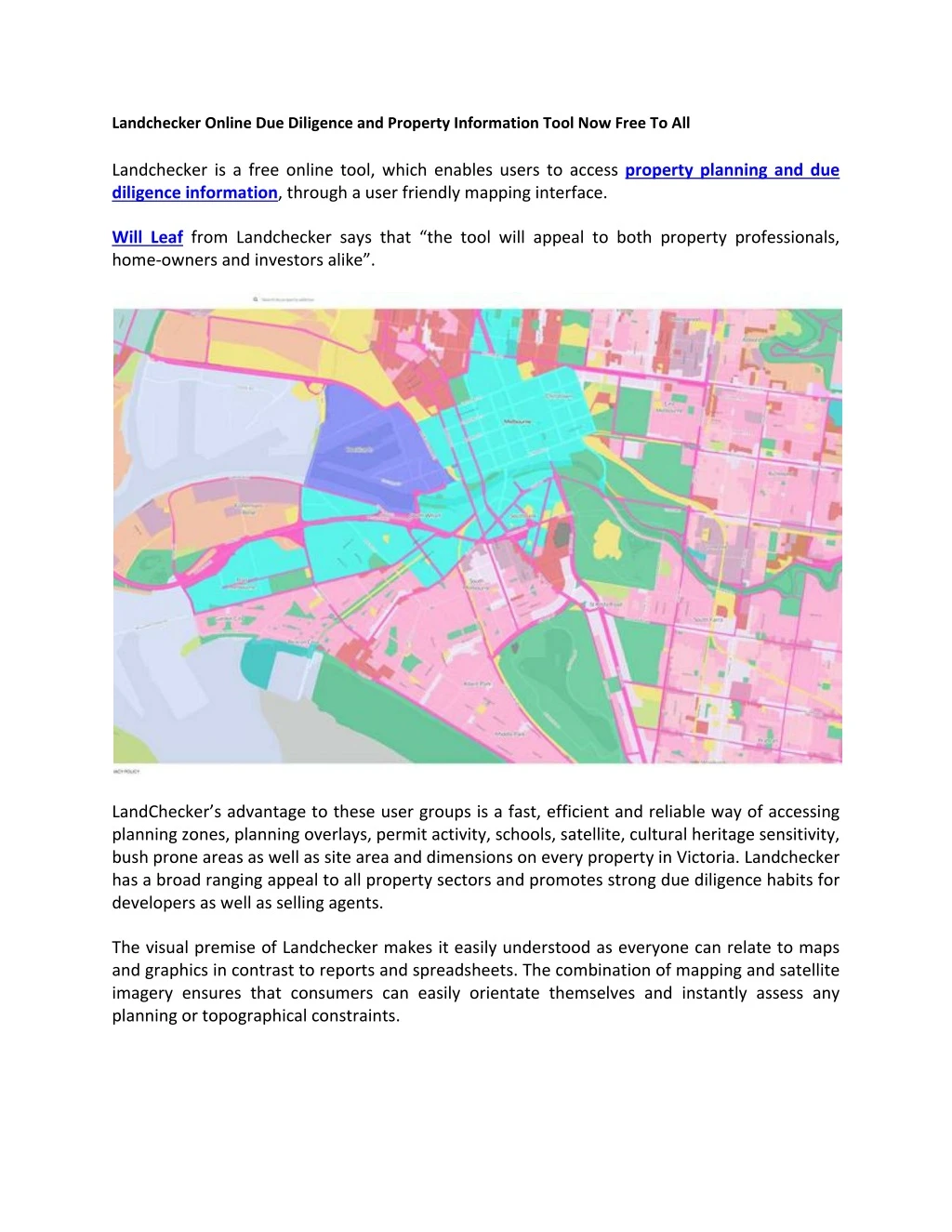
Landchecker Online Due Diligence and Property Information Tool Now Free To All Landchecker is a free online tool, which enables users to access property planning and due diligence information, through a user friendly mapping interface. Will Leaf from Landchecker says that “the tool will appeal to both property professionals, home-owners and investors alike”. LandChecker’s advantage to these user groups is a fast, efficient and reliable way of accessing planning zones, planning overlays, permit activity, schools, satellite, cultural heritage sensitivity, bush prone areas as well as site area and dimensions on every property in Victoria. Landchecker has a broad ranging appeal to all property sectors and promotes strong due diligence habits for developers as well as selling agents. The visual premise of Landchecker makes it easily understood as everyone can relate to maps and graphics in contrast to reports and spreadsheets. The combination of mapping and satellite imagery ensures that consumers can easily orientate themselves and instantly assess any planning or topographical constraints.
On the main map view, users can either work their way across Victoria with the map controls or directly search for a property address. Upon selecting an individual property, a summary appears outlining applicable planning zones, planning overlays as well as displaying nearby schools, whether the property is in a bushfire prone area or has cultural heritage sensitivity. Furthermore, users can click to view a more detailed property report - at no charge - which outlines cadastral details, municipal and council information (along with contacts for the statutory planning units in each municipality). Detailed maps and satellite images are then provided for each piece of summarised information on the property. Sign up for free and happy mapping. https://landchecker.com.au/