Download
1 / 34
340 likes | 343 Views
Explore the historical explanations for the origin of continents and the formation of mountain belts. Learn about theories like geosynclinal concept and continental drift. Discover the forces behind mountain building and the puzzle of continents drifting apart.

E N D
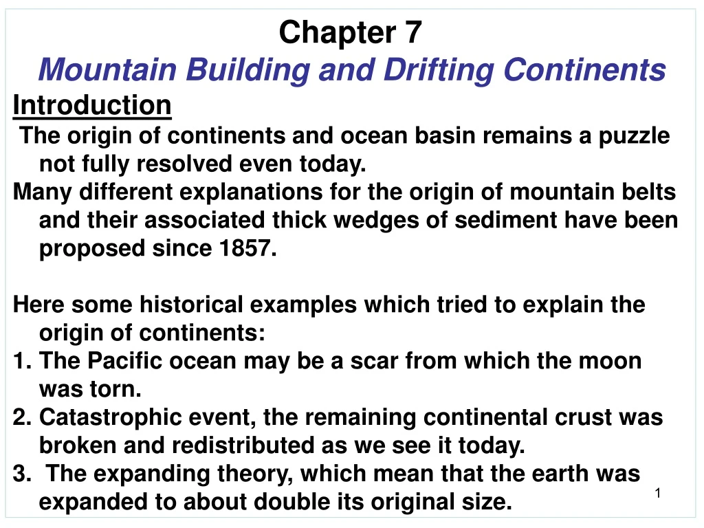
Chapter 7 • Mountain Building and Drifting Continents • Introduction • The origin of continents and ocean basin remains a puzzle not fully resolved even today. • Many different explanations for the origin of mountain belts and their associated thick wedges of sediment have been proposed since 1857. • Here some historical examples which tried to explain the origin of continents: • The Pacific ocean may be a scar from which the moon was torn. • Catastrophic event, the remaining continental crust was broken and redistributed as we see it today. • The expanding theory, which mean that the earth was expanded to about double its original size.
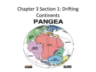
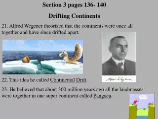
As a result , the ocean basins formed as cracks between the ruptured continents. 4. Parallelism of outlines of the opposing coasts of the South Atlantic was observed. In 1859, the first map fitting South America against Africa was published. After this event, the concept of large-scale re- arrangement of continents, or Continental drift, began to receive considerable attention. 7.1 Orogenic Belts and Mountain Building 7.1.1 The Geosynclinal Concept 1. Hall´s Theory: In 1857, Hall noted that, in the Apalachian mountains the strata of the Paleozoic Systems are not only more deformed but are also ten times thicker than are their counterparts in the Mississppi Valley.
Hall´s theory :- • The thick sedimentation along the edge of the continent depressed the crust. • The down bending crust was stretched and faulted. • The overlying sediments were compressed and folded. • The last result that a topographic mountains were raised at the surface. • Dana´s Geosynclinal theory:- • Bending of crust as the interior cooled and shrinkage. • Bending was concentrated at continental margins, where erosion of an upraised genaticline provided sediment to an adjacent geosyncline. • Finally, the crust failed, mountains raised, and the geosyncline was welded to the continent. • Repetition of this process caused growth of the continent through mountain building. Fig. 7.3
Dana reject Hall´s simple explanation of the great subsidence by sediment-loading alone because less dense sediments could not depress more dense crust nearly so much as was required by the great thickness of strata. A geosyncline was defined as an elongate belt of thick strata that was linked closely with the formation of mountains. - It shows tightly compressed folds. - low angle overthrust faults. - Most contain granitic batholiths and regionally metamorphosed rocks. Thus, geosynclines have developed within structurally unstable orogenic belts located between stable regions. The study of plates boundaries lead that these regions are fit to the : - Modern oceanic island arc-trenches. - Volcanic arcs, especially those in mid-oceans.
Until now, it is accepted that mountain belts are primarily the results of profound (deep) lateral compression across relatively narrow zones. • But what type of forces must be required to accomplish such impressive work??? • A cooling and Shrinkage Earth. • This was proposed by Dana, in his day, the universal assumption was that the earth was cooling from a molten origin. • Because it was cooling, the earth must also be contracting, and its cold , rigid crust must be bend or rupture somehow as the interior shrinks. • The most of the compressive adjustment of the crust would occur at the boundaries between continents and ocean basins, exactly where North American mountains occur now.
2. Continental Drift as a Cause of Mountain Building. • In 1908, Taylor suggested that drifting of the continents had caused wrinkling of the crust to produce all the great Cenozoic mountain systems. • The mechanism was: • The leading edges of the moving continents depressed the oceanic crust ahead to form troughs in which sediments could accumulate. • Further movement then compressed and up-heaved those strata to produce the present mountains rimming the Pacific. • The catastrophic tidal action as a force source was rejected Up-heaval of the Alpine-Himalayan resulted by the direct collision of continents.
The first detailed reconstruction of the continents was by Baker, who proposed that a single, huge landmass or Supercontinent split suddenly to form the present Artic and Atlantic oceans at the Mesozoic time. Baker, speculated a severe tidal distortion that a large portion of the continental crust was torn from the Pacific to form the moon, with the remaining continental crust rupturing and slipping toward the Pacific void (Place). This source of force was rejected because: a. No record in Cenozoic strata of a catastrophic of such magnitude. b. The last major displacements of continents began in early Mesozoic time.
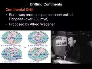
As Beker proposed the supercontinet Wagner soon introduced the drift theory. • Wagener, in 1912 introduced • the first complete and • influential statement of the drift theory. • He believed that drifting apart • of the continents occurred • over a long period during • Mesozoic and early Cenozoic • Eras. • He was the first who attempted • to reconstructed the former • suppercontinent by fitting • edges of continental shelves • rather than present • coastlines.
Besides the parallelism of the continental margins, Wagener appealed to apparent paleoclimatic indicators in late Paleozoic rocks, including glacial, desert, and tropical rain forest deposits, to reconstruct Permian climatic zones. • Fig. 7.8. • In 1921, Du Toit, support Wagener´s concept with many fossils which found • now in widely separated continents. • Wegner reconstruct the Permian continents and Paleo-climate zones.
3. Thermal Convection- Panacea for Mountain building and Drift • In 1928, Holmes stated that: • If more heat were generated in one portion of the deep mantel due to irregular • distributions of radioactive isotopes, there would tend to be a very slow • plastic flow of the hotter material upward. • As it rose, this hot material would cool and flow laterally beneath the • lithosphere. • finally, when cooler than the average mantle below, it would sink. • This mean a slow convective overturn of the mantle, like the convective • circulation of warm air in a room heated by a radiator.
Fig. 7.9 Top:convection begins to stretch an overlying continental block. Bottom: block ruptures and two fragments move apart.
7.2 Paleomagnetism- Drift´s Renaissance • The Very young lavas should show magnetization parallel • to that of the earth´s present field. • The apparent ancient pole positions should have been the • same for all continents at any given time in the past. • The magnetic minerals retain their fossil, or remnant • magnetism unless later heated above the demagnetization • temperature which is about 500ºC where the • magnetization is lost. • Thus, many rocks, containing these minerals today retain • evidence of the orientation of the magnetic field when and • where they were formed.
Fig. 7.11 The declination angle is relative to present north and is measured in a horizontal plane, it provides an indication of paleo-longitude. The inclination angle is relative to the horizontal earths surface, it provides evidence for paleo-latitude. Steep inclination of fossil magnets indicates formation of the rock at high latitude, Whereas a very low angle indicates a location near the equator.
I. Present earth showing magnetically susceptible mineral orientations (arrows) in modern rocks on three different continents. IIA. The positions of fossil magnets in rocks of the same age on each continent. Each is discordant with the field at its present position. IIB. Their pre-drift positions are found by rotating each to a paleolatitude that is concordant with the magnetic field. continent Y and Z may have been part of a single super cocontinent before they drifted to their present positions. Fig. 7.12
Fig. 7.13 Different positions of North America relative to the equator from Cambrain (1) to present time (6) according to paleomagnetic evidence. Note the progressive counterclockwise rotation and northward shift through time.
7.3 General Nature of the Sea Floor • Before 1960s, geologists assumed that the crust beneath • ocean basins was very old, topographically feature less, • structurally tranquil, and essentially fixed in place. • All these assumptions appear to be incorrect. • Profiles established by reflection of low-frequency sound • waves from sea floor and buried layers beneath have • shown that: • - Not smooth ocean floor. • - The ocean floor characterized by ridges, deep • trenches, escarpments, and countless seamount. • - The oceanic crust is more rugged than most • continental areas. • - Oceanic crust is more younger than the continental • crust.
7.3.1 Oceanic Ridges • The most striking features, especially of the Atlantic and • Indian ocean floor, are the Submarine ridges. • These ridges are scars of a pre-drift configuration of the • crust. • The oceanic ridges are made up mainly of basaltic lavas. • Show a high volcanic activity. • Ridges display only shallow seismicity beneath their • axes. • Ridges are characterized by greater than average heat • flow through the crust along their axes. • Ridges had a narrow depressions that extends along • their axis for thousands of kilometers. • Oceanic ridges are zones of extension along which the • crust is being to torn open. Ridge patterns may be • complicated by branching, each branch called Rift. • Any juncture of three separate rifts is called a triple junction.
The East African rift system. • It is part of • Carlsberg Ridge of • the northern Indian • Ocean. • The Afar Triangle • is a triple-junction • intersection of Red • Sea, Aden, and • east African rifts. • It is probably the • surface • expression of a • hot mantle plume. • Such a system of • diverging rifts • initiates new • continental drifting • episodes. • Dots indicate • young volcanoes. Fig.7.18
7.4 Sea-Floor Spreading-a Breakthrough • As mentioned before, Holmes in 1928, presented the hypothesis of convection as a cause of mountain building, this hypothesis was accepted by Wagener at the same year. • In 1962, H.H. Hess introduced the • hypothesis of sea-floor spreading: He postulated that two opposing thermal convection cells rising beneath ocean ridges cause the abnormal heat flow observed there and produce tension in the crust. Fig. 7.19 • Hess envisioned that, finally, the slow, convective flow laterally away from ridge axes carries older oceanic crust along as if on a conveyor belt, causing the spreading of sea floors through time.
Examples or application for Hess hypothesis: 1. Atlantic and Indian Oceans. 2. Eastern Africa and Arabia are today experiencing the beginning of a new phase of disruption in response to the shift of mantle convection patterns. Fig 7.18. 3. Spreading along the extension of the western Indian Ocean tore open the Aden-Red Sea rift in the crust. Fig. 7.20.
Fig. 7.19 Fig. 7.19
The suggested mechanism by which rising hot mantle plumes drive rifting and continental drifting is as follows: • A continent is situated over a deep mantle,* hot spot *. • The uplift of the flat, brittle continental plate results in the formation of a triple junction with three radiating cracks, swarms of radiating igneous dikes are commonly associated. • As two of the three main cracks get wider, two arms of the trio tend to open up to form a new ocean basin. The third (or failed) arm, which is nearly perpendicular to the opening seaway, becomes a sediment-filled trough, called Aulacogen. • So, Aulacogen is a trough formed by a rift that has failed to develop. • Example, The southward-trending East African rift system seems to be an aulacogen of the Red Sea- Aden spreading new ocean. • Although the East African rifts are tectonically active, they have not opened up as has the Red Sea-Aden system, Why?? • The East African rift systems have continental crust beneath, rather • than oceanic. • The Aulacogens have a special important: • - Many great rivers flow down it, Mississippi, Rhine and Amazon. • - Hold important petroleum resources. • - Ore deposits also may be formed where hot solutions rise along the faults bordering the troughs.
About the same time that Hess first stated his concept of sea-floor spreading, Wilson postulated that oceanic islands, which are practically all volcanic in origin, tend to be symmetrically distributed as to relative age outward from submarine ridges. That’s mean youngest islands tend to be at or near the axes of ridges, whereas those more distant are progressively older. 7.5. Confirmation of Sea-Floor spreading Sea-floor Spreading was confirmed by magnetic Anomalies, in 1961, a parallel linear magnetic anomalies unique to the oceanic crust were discovered. Fig. 7.23 and 7.24. The anomalies strips show two striking features: 1.They parallel closely the ridge axis. 2. They have a remarkable bilateral symmetry such that those on one side of the axis tend to mirror those on the other.
Anomaly map showing alternating black (high magnetic intensity) and tan (low magnetic intensity) bands for oceanic crust along the mid-Atlantic ridge southwest of Iceland. It was the strikingly symmetrical relation of such anomalies to ridge axes that led to the hypothesis that these anomalies reflect successive reversal of polarity of the magnetic field while the sea floor was spreading away from the ridges. Fig. 7.23
Oceanic crust magnetic anomalies plotted as profiles of measured magnetic intensity along straight-line crossings of South Pacific-Antarctic Ocean ridge. Note symmetry of anomalies on either side. Note also sharp contrasts of magnetic intensity peaks.
Fig. 7.26: Age of the oceanic crust based on magnetic anomalies and deep-sea drilling. Notice the intense red, orange, and yellow colors that marks the youngest rocks recently erupted along the mid-ocean ridge crests. The oldest rocks are found at the edges of the Atlantic and along western Pacific.
Fig. 7.28: Major lithosphere plates defined by the zones of active seismicity. Arrows summarize directions of plate motion, which confirm the hypothesis of sea-floor spreading by showing divergence or extension from ocean ridges and convergence or compression at volcanic arc-trench (subduction) zones.
7.6 Plate Collisions: It has been well known that erosion should be able to reduce continents to sea level in a mere 10 million years!!, Therefore the persistence of continents requires some rejuvenation mechanism, but what type of mechanism it should be ???. The principle of isostasy provided the answer. Isostasy postulates buoyant equilibrium among the larger units of the earths crust according to their total mass. This mean, thinner and/or more dense units (such as ocean basins) stand lower, whereas thicker and/or less dense ones (such as continents and mountains) stand higher. So, if a large load of sediment or ice were added, the crust would sink, whereas if some rock were removed by erosion, the crust would rise.
Fig.7.31 Several different types of lithosphere plate interactions. • Relationship of rate and angle of subduction. • Obduction of overthrusting of a slab of oceanic over continental crust. • A continent- continent collision resulting from shrinkage of an intervening ocean as subduction proceeds. • Collage tectonics resulting from multiple collisions: an arc-continent collision resulted from shrinkage of an intervening ocean by subduction at both of its margins followed by collision of a microcontinents. • S- collision suture, A- volcanic arc, M- microcontinent.
7.7 Causes of Subsidence Sedimentary basins: areas of exceptionally thick sediments vary greatly in size, shape, and tectonic setting. They include trench, forearc, foreland, intracratonic, passive margin, and rift or aulacogen basins. Fig. 7.32
The accumulation of thick sediments requires either that • sea level rose or that the underlying lithosphere subsided • during deposition- or both. • But the sea level variation can not explain the presence of • too thick sediments, therefore, the several causes of • subsidence must be considered which all are at least • indirectly related to plate tectonics. • Causes of Subsidence: • Subduction subsidance: • caused by the profound forcible depression of one lithosphere plate as it is subducted beneath another. Fig. 7.32. • 2. Thermal, or cooling, subsidence: • caused by the cooling of a lithosphere plate as it moves away from a hot, spreading ridge. Fig.7.19. • Crustal-thinning subsidence: • can provide space for thick sediment accumulation as a result of isostatic subsidence of any crust that has been thinned.
4. Sediment-loading subsidence: This type of loading is limited by the initial depth of water and ratio of densities of the loading material and of the crust and mantle beneath. 5. Thrust loading: occurs when a collision of two lithosphere plates happened, as a result, over-thrusting of thick slabs of rock onto the edge of a craton formed. Thick sediment can accumulate in the foreland sedimentary basin formed by the resulting isostatic subsidence.