Download
1 / 40
440 likes | 472 Views
Water in the Atmosphere. Earth Science Chapter 23. Atmospheric Water: States. Water in the atmosphere can exist as: solid (ice), liquid (rain), or gas (water vapor) . Types of changes: Solid to liquid: melting Liquid to gas: evaporation Gas to liquid: condensation

E N D
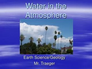
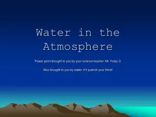
Water in the Atmosphere Earth Science Chapter 23
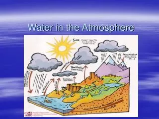
Atmospheric Water: States • Water in the atmosphere can exist as: solid (ice), liquid (rain), or gas (water vapor). • Types of changes: • Solid to liquid: melting • Liquid to gas: evaporation • Gas to liquid: condensation • Latent Heat: heat required to convert solid into a liquid or vapor, or a liquid into a vapor, without change of temperature.Water may change from one state to another by adding or taking away energy. • Most water vapor comes from lakes, oceans, marshes and glaciers. • Water vapor is spread throughout the troposphere by convection currents & wind.
Evaporation • The molecules of liquid water are always in motion • Molecules evaporate when they have sufficient energy to escape the water’s surface. • As temperature increases, the molecules gain in energy and evaporation increases. • Water and other liquids absorb heat energy from their surroundings when they evaporate. • Then the molecules left behind have less energy so that makes evaporation a cooling process.
Condensation and Dew Point • Water vapor that condenses on surfaces is called dew. Water vapor that condenses in the air forms clouds or fog. • Saturation: occurs when the medium (air) will not allow more of the solute (water vapor) to be added. • As temperature decreases, air cannot hold as much water vapor and it begins to condense on surfaces. • The temperature at which saturation occurs is called the dew point, and dew begins to form. • Condensing water vapor molecules release heat energy to their surroundings and slow down the rate at which the air cools.
Condensation Requires Nuclei • Condensation can not occur unless water vapor has something to condense upon. • The tiny particles in the air on which water vapor condense are called condensation nuclei. • Condensation nuclei are usually substances such as salt, sulfate particles or nitrate particles.
Condensation Requires Cooling • For water vapor to condense, air must be cooled below its dew point. • Air can lose heat in the following ways: • Contacting a cooler surface • Radiating heat • Mixing with colder air • Expanding when it rises
Sublimation • Change of a solid directly into vapor. • Requires dry air & below freezing temps.
https://www.eoas.ubc.ca/courses/atsc113/sailing/met_concepts/10-met-local-conditions/10f-optical-phenomena/https://www.eoas.ubc.ca/courses/atsc113/sailing/met_concepts/10-met-local-conditions/10f-optical-phenomena/ https://en.wikipedia.org/wiki/Mirage
Absolute Humidity & Capacity • The amount of water vapor actually present in the air is called the absolute humidity. • Determined by dividing the mass of water vapor by a volume of air (grams of water/ cm3 of air). • The capacity of air for “holding” water vapor depends on the temperature of the air. The warmer the air, the more water vapor it can hold. • The air’s capacity for holding water vapor roughly doubles for every rise of 11°C.
Specific Humidity (not in book) • is also known as moisture content or humidity ratio • Is the ratio of water vapor mass to the total air mass (wet & dry) • Saturation: occurs when the solvent or medium will not allow more of the solute to be added. • Saturated air occurs when the absolute humidity equals the air’s capacity. • Saturated air has a humidity of 100%.
Relative Humidity • Relative humidity compares the actual amt of water vapor in air to the maximum amt of water vapor the air can hold at that temperature. • Relative humidity is calculated using this equation: • (Specific humidity/ Capacity) x 100% = Relative humidity • Demo: RH vs Absolute Humidity
Finding Relative Humidity • Instruments used to measure relative humidity are called hygrometers. They measure the affect of the water vapor on instruments. • Experimentation is combined to form a data table that is then used to calculate relative humidity. • Psychrometers: use wet & dry bulbs. Diff tween the temps is used to find RH. • No difference = 100% RH or saturated air. • Making a psychrometer
Dew and Frost from Contact • Condensation usually happens when air is cooled below its dew point. • If the temperature is above 0°C, dew usually forms on surfaces that cool quickly. • Clear nights have greater cooling & heavier dew. • If the temperature is below 0°C, water vapor condenses into a solid called frost.
Radiation Fogs • When a surface layer of air a few hundred meters thick is cooled below the dew point, water vapor condenses in the entire layer & forms fog. • Radiation or ground fogs form under conditions similar to those that form dew.
Advection Advection fogs result when warm, moist air blows over cool surfaces.
Origin of Clouds • A cloud is a large collection of very tiny droplets of water or ice crystals that are so small and light they float in the air. • Clouds form when air above the surface cools below its dew point. • If air movement is horizontal clouds form in layers and are called stratiform clouds. • If air movement is vertical, cumuliform clouds grow in piles.
Temperature of Clouds • Clouds that form at temperatures above freezing are made of water drops. • Below freezing, clouds are mixtures of snow crystals & super cooled water. • Super cooled water is water that has cooled below 0°C without freezing. • Below -18°C, clouds are entirely snow and ice crystals.
Temperature Changes in Clouds; Dry adiabatic lapse rate • Air moves upward because of buoyancy • Air is buoyant because it is warmer than surrounding air. • Dry-adiabatic lapse rate: Cooling is caused because air is expanding due to less pressure, altho no heat energy is gained or lost. • Rising dry air cools at a rate of 1°C per 100 m
Moist-Adiabatic Lapse Rate • Air rising in a cloud does not cools as fast as rising dry air does. • The condensing water in the cloud releases heat to the air which makes it cool more slowly. • The rate of temperature change of a rising or sinking saturated parcel of air (a cloud) is called the moist-adiabatic lapse rate. • In a cloud, air cools at 0.6°C per 100 m.
Clouds with Vertical Development • Clouds with vertical development form when rising air currents are buoyant or lighter than the surrounding air. • Rising air in the cloud is warmer than the surrounding air because saturated air cools slower than dry air even tho it gets cooler as it rises. • If a shallow layer of air is unstable, cumulus clouds form. • If a deep layer of air is unstable, cumulonimbus clouds may form which produce severe thunderstorms.
Cloud Names & Meanings • Three names represent the three main cloud types. • Cirrus – thin, feathery or tufted clouds that form so high they are made entirely of ice crystals • Stratus – low sheets or layers of clouds • Cumulus – formed by vertically rising air currents, they are piled high in thick, puffy masses
More Cloud Types • All other cloud names are combinations of the original three types. • Cirrostratus – high, thin, smooth or fibrous sheets of ice-crystal clouds, indicate rain or snow • Stratocumulus – layers of round puffs, often cover the entire sky in the winter • Cirrocumulus – small globular patches of cloud made of ice crystals
Cumulus Clouds • Rising buoyant air forms cumulus clouds. • The clouds have flat bases and billowy tops. • They form over heated ground that cause the raising air to remain buoyant. • The flat cloud base is the area where the water vapor begins to condense. • The height of the cloud is called the condensation level where the temperature is equal to the dew point.
Lifting Condensation Level • The lifting condensation level is the level the air must reach for condensation to begin. • It is calculated by dividing the difference in ground air temperature and the dew point by 0.8°C and multiplying by 100. • Meteorologists use this to calculate the highest possible cloud tops.
Layer Clouds • Layer clouds form in stable air where motions are mainly horizontal. • Stable air has a lapse rate that is smaller than the moist-adiabatic lapse rate. • Clouds can form in stable air in two ways: • The air can be forced slowly upward to its condensation level or, • Layer clouds form if radiation or mixing cools a layer of air to its dew point
Even More Cloud Names and Meanings • The prefix “alto” (high) and the word nimbus (rain cloud) are also used to describe clouds. • Altocumulus – look like stratocumulus clouds, but the puffs appear smaller because they are higher up • Altostratus – stratus clouds that appear at a higher level, they appear gray or bluish and produce no halo around the sun or moon. • Nimbostratus – dark, gray layers of cloud that produce steady rain
Precipitation • Precipitation is the falling of any form of water from the air to Earth’s surface. • Precipitation occurs when cloud droplets grow heavy enough to fall to Earth. • Raindrops can form in two ways: • Warm-cloud processes • Ice processes
Warm-cloud Process • In the warm cloud process: • Tiny droplets form by condensation • The drops grow by bumping into other droplets • The bigger droplets fall faster and capture smaller droplets. • Mixing of air from different parts of the cloud results in droplets of different sizes
Ice Processes • Droplets can also form by ice processes. • Temperatures in the upper layers of clouds are below freezing. • Super-cooled water evaporates faster than ice and the water vapor condense on the ice crystals. • When ice crystals get heavy enough they begin to fall and capture smaller crystals on the way down.
Forms of Precipitation • Precipitation comes in many forms including: • Drizzle – small drops close together & fall slowly • Raindrops – larger drops that are farther apart and fall faster • Snow –six-sided ice crystal clumps, may melt as they fall • Sleet – raindrops falling thru freezing air & form into pellets of ice • Hail – a frozen raindrop that forms in cumulonimbus clouds and grows larger the longer it falls due to up & down motion
Measuring Precipitation • Rainfall is measured by an instrument called a rain gauge. • Snowfall is measured in inches and tenths of an inch and a measuring stick is typically used. • The rain equivalent is determined by melting a definite depth of snow. • On average 10 inches of snow = 1 inch of rain and varies depending on the type of snow. • Check out the NRCS (usda.gov) SNOTEL site • https://www.nrcs.usda.gov/wps/portal/nrcs/mt/snow/
Location of Precipitation • Precipitation occurs in every part of the world. • The differences in rainfall between two locations depends upon how warm air is and how far it rises, & proximity to large bodies of water or large forest areas. • Rainy areas on Earth occur where air rises in large quantities.
Rainy Areas • Areas that typically get a lot of rain include: • Windward side of mountain ranges. • Storm areas of all kinds • Areas favored by global wind belts
Dry Areas of Earth • In areas of sinking air, the air is warmed by compression and thus precipitation does not occur. • Sinking air occurs: • On the leeward sides of mountains • High-pressure areas • Areas where global wind belts diverge or blow away from an area.
Rainmaking • Two methods of rainmaking: • Method #1: Cold, solid C02 pellets are dropped into a super-cooled cloud. The pellets form ice crystals until they are heavy enough to fall. • Method #2: Artificial ice nuclei are put into the cloud. Precipitation again forms through the ice processes method.
Acid Clouds and Acid Rain • Acid rain is low pH rain that forms from sulfate & nitrate oxides released into the air. • Cloud droplets that form on these nuclei are very acidic and can cause damage to soils and plant life. • Acid rain also destroys microorganisms & plankton in lakes & streams because the water becomes to acidic, destroying the food web. • Acid rain also damages rock, concrete, metals, paints, and plastics used for buildings.