Download
1 / 4
40 likes | 154 Views
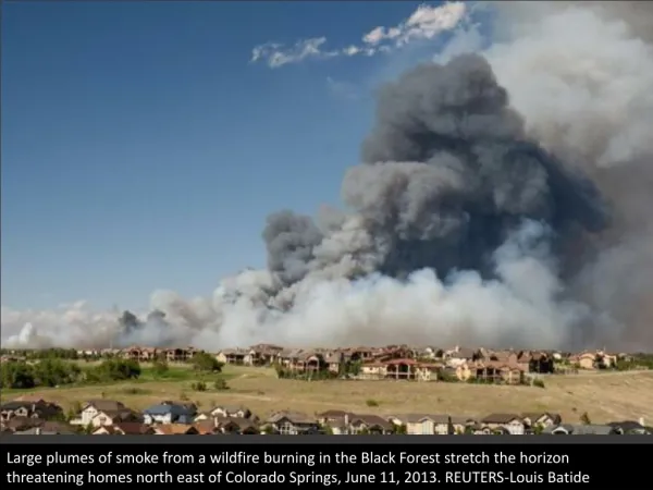
Colorado Wildfires in VIIRS. 26 June 2012 Curtis Seaman Colorado State University/CIRA. Active and visible Active (not visible) Inactive and visible Inactive (not visible). High Park. Woodland Heights. Flagstaff. Last Chance. Treasure. Lower North Fork. Springer. Waldo Canyon.

E N D
Colorado Wildfires in VIIRS 26 June 2012 Curtis Seaman Colorado State University/CIRA
Active and visible Active (not visible) Inactive and visible Inactive (not visible) High Park Woodland Heights Flagstaff Last Chance Treasure Lower North Fork Springer Waldo Canyon Sunrise Mine Little Sand Weber I-4 (3.7 mm) 19:58 UTC 26 June 2012
Active and visible Active (not visible) Inactive and visible Inactive (not visible) High Park Woodland Heights Flagstaff Last Chance Treasure Lower North Fork Springer Waldo Canyon Sunrise Mine Little Sand Weber RGB 19:58 UTC 26 June 2012 Blue: I-1 (0.64 mm) Green: I-2 (0.86 mm) Red: I-3 (1.61 mm)
Notes • Hot spots primarily identified in VIIRS channel I-4 (3.7 mm) • If the fire is hot enough, hot spots are visible in RGB composite (I-1, I-2, I-3) – bright red pixels • RGB composite also shows burn scars – dark brown pixels • Active Fires on 26 June 2012 (statistics as of 28 June 2012): • High Park Fire: ~87,000 acres (1 fatality, 250+ homes destroyed) • Numerous warm pixels (not exactly “hot”) in I-4; large visible burn scar in RGB; much of burn area obscured by clouds • Waldo Canyon Fire: ~19,000 acres (300+ homes destroyed) • Significant hot spots visible in I-4 and in RGB; visible burn scar in RGB • Saturation (367 K) reached in numerous pixels in I-4; fold-over (208 K) noted in two pixels • Little Sand Fire: ~23,000 acres • Mostly hidden by clouds; a few hot pixels visible in I-4 and RGB • Weber Fire: ~9,000 acres • Mostly hidden by clouds; visible hot pixels in I-4 and RGB • Treasure Fire: ~400 acres • A few pixels identified as warm in I-4 and dark brown in RGB • Flagstaff Fire: ~300 acres • Not visible: obscured by the thunderstorm cloud that created it • Inactive Fires • Last Chance Fire: ~45,000 acres (“several” homes destroyed), contained on 26 June 2012 • Large burn scar visible in RGB; some heat signature in I-4 • Sunrise Mine Fire: ~6,000 acres, contained on 3 June 2012 • Visible burn scar in RGB • Springer Fire: ~1,000 acres, contained on 23 June 2012 • Not visible: obscured by clouds • Woodland Heights Fire: ~20 acres (22 homes destroyed), contained on 25 June 2012 • Not visible: obscured by clouds • Lower North Fork Fire: ~4,000 acres (3 fatalities, 25 homes destroyed), contained on 2 April 2012 • Not visible: obscured by clouds