Download
1 / 29
290 likes | 391 Views
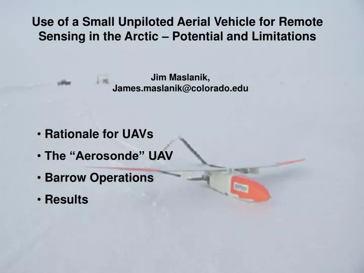
Use of a Small Unpiloted Aerial Vehicle for Remote Sensing in the Arctic – Potential and Limitations. Jim Maslanik, James.maslanik@colorado.edu. Rationale for UAVs The “Aerosonde” UAV Barrow Operations Results. Potential Research/Application Areas.

E N D
Use of a Small Unpiloted Aerial Vehicle for Remote Sensing in the Arctic – Potential and Limitations Jim Maslanik, James.maslanik@colorado.edu • Rationale for UAVs • The “Aerosonde” UAV • Barrow Operations • Results
Potential Research/Application Areas • surface characterization / time-space variations • ice-atmosphere interactions • ocean temperatures – local/regional variations, forcings • polar clouds and radiation • satellite product validation • coastal processes (erosion, productivity, currents) • wildlife studies • vegetation / lake studies • search and rescue • …
Aircraft Support Issues for Polar Research • research-grade aircraft • easily deployable with less long-range planning needed • ability to stay on site for long periods • low cost • minimum hassle • basic instrument suite • long range/duration • multiple aircraft • …
Why UAVs? • Considerations: • safety • access • operating conditions • logistics and cost
Why UAVs? • access • local impacts
The Aerosondetm Unpiloted Aerial Vehicle • Design philosophy: • fully robotic • low cost per plane (approx. $50,000) • low/moderate operations/logistics costs • long range/flight duration • small but effective payload capacity • flexible communications/operations modes
Advantages/Disadvantagesof the Aerosonde • Relatively low cost • Ease of deployment • Global sat-comm operation • Range and multi-plane capabilities • payload restrictions • no “see and avoid”
Manufactured and operated by Aerosonde, Ltd., Melbourne (www.aerosonde.com) • Instrument Payloads: • air temp., RH, wind speed and direction • digital camera (800 image capacity) • infrared pyrometer (skin temps., cloud top temps.) • video (visual and thermal: long-range transmission) • icing sensor • imaging radar, profiling laser, pyranometers, cloud particle sampler • ozone sampler, profiling spectrometer, turbulent flux measurements
Multi-Plane / Long-Duration Mission Configurations • aircraft at multiple altitudes • two planes flying in tandem • tag-team missions
Mission Planning and Control Lead Mission: 29 March 2003 Profiles Survey Legs
Engineering accomplishments for operations in cold regions • Oil heating • Icing sensor for avoidance • Insulate electronics • Replace carburetor with fuel injection system • Strengthened airframe to withstand icing
Limitations: • airframe icing • availability and maintenance of launch/landing areas • payload/power restrictions • availability and scheduling • cost • local impacts • FAA restrictions
james.maslanik@colorado.edu curryja@eas.gatech.edu g.holland@aerosonde.com www.aerosonde.com
Lead Processes and Surface Temperature Studies air temperature skin temperature wind direction
Mesoscale variability caused by open water downwind upwind
4am ADT, Tuesday, July 29 Improving Weather Forecasts L Winds: West-southwest at 38 mph, Gust of 49 mph, Temperature: 47°F
Surface Characterization Shoreline/Vegetation Mapping
Potential Contribution to Other Programs • SEARCH • RIME • EOS / NPOESS • PARCA • Int. Polar Year • …
Links and Contacts www.aerosonde.com http://polarbear.colorado.edu/barrow03/ James.maslanik@colorado.edu Curryja@eas.gatech.edu g.holland@aerosonde.com
Major (Barrow Area) Limiting Factors / Solution Options • #1.FAA flight restrictions • FAA limits flight operations to outside 12 miles from shore • FAA requires visual-flight-rule (VFR) conditions for take-off (Aerosondes are capable of operating under IFR conditions) • increased FAA flexibility, clearly-defined FAA technology requirements for UAVs, new flight monitoring technology (e.g., “Capstone” program) • #2. Airframe icing • detect and avoid icing conditions through onboard instrumentation and mission planning • anti-icing engineering • #3. Cross-winds • presently limited to east-west launch tracks • launch procedure mods. • additional launch area