Download
1 / 42
430 likes | 554 Views
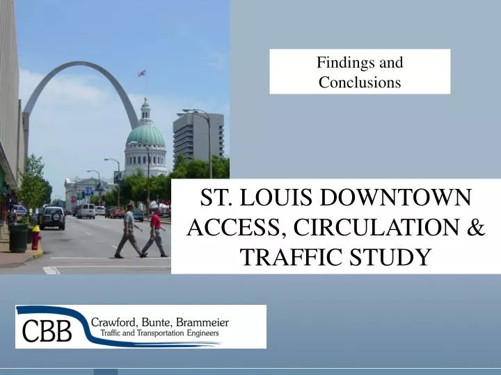
Findings and Conclusions. ST. LOUIS DOWNTOWN ACCESS, CIRCULATION & TRAFFIC STUDY. Study Area Map. Goals & Objectives.

E N D
Findings and Conclusions ST. LOUIS DOWNTOWN ACCESS, CIRCULATION & TRAFFIC STUDY
Goals & Objectives • Identify measures to improve motorist’s access and vehicular movement throughout the CBD, while enhancing the safety and attractiveness of Downtown to pedestrians and making street-level retail more attractive and safe for customers. • Emphasis on addressing changes proposed by the Downtown CBD Streetscape Plan and to respond to specific issues raised for this evaluation.
Study Guidelines • St. Louis Downtown CBD Streetscape Plan • “Street Hierarchy” vs. Functional Classifications • Proposed Conversion of Several Streets • Downtown Development Plan • Stakeholder Survey Results and Identification of Primary Issues
Stakeholder Survey • Primary sources of frustration are signal operations, unnecessary delays and obstructions; • Strong desire for peak period parking restrictions, more aggressive enforcement and consistent street patterns; • Competing emphases between access to/from the CBD (a concern of the existing office uses) and mobility within the CBD (a concern of the up and coming residential & commercial developments); • Priorities for improving circulation and/or decreasing delay include simplified signal operations and more liberal regulations.
Study Elements • Vehicular Access To & From CBD • Improved Traffic Operations • Improved Circulation: 1-Way Vs. 2-Way • Pedestrian Accommodations • On-Street Parking Treatments, Loading Zones & Cab Stand Observations • Evaluation of Key Landmarks
Vehicular Access To/From CBD To/From Highway 40 (I-64) West
Vehicular Access To/From CBD To/From I-55/70/64 East (Illinois)
Vehicular Access To/From CBD To/From I-70 West
Vehicular Access To/From CBD To/From I-55 South & I-44 West
Vehicular Access To/From CBD To/From North City, Midtown / CWE and South City
Vehicular Access To/From CBD Anticipated Changes in Vehicular Access To/From the CBD Due to the New Mississippi River Bridge
Improved Traffic Operations Signal Coordination & Simplified Phasing: • Advanced Traffic Management System (2006) • Upgraded signal equipment & fiber optic communications. • Optimized signal timing for priority corridors. • Fewer stops, less delay, improved traffic flow. • Simpler – two phase – operations for motorists and pedestrians. • Increased flexibility in the use of the system (special events, sporting event, different flashing modes, etc.)
Improved Traffic Operations Improved Traffic Signal Operations
Improved Traffic Operations Operational & Regulatory Enhancements: • Modification of “Flashing” operations • Inner core signals flash ~7:00 p.m. • Arterial signals flash ~10:00 p.m. • Allow LTOR at One-Way Streets • Maneuver is already common-place. • Not currently allowed in Missouri; legislative action is required. • Would require aggressive public education.
Improved Traffic Operations Operational & Regulatory Enhancements: • Standardization of RTOR • Perceived lack of consistency in application & enforcement. • Contributes to delay and disrupts circulation. • Some RTOR restrictions will be warranted. • Restrictions could increase pedestrian conflicts. • Promote countermeasures to reduce pedestrian conflicts (small radii, curb bulbs, signage).
Improved Traffic Operations Modification of Traffic Control: • Spruce & 11th – Potential signalization and lane modifications. • Walnut & 11th – Potential signalization. • Walnut & 9th – Potential signalization. • Walnut & Tucker – Potential signalization. • 4th & Locust – Pedestrian signal enhancements. • Broadway & Locust – Pedestrian signal enhancements and turning restrictions.
Improved Traffic Operations Miscellaneous “Spot” Improvements: • Pavement markings to reinforce lane utilization and provide improved guidance. • Addition or clarification of dual left-turn lanes and dual right-turn lanes at selected locations. • Modifications of Memorial Drive at Pine, Chestnut, Market and Walnut to reduce conflicts, improve compliance, improve efficiency and reduce confusion.
Improved Traffic Operations Recommended Modifications Along Memorial Drive
Proposed Streetscape Modifications Tucker Boulevard Reconfiguration: • Eliminates “extra” lanes (two southbound, one northbound). • Provides obvious streetscape and “calming” benefits. • Will require extensive signal, striping and signage modifications and restrictions of peak period parking. • Could facilitate two-stage pedestrian crossings (with refuge) and improved signal timing along Tucker. Reconfiguration can be accommodated.
Proposed Streetscape Modifications Tucker Boulevard Streetscape Treatment
Proposed Streetscape Modifications Vision for CBD: • Two-way streets to address concerns about access, mobility and vitality. • Improved access, circulation and convenience for street-level retail.
Proposed Streetscape Modifications Existing Street Patterns
Circulation: 1-Way vs. 2-Way Recommended Street Conversions: Downtown Streetscape Plan
Circulation: 1-Way vs. 2-Way Existing Circulatory Patterns: • Odd number of north-south streets creates an imbalance. • Street grid is interrupted in several locations. • Temporary closures exacerbate conditions. • Consecutive southbound streets (Broadway & 6th) results in poor circulation. • Lack of complement to eastbound Walnut. • Some landmarks are located on blocks with non-complimentary orientations (Laclede Gas Bldg).
Circulation: 1-Way vs. 2-Way • One-way flow improves capacity, reduces delay and allows more efficient signal operations. • One-way flow affects retail operations, creates more adverse travel, increases turning movements and can be confusing to visitors. • Two-way flow provides improved mobility and access, reduces confusion and provides calming benefits.
Circulation: 1-Way vs. 2-Way Conversion of existing one-way streets will… • Increase visibility & convenience for street-level retail and reduce confusion for visitors. • Will adversely affect signal operations, reduce capacity and cause more congestion. • May cause loading, parking maneuvers and turning movements to disrupt flow and may adversely affect access to some parking facilities.
Circulation: 1-Way vs. 2-Way Evaluation of Streetscape Plan: Conversion of 8th Street • “Natural” two-way spine for Downtown. • Enhanced circulation in vicinity of Laclede Gas, U.S. Bank Plaza and improved access to new Highway 40 ramps at Gratiot. • Consistent with Ballpark Village modifications. • Cross-section will pose capacity constraints. • Potentially significant transit impacts. APPROPRIATE
Circulation: 1-Way vs. 2-Way Evaluation of Streetscape Plan: Conversion of 9th and 10th Street • Enhanced circulation in vicinity of Old Post Office and Renaissance/Mayfair. • Conflicts with access at Highway 40 and disrupts access to I-70. • Conflicts with SBC garage ramps. • Adverse impact on Metro Bus operations • Requires 8 signal modifications. INAPPROPRIATE
Circulation: 1-Way vs. 2-Way Evaluation of Streetscape Plan: Conversion of 11th Street • Enhanced access to loft district and retail. • Relatively lightly traveled. • Safety/alignment concerns at Spruce/Highway 40 off-ramp and offset intersection with Market • Requires up to 8 signal modifications. • Can be accommodated north of Market. APPROPRIATE (with limitations)
Circulation: 1-Way vs. 2-Way Evaluation of Streetscape Plan: Conversion of Walnut Street • Enhanced access to Ballpark Village and Pavilion. • Relatively lightly traveled. • Limitations at Memorial. • Requires up to three new signal installations and modifications of four others. • Requires enforcement of double parking and elimination of some parking near Tucker. APPROPRIATE
Circulation: 1-Way vs. 2-Way Evaluation of Streetscape Plan: Conversion of Locust Street • Enhanced access to Old Post Office and retail. • Relatively lightly traveled. • Potentially significant impact on Metro Bus operations. • Limitations at Broadway and Tucker and it isolates Olive as a one-way street. • Narrow width near 6th and 7th would require elimination of parking/stopping and potentially some widening. INAPPROPRIATE (but viable)
Circulation: 1-Way vs. 2-Way Consideration of Additional Alternatives: Evaluation of Pine Street as Two-Way • Westbound leg of “couple” with Chestnut. • Important freeway access route. • Concentration of parking facilities results in heavy commuter flows. • Intersections with Memorial, 4th & Broadway aren’t conducive to two-way, and blockages at garages and loading docks would be too disruptive. INAPPROPRIATE
Circulation: 1-Way vs. 2-Way Consideration of Additional Alternatives: Conversion of Olive Street • Enhanced access to Old Post Office. • Complements potential conversion of Locust. • Closure of Locust at Broadway creates increased demand for a westbound street. • Potentially significant impact on Metro Bus operations. • Significant constraints (lane restrictions) from 9th through 6th would require elimination of parking/stopping/loading and potentially widening. INAPPROPRIATE (but viable)
Circulation: 1-Way vs. 2-Way Consideration of Additional Alternatives: Conversion of 6th / 7th Street • Enhances access to Metropolitan Sq., Laclede Gas and U.S. Bank (corrects existing problem with consecutive SB streets) and improves circulation west of Broadway. • Relatively lightly traveled corridors. • Potentially significant impact on Metro Bus operations. • Significant constraints (lane restrictions) from Washington through Pine would require elimination of parking/stopping and potentially some widening. INAPPROPRIATE (but viable)
Circulation: 1-Way vs. 2-Way Alternative Circulatory Plan
Pedestrian Accommodations • Evaluate maintenance needs of existing pedestrian equipment. • Standardize & update pedestrian signal heads with pedestrian friendly equipment. • Provide pedestrian signals at all signalized intersections. • Simplify pedestrian operations at signalized intersections. • Provide supplemental signage to reinforce the requirement for motorists to yield to pedestrians.
Pedestrian Accommodations • Provide ADA compliant accessibility ramps at each intersection. • Install audible pedestrian heads for the visually impaired where specific needs have been identified.
Pedestrian Accommodations Treatment of Pedestrian Barriers: • Narrowing of crossings of Tucker Boulevard and provision of a pedestrian refuge. • Enhancing the signalized crossings of Market Street. • Elimination of pedestrian/vehicle conflicts at Memorial Drive. • Elimination of pedestrian/vehicle conflicts on Broadway at I-64 westbound.
Treatment of On-Street Parking & Loading Zones • Establish more consistent regulations. • Provide more aggressive & consistent enforcement of regulations. • Consider additional angled parking on 11th Street. • Provide short-term parking in the vicinity of street-level retail or convenience oriented uses. • Remove peak period parking restrictions on Market Street.
Treatment of On-Street Parking & Loading Zones • Additional on-street parking recommended at specific locations. • Discourage parking on Washington Avenue during peak traffic periods. • Consider alternative methods of parking control (e.g., Pay & Display systems).
Treatment of On-Street Parking & Loading Zones • Provide more aggressive enforcement of loading zones regulations. • Restrict parking and provide commercial loading zones adjacent to Metropolitan Square. • Prohibit on-street loading during peak periods along 8th Street. • Enhance Poplar Street to accommodate potential closure of Spruce Street east of Broadway. • Establish cab stands at designated locations.