Download
1 / 11
110 likes | 283 Views
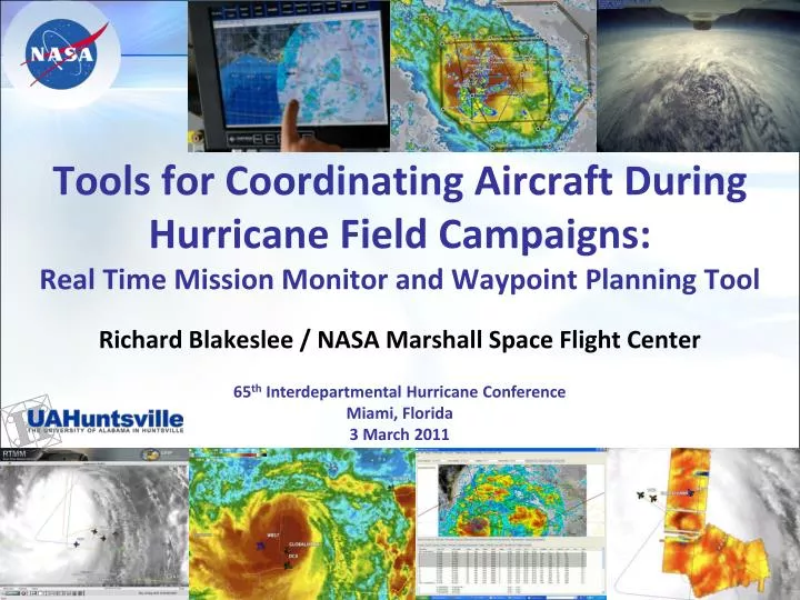
Tools for Coordinating Aircraft During Hurricane Field Campaigns: Real Time Mission Monitor and Waypoint Planning Tool. Richard Blakeslee / NASA Marshall Space Flight Center. 65 th Interdepartmental Hurricane Conference Miami, Florida 3 March 2011. Acknowledgments. Team Members

E N D
Tools for Coordinating Aircraft During Hurricane Field Campaigns:Real Time Mission Monitor and Waypoint Planning Tool Richard Blakeslee / NASA Marshall Space Flight Center 65th Interdepartmental Hurricane Conference Miami, Florida 3 March 2011
Acknowledgments • Team Members Michael Goodman NASA MSFC Co-Principal Investigator John Hall UAHuntsville Lead Developer, RTMM Matt He UAHuntsville Lead Developer, WPT Paul Meyer NASA MSFC Systems Developer Helen Conover UAHuntsville Project Manager Kathryn Regner UAHuntsville Systems Engineer Danny Hardin UAHuntsville Web Team Lead Tammy Smith UAHuntsville Web Design and Development Michele Garrett UAHuntsville Systems Administrator • Users and Collaborators • Provided valuable suggestions and feedback that have contributed to steady improvements in RTMM and WPT • Special thanks to Michael Black, NOAA HRD, who has certainly been one of our power users! 2
Real Time Mission Monitor“Making Science Easier” Integrates satellite, airborne, and surface data sets Tracks airborne vehicle state information Displays model and forecast parameter fields Utilizes a distributed Web-based architecture The Real Time Mission Monitor (RTMM) is an interactive visualization application that provides situational awareness and field asset management to enable adaptive and strategic decision making during airborne field experiments. Screen capture of RTMM on 12 Sept 2006 showing DC8 flight of Tropical Storm Helene during the NAMMA field campaign. 3
RTMM Applications“Making Science Easier” Pre-flight planning Model and forecast fields Satellite overpass predicts Waypoint Planning Tool In-flight monitoring and adaptive flight strategies Operations center focal point Current weather conditions Plane-to-plane data transfer Post-flight analyses, research, and assessments Encapsulate and replay missions RTMM supports all phases of field experiments Matt He works aboard the NASA DC-8 during a flight over the Gulf of Mexico, Tuesday, Aug. 17, 2010. Photo Credit: (NASA/Paul E. Alers) 4
RTMM User Base“Making Science Easier” Research Scientists Program and Project Managers Pilots and Flight Engineers Educators and Students Media and Public Affairs Science Attentive Public RTMM available for use by user base that includes: Mission Scientists John Molinari and Richard Blakeslee use RTMM on the DC-8 during the Hurricane Earl flight on 1 Sept 2010. RTMM enables: • Real time interactions and collaborations • Post-flight mission review and case study development RTMM used in the cockpit of the DC-8 during GRIP on September 6, 2010. 5
RTMM 2nd Generation“Making RTMM Better” • Implemented RTMM from a web portal using applications on a common framework for science data visualization and airborne mission management. • Move RTMM from desktop to web browser application • Simplify and enhance the user interface and functionality • Seamlessly integrate multiple applications • Use standard access methods for data, tools, and services • Enhanced features in the Waypoint Planning Tool in response to feedback from scientists and aircraft pilots • Support multiple formats for output data • Provide for improved visualizations and ease of use 6
2nd Generation User Interface • Multiple windows within the interface to support multi-tasking using different RTMM tools • Many different layouts possible • Easy set-up and configuration • Integrates and displays multiple data types and sources Screen shot on 16 Sept as Global Hawk, WB-57, and DC8 enter the Gulf for a rendezvous with Hurricane Karl 7
Field Campaign Support • Supported many field campaigns, including inter-agency hurricane studies (e.g., TCSP, NAMMA), since 2005 • Earlier campaigns used heritage RTMM applications • Genesis and Rapid Intensification Processes (GRIP) Experiment • 15 Aug to 30 Sep 2010, closely coordinated with NOAA IFEX and NSF PREDICT • Tracked 9 aircraft (3-NASA, 3-NOAA, 1-NCAR, 2-AF), flying from different locations • Winter Storms and Pacific Atmospheric Rivers (WISPAR) Experiment • NOAA/NASA/NSF Global Hawk flight to the North Pacific and Arctic • February, March 2011 (still underway) 9
Hurricane Karl on 16 September 2010 Seven separate aircraft flew over and through H. Karl as it approached the Mexican coast. Animation includes colorized IR and lightning flashes 10
Summary • RTMM has evolved into a powerful and easy to use application in support of planning, situational awareness and strategic decision-making during airborne field campaigns. • NASA is very open to sharing these capabilities with any interested group through interagency collaborations in future field activities. For additional information about RTMM or WPT please contact: rich.blakeslee@nasa.gov, phone 256.961.7962 11