Download
1 / 10
110 likes | 521 Views
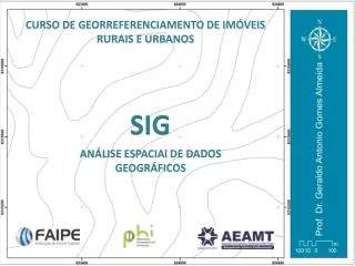
PENGANTAR SIG. GALIH WASIS WICAKSONO TEKNIK INFORMATIKA. Sejarah Peta. Peta pertama ditemukan di mesir (1292-1225 SM) menggamabar lokasi tambang . Peta abad berikutnya berkembang di arab untuk tujuan perdagangan , pelayaran dan ekplorasi . Peta geologi pertama 1811 di paris

E N D
PENGANTAR SIG GALIH WASIS WICAKSONO TEKNIK INFORMATIKA
SejarahPeta • Petapertamaditemukandimesir (1292-1225 SM) menggamabarlokasitambang. • Petaabadberikutnyaberkembangdiarabuntuktujuanperdagangan, pelayarandanekplorasi. • Petageologipertama 1811 diparis • Petajalankeretaapidiirlandia 1888. • Fotoudarapertama 1909.
Sejarahperangkatlunak SIG • CGIS (Canadian Geographic Information System) tahun 1963, duatahunkemudiandikembangkandi AS dengannama MIDAS. • 1976 norwegiamulaimengembangkankompilasipendaftarantanahnasionalberbasiskomputerdanselesai 1980. • Tahun – tahunselanjutnyaseiringdenganperkembangankomputer, teknologi GIS pun semakinberkembang.
Perusahaan Pengembang SIG • Esri : - Arcinfo - Arcview • Map Info Corp. : - Map info
Esensi SIG • Jenis data : • Data ygmerepresentasikanaspek – aspekkeruangan, posisi, koordinat, ruangdisebutspasial • Data ygmerepresentasikan items, propertisbahkanwaktudisebut data non-spasial. • Jenis data spasialdigunakandalamalat bantu sistem – sistemperancangan CAD (computer aided design)
TeknikPerolehan Data Spasial • Sistemsatelitpenentuanposisi (navigasi) yang makinakuratdanbisadiakseskapandandimanasaja, contohGlonass, GPS danGallileo • Perangkat total station yang dapatmenghasilkan data ukuranterestrisberskalabesar • Perangkat Digital echo-sounder single/multi beam • Provider penyedia data spasial (citrasatelit, fotoudara, DEM) contohgoogle map, google earth, yahoo map dll.
Perangkat SIG Open Source • ILWIS • Map window • Quantum GIS • Map server • Diva GIS • Grass GIS • PostgreSQL (PostGIS)
Perkembangan GIS diakademik • Havard University : • SYMAP (synagraphic mapping) 1964 • CALFORM, SYMVU, GRID, 1960 • POLYVRT 1970 • ITC Belanda • ILWIS (integrated land and water information) • Clark University, AS • IDRISI
Minnesota University • Mapserver • Utah State University dan Idaho State University • MapWinGis (MapWindow)