Download
1 / 35
350 likes | 356 Views
This presentation explores the use of GIS in natural resource management, including current problems, the integration of GIS, and examples of its application. Presented by Phil Hurvitz, a GIS Specialist from the College of Forest Resources at the University of Washington.

E N D
GIS Applications in Natural Resource Management presented atCommon Ground, Common WaterSkill Standards WorkshopNovember 8, 2001Hood Canal Institute at Theler Wetlands by Phil HurvitzGIS SpecialistCollege of Forest ResourcesUniversity of Washington Phil Hurvitz 1
Overview • Current problems in natural resource management • Introduction to GIS • How does GIS fit into natural resource management? • Examples of GIS use • GIS in Education Phil Hurvitz 2
Overview • Current problems in natural resource management • Introduction to GIS • How does GIS fit into natural resource management? • Examples of GIS use • GIS in Education Phil Hurvitz 3
Current problems in natural resource management • Habitat loss/endangered/exotic species • Unsustainable resource use/extraction • Terrestrial, aquatic, & atmospheric pollution • Climate change • Population growth Phil Hurvitz 4
Current problems in natural resource management • Responsible management is possible only with high quality data and analysis • Problems are complex • Solutions to problems are complex • Powerful tools are needed • Capable professionals are needed • Education is crucial to success Phil Hurvitz 5
Overview • Central problems in natural resource management • Introduction to GIS • How does GIS fit into natural resource management? • Examples of GIS use • GIS in Education Phil Hurvitz 6
Introduction to GIS • Geographic Information Systems • Integrated system for the capture,management,manipulation,analysis, anddisplay of spatially referenced data Phil Hurvitz 7
hardware, • software, • data, • people, and • methods Introduction to GIS • Components of a GIS Phil Hurvitz 8
Introduction to GIS • Geographic Information Systems/Science • Convergence of several technologies maturing through the 1950s-90s • CAD/CAM • Relational database management systems • Satellite remote sensing • Global positioning system (GPS) Phil Hurvitz 9
Introduction to GIS • Geographic Information Science • Evolution from a technology to a science • Standardized curricula • Standardized methods • More than simply a technical tool • Legitimizing of a discipline Phil Hurvitz 10
Introduction to GIS • GIS analysis • GIS treats real-world spatial features as combinations of geometric primitives and database records • GIS analysis and processing uses specialized applied geometric, mathematical, and relational operators on the basic features/records Phil Hurvitz 11
Introduction to GIS • Spatial data model: points Phil Hurvitz 12
Introduction to GIS • Spatial data model: lines Phil Hurvitz 13
Introduction to GIS • Spatial data model: polygons Phil Hurvitz 14
Introduction to GIS • Spatial data model: raster Phil Hurvitz 15
Introduction to GIS • Spatial/tabular data model Phil Hurvitz 16
Introduction to GIS • Spatial/tabular data model Phil Hurvitz 17
Introduction to GIS • Spatial referencing in GIS Phil Hurvitz 18
Overview • Central problems in natural resource management • Introduction to GIS • How does GIS fit into natural resource management? • Examples of GIS use • GIS in Education Phil Hurvitz 19
GIS & natural resource management • Nearly all resource management problems are spatial in nature or have a strong spatial component • Most natural resources are tied to a particular place • Knowledge of the properties of a place is crucial to understanding of place Phil Hurvitz 20
GIS & natural resource management • GIS is the leading integrated system for storing and analyzing space-related data • All natural resource management organizations are using GIS • Government • Industry • NGOs Phil Hurvitz 21
GIS & natural resource management Phil Hurvitz 22
Overview • Central problems in natural resource management • Introduction to GIS • How does GIS fit into natural resource management? • Examples of GIS use • GIS in Education Phil Hurvitz 23
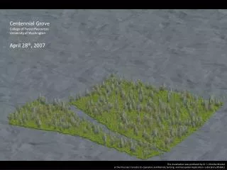
Examples of GIS use • Basic ecological research Phil Hurvitz 24
Examples of GIS use • Management: identification of landscape areas meeting particular complex criteria • 50-70 year old forest Phil Hurvitz 25
Examples of GIS use • Management: identification of landscape areas meeting particular complex criteria • 50-70 year old forest • < 100 m to a stream Phil Hurvitz 26
Examples of GIS use • Management: identification of landscape areas meeting particular complex criteria • 50-70 year old forest • < 100 m to a stream • > 50 m from a road Phil Hurvitz 27
Examples of GIS use • Management: identification of landscape areas meeting particular complex criteria • 50-70 year old forest • < 100 m to a stream • > 50 m from a road • 10-20% slope Phil Hurvitz 28
Examples of GIS use • Management: identification of landscape areas meeting particular complex criteria Phil Hurvitz 29
Overview • Central problems in natural resource management • Introduction to GIS • How does GIS fit into natural resource management? • Examples of GIS use • GIS in Education Phil Hurvitz 30
GIS in Education • Basic skills need attention • Quantitative reasoning • Mathematics • Logical thinking • Computing skills • Command of applications and Operating System • Programming Phil Hurvitz 31
GIS in Education • Few application-oriented GIS higher educational tracks • Most GIS in Education is in geography • Natural resource programs often lack applied GIS courses • Applied curricula need development • Professors need to integrate GIS into existing curricula Phil Hurvitz 32
Resouces • WWW (Search for “GIS education”) • USGS (www.usgs.gov) • FGDC (www.fgdc.gov) • Federal Geographic Data Committee • National Spatial Data Infrastructure Phil Hurvitz 33
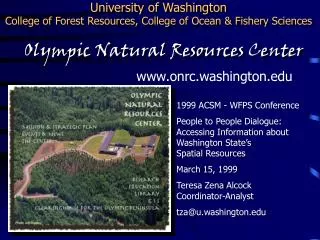
Resouces • ESRI (www.esri.com), leader in GIS software development • UCGIS (www.ucgis.org) • University Consortium of GIScience • University of Washington • wagda.lib.washington.edu • gis.washington.edu Phil Hurvitz 34
Questions? • Demonstration (time permitting) Phil Hurvitz 35