Download
1 / 17
170 likes | 392 Views
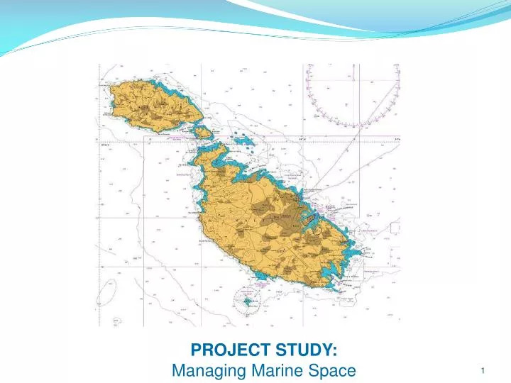
PROJECT STUDY: Managing Marine Space. CURRENT ACTIVITIES. ENERGY FISHING AND FISH FARMING ENVIRONMENT PROTECTED AND CONSEVATION AREAS BUNKERING AREAS MARINAS AND MOORING AREAS DREDGING - DUMPING AREAS AND LAND RECLAMATION TOURISM OTHER ACTIVITIES TRANSPORTATION. Base Maps. BA Chart 36.

E N D
CURRENT ACTIVITIES ENERGY FISHING AND FISH FARMING ENVIRONMENT PROTECTED AND CONSEVATION AREAS BUNKERING AREAS MARINAS AND MOORING AREAS DREDGING - DUMPING AREAS AND LAND RECLAMATION TOURISM OTHER ACTIVITIES TRANSPORTATION
Base Maps BA Chart 36 British Admiralty Chart 194 BA Chart 177
Energy Ħas Saptan Fuelling Dolphin:-Underground installation linked to Valetta fuelling Dolphins. Marsaxlokk Bay LPG InstallationDisused Delimara Power Station: 31 March Installation Grand Harbour San Lucian Oil Co. Ltd Mediterranean Offshore Bunkering Company Limited (MOBC): Liquigas Limited Oiltanking Malta Limited:4 tank farms of 535,000 cu mt. Marsa Power Station: Marsa Fueling Dolphin: Underground installation linked to Valetta fuelling Dolphins
Fishing & Fish Farming • Fisheries Management Zone(FMZ) established by EU Council Regulation (Council Regulation (EC) No 813/2004 of 26.04.2004) on joining the EU. • FMZ is 25 NM which protects the fishing resources and Eco System King Prawns King Prawns Red Mullet Red Mullet -Artisanal Fishing:- is carried out all around Malta limited to the boat size. (Interview with fisherman at Marsaxlokk). Swordfish Corridor Some Lampuki line trails Malta Mariculture AJD Tuna Fishing trial with fish aggregating devises (kannizzati) - Not 59 of 2010 Pisciculture Reserved for fishing – No Anchoring - Not 12 of 2012 Malta Fishfarming Fish and Fish` Offshore Farm` Aquaculture Centre Tuna And Swordfish Fishing area Swordfish Corridor http://www.faocopemed.org/old_copemed/vldocs/0000174/maltafisheries.pdf
Environment Protected/Conservation Areas Birds Directive Directive 2009/147/EC of the European Parliament and of the council of 30 November 2009Notice to Mariners No 4 of 2009 Natura 2000 Habitats Directive Sites (pSCI, SCI,SAC) Posedonia Protected under the Flora, Fauna and Natural Habitat Protection Regulations (S.L.504.73) Xlendi/Karwela Maerl Tug Rozi/P29 Imperial Eagle Bristol Beaufighter Wrecks, Conservation areas Notice to Mariners No 5 of 2008 Tug Boats Natura 2000 Habitats Directive Sites (pSCI, SCI,SAC) Blenheim Bomber Legislation in Force: The Filfla Reserve Act, 1988 (Act XV of 1988) and G.N. 173 of 1990 Um El Faraud Maerl – Red Coralline Algae Maerl Grounds Annnex to Aquaculture study for Malta March 2012 – MMRA Downloads
Bunkering Areas All bunkering services and activities are strictly regulated by the Dangerous Cargo Ships, Marine Terminals and Facilities and Bunkering Regulations (S.L. 499.12). Total Bunker operations 2011 Within Ports = 125 (decreasing) Within Territorial Waters = 2964 (Increasing) 20042005 2006 20072008200920102011 Waiting Area http://www.transport.gov.mt/admin/uploads/files/TM%20bunkering%20areas.pdf
Marinas-Mooring Areas Commercial berthing Manoel Island Fishermen Small craft Yachting Msida/Ta Xbiex Ferry Marsaxlokk Maritime Squadron Proposed Marina Birzebugia Kalkara Marina http://www.timesofmalta.com/articles/view/20120809/local/more-berthing-spaces-for-yachts.432212 Cruise liners Grand Harbour Marina Freeport
Dredging-Dumping at Sea & Land Reclamation Disused Spoil Grounds Land reclaimed in the past? Hilton Spoil Ground Smart City http://www.mepa.org.mt/waste-disposalatsea
Variety of tourism activities Specific attractions: Dingli Cliffs Comino and Blue Lagoon GhajnTuffieha Dwejra and Azure Window Source: http://wirtizzejtun.com/about/tourist-information/ Source: http://mappery.com/Maltese-Islands-Dive-Sites-Map
Other Areas Reverse Osmoses Wrecks Swimmer Zones Cables Sewage outfalls Port approaches Military Area Ferry route http://www.transport.gov.mt/ports-marinas/maritime-leisure-activities/safety-at-sea
Project of “Sicily – Malta” Interconnector • Through this planning permit, which was approved by MEPA in April, as of next year, Enemalta will be in a position to start the process of shutting off and decommissioning the Marsa PowerStation. The cost of the interconnector project is €200 million. • “The project will also ensure that the Island’s local generating plant could be used more optimally to reduce emissions and improve local air quality,” MEPA said. • At the present time the electricity generated at the Delimara Power Station is 571MW, with the interconnector it will be increased to 685MW. The interconnector could, in an emergency, boost the power by an extra 100 megawatts for an additional hour. Published on Tuesday, 24, July, 2012 at 18:12 in Malta News
Transportation • The total number of vessels within a 20NM radius around the coastline of Malta is estimated to be 65,668 vessels • (an average of 180 passing/calling vessels per day) Reference: Contingency Planning, A case study for Malta, Malta Transport Center, 17 November 2010, Gabrielle Galea