Download
1 / 33
330 likes | 490 Views
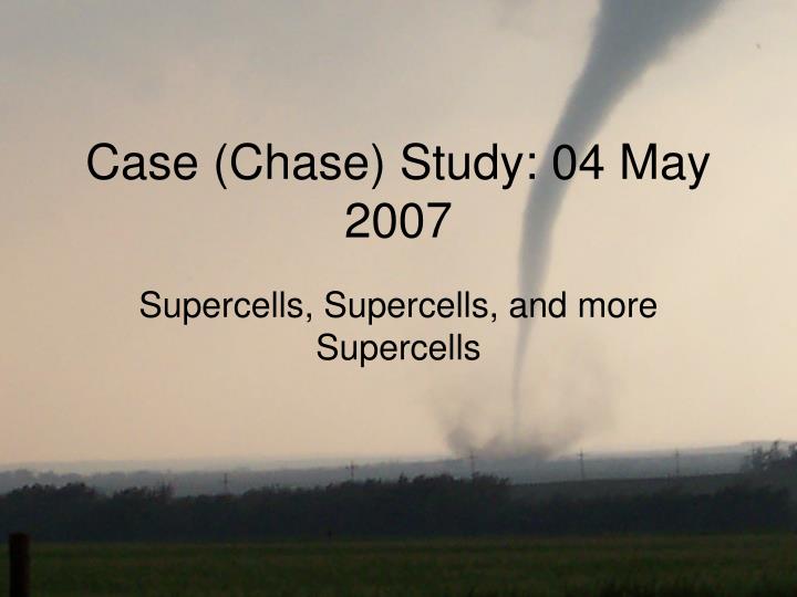
Case (Chase) Study: 04 May 2007. Supercells, Supercells, and more Supercells. Us. 23214 SW ARNETT ELLIS OK MULTIPLE MEDIA REPORTS...NSSL EMPLOYEES...EMERGENCY MANAGEMENT OFFICIALS REPORTED THE TORNADO. BEGAN AT 621 PM...STILL OCCURRING AT 627 PM. (OUN).

E N D
Case (Chase) Study: 04 May 2007 Supercells, Supercells, and more Supercells
Us 23214 SW ARNETT ELLIS OK MULTIPLE MEDIA REPORTS...NSSL EMPLOYEES...EMERGENCY MANAGEMENT OFFICIALS REPORTED THE TORNADO. BEGAN AT 621 PM...STILL OCCURRING AT 627 PM. (OUN) 00153008 W SHARON WOODWARD OK REPORTED BY NSSL EMPLOYEE. (OUN)
Preliminary Forecast • Why did we choose Woodward, OK? • Model output • Forecast soundings, forecast upper air, forecast surface • CAPE, Helicity, low level moisture, low level convergence • GFS, NAM, WRF all in good agreement • Observations • Observed upper level divergence • Obvious dryline • Lee cyclogenesis • Good agreement with model initialization
The Morning Of • Still kept Woodward, OK as ‘target’ • Again, good model initialization • Dryline setup was as progged • SPC gave some good reassurance • All in all, not much change • That made us happy http://www.spc.noaa.gov/
INTO OK...WITH MID-UPPER 60S INTO THE DRYLINE OVER KS...NWD INTO SCNTRL NEB. GIVEN THIS MARKED INCREASE IN MOISTURE MDT-HIGH INSTABILITY WILL DEVELOP ACROSS THE ENTIRE WARM SECTOR BY LATE AFTERNOON. SBCAPE VALUES COULD EASILY EXCEED 4000 J/KG ACROSS MOST OF THE SRN PLAINS INTO PORTIONS OF KS...HIGHER THAN MODELS WOULD SUGGEST. ADDITIONALLY...STRONG SFC HEATING ALONG/WEST OF THE DRYLINE OVER THE TX SOUTH PLAINS INTO THE OK PANHANDLE WILL CERTAINLY REMOVE ANY INHIBITION ACROSS THIS REGION. IT SEEMS REASONABLE THAT SUPERCELLS SHOULD DEVELOP DURING THE 21-00Z TIME FRAME FROM SWRN KS...SWD INTO SWRN TX WHERE DEEP LAYER SHEAR WILL ONLY INCREASE AS UPPER TROUGH ADVANCES EWD. AS LLJ STRENGTHENS DURING THE EVENING HOURS SCATTERED SUPERCELLS SHOULD BE MAINTAINED WITHIN HIGH QUALITY AIRMASS ACROSS THE PLAINS...WHILE LARGE SCALE FORCING/ASCENT GRADUALLY INCREASE AFTER DARK. ALTHOUGH DRYLINE SHOULD BE THE INITIAL INSTIGATOR FOR SUPERCELLS...ADDITIONAL DEVELOPMENT IS POSSIBLE DURING THE OVERNIGHT HOURS AS UPPER SPEED MAX EJECTS INTO THE CNTRL HIGH PLAINS. AT THAT TIME WIDESPREAD CONVECTION SHOULD EVOLVE WITHIN STRONG WARM ADVECTION REGIME ACROSS MUCH OF NEB/SD. VERY LARGE HAIL MAY ACCOMPANY HIGH INSTABILITY SUPERCELLS...ALONG WITH A FEW STRONG TORNADOES. THE INTERSECTION OF DRY LINE/COLD FRONT OVER WRN KS FOCUSES ANOTHER AREA OF ENHANCED CONVERGENCE AND CONVECTIVE INITIATION BY MID/LATE AFTERNOON. WITH THE HIGH INSTABILITY AND ENHANCED VEERING SHEAR PROFILES VICINITY FRONTAL ZONE/DRY LINE...SUPERCELLS WOULD RAPIDLY BECOME SEVERE WITH VERY LARGE HAIL AND TORNADO POTENTIAL. STRONG TORNADOES CERTAINLY A POSSIBILITY IN WRN KS GIVEN THE HIGH CAPE/SHEAR ENVIRONMENT EXPECTED TO BE IN PLACE BY LATE AFTERNOON. FURTHER SOUTH ALONG DRY LINE FROM SRN KS ALONG TX/OK BORDER INTO SWRN TX...THE THREAT OF STORM INITIATION WILL BE BOTH MORE CONDITIONAL AND LATER. BY EVENING WITH CAP WEAKENING AND INCREASING UPPER DIFFLUENCE AHEAD OF APPROACHING WIND MAX...AT LEAST ISOLATED INITIATION IS LIKELY VICINITY/JUST E OF DRY LINE. WITH MLCAPES AOA 4000 J/KG...STORMS THAT AREA ABLE TO FORM WILL QUICKLY BECOME SEVERE/SUPERCELLS WITH LARGE HAIL AND TORNADO THREAT. AFTER 00Z SEVERE THUNDERSTORMS WILL LIKELY CONTINUE AND BECOME MORE WIDESPREAD AS THEY SPREAD NEWD ACROSS CENTRAL PLAINS AS FAR N AS SRN SD. THIS SUPPORTED BY CONTINUED DEEPENING OF SURFACE LOW NEWD THRU CENTRAL HIGH PLAINS AS S/WV IMPULSE ROTATES NEWD FROM SRN ROCKIES.
On the Road • We left Norman, OK around 11:00 • Gave us time to get to where we needed to • ‘Northwest Passage’ • Arrived in Woodward at ~1:30pm • Sat at random hotel for Wifi internet • Also got free cookies and coffee! • http://www.spc.noaa.gov/exper/mesoanalysis/ • Decided to head farther North towards ‘Random Junction’
On the Road • At Random Junction we played lots of football, hacky sack, throw rocks at garbage can, etc. • Started seeing TCu going up to our SW • Very hazy, tough to tell, determined it was our ‘go’ time, I didn’t necessarily agree! • Made our way to Fargo and on to Arnett, OK. • Passed through one storm that split– not what we wanted.
Finally saw the storm • Drove up on the pendent funnel • You tube Reed Timmer
What did we learn? • Chasing is about being mobile with current, up to the minute information • Always watch the sky– it still tells you more than any weather map • Listen to your chase partners and be open-minded • Always call in your storm reports to the NWS