Download
1 / 45
460 likes | 594 Views
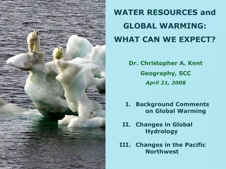
WATER RESOURCES and GLOBAL WARMING: WHAT CAN WE EXPECT?. Dr. Christopher A. Kent Geography, SCC April 21, 2008. I. Background Comments on Global Warming II. Changes in Global Hydrology III. Changes in the Pacific Northwest. I. BACKGROUND COMMENTS ON GLOBAL WARMING.

E N D
WATER RESOURCES and GLOBAL WARMING: WHAT CAN WE EXPECT? Dr. Christopher A. Kent Geography, SCC April 21, 2008 I. Background Comments on Global Warming II. Changes in Global Hydrology III. Changes in the Pacific Northwest
I. BACKGROUND COMMENTS ON GLOBAL WARMING Climate = pattern of weather in a region over long time periods - includes variability Climate change can be natural • Change occurs on many timescales simultaneously • Not all places experience the same change (direction or rate) • Data problems increase the further back in time one goes Climate change can be anthropogenic Global Warming= recent trend and projected continuation of rising average temperatures . . . caused by human activities
Today: about 59F 72F 63F 54F Global Air Temperature from 542,000,000 years ago Current Ice Age (last 1.8 million years)
Norm = 1961-1990 Global Air Temperature, 1850-2005 Statistical noise= random variation about a mean Climate Research Unit (UK)
Normal = 1940-1980 • 0.6C (1F) globally • spatially uneven • 1.5F in PNW over last 100 years Increase, 1960 to 2060 Global Warming Artwork • bigger at high latitudes • bigger over continents • bigger in winter -10 10 http://news.bbc.co.uk/2/hi/business/6098362.stm
THE HYDROLOGIC CYCLE NASA GSFC Water and Energy Cycle Program
Climate = pattern of weather in a region over long time periods - includes variability (DRY/WET) (WET/DRY) IPCC Box TS.5, Figure 1. Schematic showing the effect on extreme temperatures when the mean temperature increases, for a normal temperature distribution. IPCC = Intergovernmental Panel on Climate Change • established in 1988 by WMO & UNEP • several thousand scientists from around the world • assesses scientific information • shared 2007 Nobel Peace Prize
HAZARDS ASSOCIATED WITH GLOBAL WARMING • Changes in climate patterns • Sea level rise • Increased Drought • Changes in the biosphere (including species extinctions) • Changes in global food production • Deforestation • Increased Wildfires Examples: Changed El Nino cycles Changed Precipitation Changed Storm Intensity Changes in Water Resources
II. CHANGES IN GLOBAL HYDROLOGY +7-15% by 2100 Figure 10.12. Multi-model mean changes in (a) precipitation (mm day–1), (b) soil moisture content (%), (c) runoff (mm day–1) and (d) evaporation (mm day–1). IPCC, 2007
December – February Precipitation 2080 - 2099 (Temperature) (Atm. Pressure) IPCC, 2007 June - August Precipitation 2080 - 2099
ALTERED PRECIPITATION PATTERNS IPCC, 2002
December - February June - August IPCC, 2007 Increased Global Precipitation (2090-2099 relative to 1980-1999) Figure SPM.7. Relative changes in precipitation (in percent) for the period 2090–2099, relative to 1980–1999. Values are multi-model averages based on the SRES A1B scenario for December to February (left) and June to August (right). White areas are where less than 66% of the models agree in the sign of the change and stippled areas are where more than 90% of the models agree in the sign of the change.
North American Precipitation Changes (2090-2099 relative to 1980-1999) Figure 11.12. Temperature and precipitation changes over North America from the MMD-A1B simulations. Top row: Annual mean, DJF and JJA temperature change between 1980 to 1999 and 2080 to 2099, averaged over 21 models. Middle row: same as top, but for fractional change in precipitation.
RUNOFF CHANGES -40% 0 +40% Milly et al., 2008, Science Magazine Changes in Runoff Volume: 2050 compared to 1900-1970 Dramatic changes in runoff volume from ice-free land are projected in many parts of the world by the middle of the 21st century (relative to historical conditions from the 1900 to 1970 period). Color denotes percentage change (median value from 12 climate models). Where a country or smaller political unit is colored, 8 or more of 12 models agreed on the direction (increase versus decrease) of runoff change under the Intergovernmental Panel on Climate Change’s “SRES A1B” emissions scenario.
RISING SEA LEVEL 220-500 mm = 9-20” IPCC, 2007 FAQ 5.1, Figure 1. Time series of global mean sea level (deviation from the 1980-1999 mean) in the past and as projected for the future. For the period before 1870, global measurements of sea level are not available. The grey shading shows the uncertainty in the estimated long-term rate of sea level change (Section 6.4.3). The red line is a reconstruction of global mean sea level from tide gauges (Section 5.5.2.1), and the red shading denotes the range of variations from a smooth curve. The green line shows global mean sea level observed from satellite altimetry. The blue shading represents the range of model projections for the SRES A1B scenario for the 21st century, relative to the 1980 to 1999 mean, and has been calculated independently from the observations. Beyond 2100, the projections are increasingly dependent on the emissions scenario (see Chapter 10 for a discussion of sea level rise projections for other scenarios considered in this report). Over many centuries or millennia, sea level could rise by several metres (Section 10.7.4).
.07”/yr 1.2”/10 years
Tuvalu No orographic precipitation (9-20”) Global warming & sea-level rise • rising sea level (3.5” to 34.6” by 2100) • increased & stronger storm activity • erosion (11.8” rise = 98’ shore retreat) • environmental refugees?
III. CHANGES in the PACIFIC NORTHWEST Precipitation Temperature 1920-2000 Trends Figure 4. 20th century trends in average annual temperature (1920-2000). Increases (decreases) are indicated with red (blue) dots. The size of the dot corresponds to the magnitude of change. Figure 5. 20th century trends in average annual precipitation (1920-2000). Increases (decreases) are indicated with blue (red) dots. The size of the dot corresponds to the magnitude of change. Climate Working Group, University of Washington
PAST TRENDS Climate Working Group, University of Washington Region wide warming of about 1.5F over 100 years Increase in precipitation in most of the PNW Decline in snowpack since 1950, esp. at lower elevations Spring is arriving earlier (0-20 days since 1948)
Annual Precipitation More Rain, Less Snow Reduced Snowpack Relative Trend in April 1st Snow Water Equivalent (1950-2000) CWG, UW
Changes in the Quantity and Timing of Runoff More Rain, Less Snow Reduced Snowpack winter flow summer flow earlier peak flow Figure 3. Naturalized Columbia River streamflow at The Dalles(dashed) and in 2050, as simulated by several climate models. The blue band indicates the upper and lower bounds of projected average streamflow in the 2050s. Note the higher winter flows, reduced spring/summer flows, and the shift in the timing of peak spring flows earlier into the spring season. The effects of the Columbia River dams on streamflow have been removed. CWG, UW
1928 1966 2006 Glacier Melt South Cascade Glacier, Washington Cascades 53 North Cascade glaciers gone since the 1950s
Impact of Global Warming on Future Pacific Northwest Water Resources (part 1) Milder Winters & Hotter Summers • probable modest in precipitation • more rain, less snow • increased evapotranspiration • reduced snowpacks • higher and earlier flood peaks Oct. – March should be wetter April – Sept. uncertain June & July possibly drier
Impact of Global Warming on Future Pacific Northwest Water Resources (part 2) • increased intensity of precipitation: more extreme events • reduced water availability in summer (peak irrigation demand) • less power generation • more difficult fish migration in lower-flow rivers MORE FLOODS . . . MORE WATER SCARCITY
Changes in frequency of extreme precipitation, 1948-2006 New York Times Dec. 5, 2007 MORE FLOODS
MORE FLOODS Centralia, Washington on December 5, 2007
Barnett et al., 2008, Science Magazine (there is) “a coming water crisis in the Western United States.”
21 11 7 4 Columbia River Storage Options Study, June 2007 1 #1 site: Lower Crab Creek MORE WATER SCARCITY 2 Proposed Black Rock Dam, Yakima County
To recap, what can we expect in the PNW? • temperature by 2100 of 2-10F • best guess: 0.5F / decade . . . 5F by 2100 • milder winters, hotter summers • more rain, less snow • more extreme precipitation events • reduced snowpack • disappearing glaciers • higher and earlier flood peaks • increased water scarcity • urban / rural water conflicts • more calls for water conservation • more calls for taxpayers to build new dams All against a background trend of steady population growth “We’re headed for a train wreck” (Tim P. Barnett, Scripps Institution of Oceanography)
New York Times January 8, 2008 • Greenland could be gaining snow and ice in the interior • Greenland is losing ice at its edges • Net change: transfer of H2O from ice sheet to oceans
1928 1966 2006 South Cascade Glacier, Washington Cascades
105 years Increased Global Precipitation (Past) Figure 3.13. Trend of annual land precipitation amounts for 1901 to 2005 (top, % per century) and 1979 to 2005 (bottom, % per decade), using the GHCN precipitation data set from NCDC. The percentage is based on the means for the 1961 to 1990 period. Areas in grey have insufficient data to produce reliable trends. The minimum number of years required to calculate a trend value is 66 for 1901 to 2005 and 18 for 1979 to 2005. An annual value is complete for a given year if all 12 monthly percentage anomaly values are present. Note the different colour bars and units in each plot. Trends significant at the 5% level are indicated by black + marks. 26 years IPCC, 2007
Figure 10.12. Multi-model mean changes in (a) precipitation (mm day–1), (b) soil moisture content (%), (c) runoff (mm day–1) and (d) evaporation (mm day–1). To indicate consistency in the sign of change, regions are stippled where at least 80% of models agree on the sign of the mean change. Changes are annual means for the SRES A1B scenario for the period 2080 to 2099 relative to 1980 to 1999. Soil moisture and runoff changes are shown at land points with valid data from at least 10 models. Details of the method and results for individual models can be found in the Supplementary Material for this chapter.
FAQ 5.1, Figure 1. Time series of global mean sea level (deviation from the 1980-1999 mean) in the past and as projected for the future. For the period before 1870, global measurements of sea level are not available. The grey shading shows the uncertainty in the estimated long-term rate of sea level change (Section 6.4.3). The red line is a reconstruction of global mean sea level from tide gauges (Section 5.5.2.1), and the red shading denotes the range of variations from a smooth curve. The green line shows global mean sea level observed from satellite altimetry. The blue shading represents the range of model projections for the SRES A1B scenario for the 21st century, relative to the 1980 to 1999 mean, and has been calculated independently from the observations. Beyond 2100, the projections are increasingly dependent on the emissions scenario (see Chapter 10 for a discussion of sea level rise projections for other scenarios considered in this report). Over many centuries or millennia, sea level could rise by several metres (Section 10.7.4).
Past Precipitation Trends, by latitude IPCC, 2007 Figure 3.15. Latitude-time section of zonal average annual anomalies for precipitation (%) over land from 1900 to 2005, relative to their 1961 to 1990 means.
USA USA USA USA IPCC, 2007
Increased Global Precipitation (Projected to 2100) FAQ 11.1, Figure 1. Blue and green areas on the map are by the end of the century projected to experience increases in precipitation, while areas in yellow and pink are projected to have decreases.
FAQ 6.1, Figure 1. Schematic of the Earth’s orbital changes (Milankovitch cycles) that drive the ice age cycles. ‘T’ denotes changes in the tilt (or obliquity) of the Earth’s axis, ‘E’ denotes changes in the eccentricity of the orbit (due to variations in the minor axis of the ellipse), and ‘P’ denotes precession, that is, changes in the direction of the axis tilt at a given point of the orbit. Source: Rahmstorf and Schellnhuber (2006).