Download
1 / 26
270 likes | 440 Views
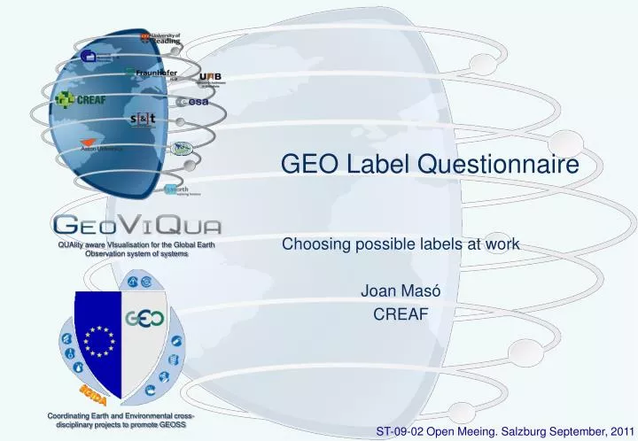
GEO Label Questionnaire. Choosing possible labels at work Joan Masó CREAF. GEO Label development phases. Phases in the development of the GEOLabel discussed in GeoViQua Phase I will be looking at what information people want without giving them actual examples (trying not to bias them);

E N D
GEO Label Questionnaire Choosing possible labels at work Joan Masó CREAF QUAlity aware VIsualisation for the Global Earth Observation system of systems
GEO Label development phases • Phases in the development of the GEOLabel discussed in GeoViQua • Phase I • will be looking at what information people want without giving them actual examples (trying not to bias them); • Phase II • will present some examples and, under controlled conditions and in a well-managed and structured way, elicit their feedback on some examples; • Phase III • will create physical prototypes which will be used in a human subject study. ST-09-02 Salzburg open meeting. September 15th, 2011
GEO Label phase II • Phase I • will be looking at what information people want without giving them actual examples (trying not to bias them). • We have been moving back and forth for a while. We have some background that we could apply to the next phase • Phase II • will present some examples and, under controlled conditions and in a well-managed and structured way, elicit their feedback on some examples. • This presentation and the GEO Exhibition questionnaire is a contribution to this phase. • Phase III • will create physical prototypes which will be used in a human subject study. ST-09-02 Salzburg open meeting. September 15th, 2011
About the questionnaire • Objectives of the questionnaire • To help understanding if people do really care about having a label/seal on the information • Which GEO Label approach do they want/need • Which elements are expected in those labels • Implicitly: How important quality information about data is for them • really important aspect for GeoViQua • Number of questions • ~10 direct questions. • ~3 extra control questions to test people understanding • This meeting will serve to gather ideas on how to improve the questions and to detect important missing questions. ST-09-02 Salzburg open meeting. September 15th, 2011
Common for all GEO Labels • For all labels shown: • Share the same look. An invented "GEOSS" logo. • It is a neutral look and is used repetitively because we do not want to condition answers to how the label looks like but to the additional elements it has or the real meaning of them. • Remember that we are on Phase II so we are NOT looking for the final content and design of the label but to the user preferences • All labels could be written on paper or used on the web. • On the web, elements could be linked to extra information • This will be Phase III ST-09-02 Salzburg open meeting. September 15th, 2011
The questionnaire • QUESTION 1: Introduction • QUESTION 2: Product integrate in GEOSS label • QUESTION 3: Quality, relevance and rate label • QUESTION 4: Spatial, thematic, date, provider and rate label • QUESTION 5: Choose one dataset only considering the label • QUESTION 6: Quantitative bar label • QUESTION 7: Descriptive label • QUESTION 8: Certification label • QUESTION 9: View and get the data label • QUESTION 10: Inter-comparison of labels • QUESTION 11: Full label • QUESTION 12: Final remarks ST-09-02 Salzburg open meeting. September 15th, 2011
Question 1:Introduction • Identify yourself as one of the following user type • GEO committee member • Data provider with some dataset in the GCI • Data provider not part of GEOSS • Private sector data user • Governmental data user • Researcher data user • Other data user • Neither of those • Do you read the meta-information of the dataset you use? • Yes, only use data with enough meta-information. • If it is available but I will use the data anyway • No. ST-09-02 Salzburg open meeting. September 15th, 2011
Question 2: Product integrate in GEOSS label The following label can be used for a GEOSS contributor organization next to a product documentation or website data access. • When you see a label like this, what do you think? • I do not know about GEOSS. I want to know more. • I know about GEOSS so their data has to be relevant to me. • This is a GEOSS product. So what? • Another useless icon that confuses me • I do not understand the label. • When the previous label is found on the GEOSS contributor website it links to the GEOPortal or CSR record for this component or services integrated in GEOSS. • It is useful because I can easily access other equivalent resource from other provider and compare them • It is interesting to know but it does not help me. • The information in GEOSS could be out of date or incomplete. I prefer the original source. • I prefer to stay in the contributor website and not get lost on links. ST-09-02 Salzburg open meeting. September 15th, 2011
Question 3: Quality, relevance and rate label The following label can be found in the GEOPortal or in a GEOSS contributor organization, in their documentation or in their website. • When you see a label like this, what do you think? (check all that apply) • It is an easy way to compare datasets • It seems relevant to some application areas • People like this resource. I want to know more about it • I do not understand the small blue symbols • I do not care about user rates or what the people like • Quality can not be summarized in a single number • Too complicated • There are important aspects missing like scale, extent, time. ST-09-02 Salzburg open meeting. September 15th, 2011
Question 4: Spatial, thematic, date, provider and rate label We have added more information: It is more explicit about quality. • What is your opinion about this (compared with the last one)? • Additions are very important • Additions are more informative • Additions are irrelevant • Additions are confusing • Too much information • I do not understand the label ST-09-02 Salzburg open meeting. September 15th, 2011
Question 5: Choose one dataset only considering the label • Which one do you choose? • "A" because I work with global data • "A" because it has more categories • "B" because it has more thematic quality • "B" because it has more spatial quality • I need more data to decide • I'm completely overwhelmed by the amount of information. • I do not understand the labels ST-09-02 Salzburg open meeting. September 15th, 2011
Question 6: Quantitative bar label We have simplified the information in the GEO Label to a single indicator you do not know how it is generated. • When you see a label like this, what do you think? • That is what I like. Easy to compare an simple • I do not know what the value represents. I need more information • This is a GEOSS product • Another useless icon that confuses me ST-09-02 Salzburg open meeting. September 15th, 2011
Question 7: Descriptive label This GEO Label shows that the product has data quality information (does not gives us a value), provenance information and possible use cases documented. A click on the text will get more information. • When you see a label like this, what do you think? • That is what I like. I know that the data has been carefully documented • I would have preferred to see real values in the label • Another useles icon that confuses me • I do not understand the label ST-09-02 Salzburg open meeting. September 15th, 2011
Question 8: Certification label This GEO Label certifies that the product has followed strict procedures and protocols that GEOSS requires to get this label • When you see a label like this, what do you think? • That is what I like. I know that the data has been carefully processed and documented • I do not care about certification. This is only a bureaucratic step • Another useless icon that confuses me • I do not understand the label ST-09-02 Salzburg open meeting. September 15th, 2011
Question 9:View and get the data label This GEO Label guides the user to viewing the data, the quality information and also to download the data. • When you see a label like this, what do you think? • Now I know that I can download the data and test it myself • Now I know that data will not cost me money so do not care about quality. • Knowing the formats is important. Some formats do not contain important metadata or the data is degraded • All data in GEOSS can be downloaded for free. Isn't it? • Another useless icon that confuses me • I do not understand the need for this label ST-09-02 Salzburg open meeting. September 15th, 2011
Question 10: Inter-comparison of labels • You have the possibility to choose a particular GEO Label design • Please choose one of these labels • A • B • C • D • None of them are useful • I do not care • I do not understand some of these labels • Why do you choose a particular one? • More informative • Easy to compare • A gateway to more information • Simple • I do not understand the others B A D C ST-09-02 Salzburg open meeting. September 15th, 2011
Question 11:Full label This GEO Label combines many of the aspects previously shown in a single label. • What do you think? (check all that apply) • Some important aspects are still missing • All information is important to me • The box with quality rates, scale and dates is not important to me • The box with provenance info and use cases is not important to me • The box with "view and download" is not important to me • Certification is not important to me • Too much information. • Some aspects are redundant • I do not understand the label ST-09-02 Salzburg open meeting. September 15th, 2011
Question 12: Final remarks • Final remarks. (check all that apply) • The idea of the GEO Label is important to compare products. • The label has to have the GEO logo and not the GEOSS logo. • I prefer numerical labels • I prefer simple labels with only a couple of parameters • I prefer simple labels with as much information as possible • I do not understand the need for the GEO Label • Any label should link to a comprehensive quality report • Any label should link users comments list and a representation translated by system into “rate”) • Any label should include any available certificate attached to the selected information source and link to a explanation. • The existence of usage information ( i.e. a system derived parameter based exclusively on users comments) should be linked to the GEO Label. ST-09-02 Salzburg open meeting. September 15th, 2011
The role of GeoViQua, EGIDA and STC • GeoViQua may conduct the questionnaire and test future prototypes • GEO STC is formally endorsing this approach (thanks!) and will help to promote it • GEO STC and EGIDA may contribute • Moving the questions to final • Announcing/emailing the questionnaire • Inferring conclusions from the results analysis ST-09-02 Salzburg open meeting. September 15th, 2011
October 2011 Have the questions ready to distribute in the GEO exhibition Contact EC and request space and time to do this November 2011 Do the questionnaire in the EC booth December 2011 Leave open the questionnaire for 3 more weeks January 2012 Analyze the results Aston University in GeoViQua could do this February 2012 Report back to the relevant committee, board, task… March 2012 Start Phase III during 2012: development and test of selected alternatives October? 2012 Deliver final test results to the GEO Plenary What if replies result in users do not wanting any ‘label’? The process ST-09-02 Salzburg open meeting. September 15th, 2011
Discussion • Thanks • Joan.Maso@uab.cat ST-09-02 Salzburg open meeting. September 15th, 2011
Possible extra design • This are the 4 checks that are new on the CSR. Producer has to mark the relevant concepts: [x] GEOSS Data Core [x] GEOSS No Monetary Charge [x] GEOSS User Registration [x] GEOSS Attribution • This gives use 4 flags that can be included in the GEOLabel ST-09-02 Salzburg open meeting. September 15th, 2011
First approach: Encourage to contribute • Aim: Encourage scientists, researchers, and others to contribute their data and systems to GEOSS by offering an accepted voluntary label that provides recognition that their contribution is valued by the GEO community. • From: STCGEOlabel_June2010.doc ST-09-02 Salzburg open meeting. September 15th, 2011
First Approach: Encourage to contribute GEOSS Contributes to the CSR and the GCI «invokes» Contribution aproved «precedes» CSR moderator The registration confirmation Contributor to GEOSS shall contain a GEO Label as (Scientist, data provider, Gets a GEOLabel HTML code and text and or other) suggestions on how to embed it in websites, metadata, etc Contributor documentation, Contributor documentation, website, etc website, etc Publicites the GEO Label along with the data Reads the GEO Label and knows about GEOSS «precedes» Uses GEOSS EO user GEO Label shall contain references to GCI and CSR records ST-09-02 Salzburg open meeting. September 15th, 2011
Second approach: Differentiate components • Aim: Differentiate components, data and products delivered through GEOSS and provide a “trusted brand” to GEOSS users; member governments may base their decisions on data/products of such contributions. • From: STCGEOlabel_June2010.doc ST-09-02 Salzburg open meeting. September 15th, 2011
Second approach: Differentiate components GEOSS Contributes to the CSR CSR registration shall and the GCI include quality information, traceability and certification Measures «include» «extend» quality (e.g. cal/val) «include» Provides well Certification documented quality «include» information Documents Certification Body Contributor to processes and «extend» GEOSS (Scientist, «precedes» traceability data provider, or GEO Label shall be build other) directly from information from the registration process Gets a GEOLabel GEO Label shall be incorporated in the GEOPortal results. Searchs and picks a Explores the GEO dataset Label data «extend» CSR moderator «extend» Decides if the GEO Label content shall dataset fits for the be easily comparable purpose EO user Uses the dataset GEO Portal shall collect feedback «extend» Feedback is Feedback shall be connected incorporated to the back to the GCI/CSR for Returns feedback «invokes» GEO Label integration into the GEO Label ST-09-02 Salzburg open meeting. September 15th, 2011