Download
1 / 37
370 likes | 375 Views
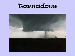
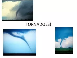
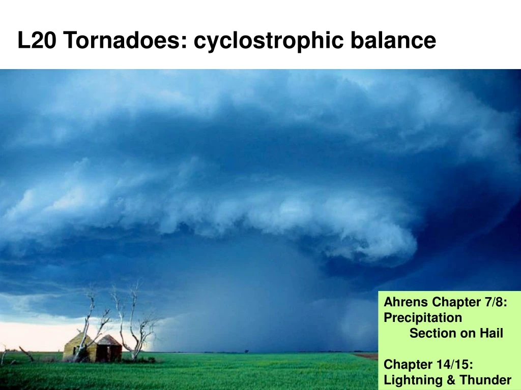
L20 Tornadoes: cyclostrophic balance. Ahrens Chapter 7/8: Precipitation Section on Hail Chapter 14/15: Lightning & Thunder. Supercell thunderstorms. Rotating updraught Rotation causes the storm to be more robust – longer-lived, and therefore more dangerous

E N D
L20 Tornadoes: cyclostrophic balance • Ahrens Chapter 7/8: Precipitation • Section on Hail • Chapter 14/15: Lightning & Thunder
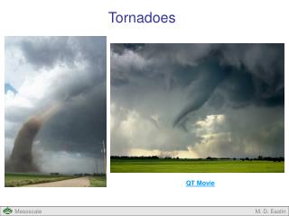
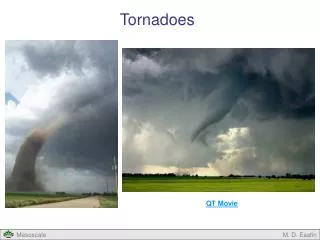
Supercell thunderstorms • Rotating updraught • Rotation causes the storm to be more robust – longer-lived, and therefore more dangerous • Forms an area of low pressure at centre of rotation, called a mesolow • Updraught centred on the low pressure • Circulation around the low is in cyclostrophic balance…
r L v PGF CentrifugalForce = Cyclostrophic balance • Rotating air in a supercell generates an area of low pressure at the centre of the rotating updraught. • The circulation is in ‘cyclostrophic balance’, where the pressure gradient force (PGF) is balanced by a ‘centrifugal force’ (really a centripetal acceleration) Acceleration (= Force/mass)given by: v2/r v ~30 m s-1 r ~1000 m v2/r ~0.9 m s-2 Tornado/supercellcase
r ~ 500 km Doesn’t this look a bit familiar? Geostrophic Balance Centripetal accelerationgiven by: v2/r v ~10 m s-1 r ~500000 m v2/r ~0.0002 m s-2 Centripetal acceleration much smaller than the supercell case. L v ~ 10 m s-1 PGF Large-scaleweathersystem CoriolisForce Coriolis force is due to planetary rotation Centrifugal force (or centripetal acceleration) is due to ‘local’ rotation
CF/m =0.0011 m s-2 v = 10 m s-1 At 50°Nf = 1.1 x 10⁻⁴ s-1 Coriolis Force Apparent force that acts on anythingthat moves in the Earth’s rotating frameof reference. Coriolis parameter, f: f is zero at equator, maximum at poles is the Earth’s rotation rate = 2 radians per day, or, in SI units (seconds): = 2 /(24x60x60) per second = 7.27 x 10⁻⁵ s-1
Comparing Coriolis & centrifugal forces Geostrophic Balance Centripetal accelerationgiven by: v2/r v ~10 m s-1 r ~500000 m v2/r ~0.0002 m s-2 r ~ 500 km L Coriolis accelerationgiven by: fv ~0.0011 m s-2 Is bigger, but in some casesthe centripetal acceleration isimportant at synoptic scales; But Ignore for now! v ~ 10 m s-1 PGF CoriolisForce Coriolis force is due to planetary rotation Centrifugal force is due to ‘local’ rotation
Cyclostrophic balance • Rotating air in a supercell generates an area of low pressure at the centre of the rotating updraught. • The circulation is in ‘cyclostrophic balance’, where the pressure gradient force (PGF) is balanced by a centrifugal force L v PGF Coriolis accelerationgiven by: fv ~0.0033 m s-2 Is much smaller thancentripetal: can ignoreCoriolis force for small scalerotations: storms/tornadoes CentrifugalForce = Centripetal accelerationgiven by: v2/r v ~30 m s-1 r ~1000 m v2/r ~0.9 m s-2
Summary of forces for rotating systems • Supercell storms/tornadoes (~1 km across): • Cyclostrophic balance: • PGF vs. centrifugal force (ignore Coriolis) • Synoptic weather systems (~1000 km): • Geostrophic balance: • PGF vs Coriolis Force (ignore centrifugal) • Scale is all-important!
Back to Supercell storms • Low pressure in rotating updraught can be so low that is causes saturation and forms a ‘funnel’ cloud • (Drop in pressure is equivalent to ascent)
Funnel cloud Dust/debrisstirred upat surface Tornadoes from supercell storms Pylonfor scale
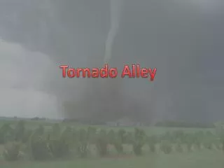
Supercells & Tornadoes in the UK • Generally much less severe than a typical US supercell/tornado, nevertheless… • The UK experiences around 40 tornadoes a year – they generally do not cause damage, or are not even noticed • A couple of recent cases: • 21st March 2004 – S. Midlands • 28th July 2005 – Lincolnshire • Data & images from www.torro.org.uk
UK Tornadoes by Month Percentages 1960 - 1999 (Reynolds) From Royal Met Soc talk by Nigel Bolton, 2010
Damage in Oxfordshire Also accompanied by 2cm diameter hail
UK supercell storm: 28th July 2005 Path of two supercells: Right-moving is the strongest Nottingham Skew T-log P – large CAPE
Spatial scale of storms • Tornadoes are generally very localised, but can cause severe damage on small scales (100’s metres) • Met: Weather and Climate (next semester), covers larger scale storms: tropical cyclones (hurricanes), also mid-latitude cyclones in more detail. Hurricane Katrina, August 2005
Summary: Tornadoes • Small scales (~1 km across) • Flow close to cyclostrophic balance: • PGF in balance with a centrifugal force • strictly: PGF creates a centripetal acceleration • Ignore Coriolis force at these small scales • cf. Geostrophic balance in synoptic weather systems • Tornadoes are an important hazard in the UK (as well as other parts of the world): they can cause very localised severe damage
Hail formation • Starts with small ice crystal surrounded by abundant supercooled droplets – within a cloud with strong updraughts • Growth by riming • Once initial crystal shape is lost: graupel
Typical hail pellets~0.5 cm Grapefruit-sized hailstones~10 cm Serious Hazard
Hailstone structure • Hail can grow quite rapidly (5-10 minutes) • As it grows, requires larger and larger updraught velocities to support it • One path is approximately horizontally across the cloud, growing as it traverses the updraught, then plummeting as it enters the downdraught • Alternating light/dark layers due to different growth stages – dark layers have bubbles trapped; ‘wet’ growth vs ice (colder) growth
Cloud electrification • Need a cold cloud – i.e. contains ice • Radar data indicates graupel or hailstones • As hail falls through cloud, bumping into other cloud particles, it tends to become negatively charged • Exact mechanism is not clear, but falling hail tends to make the lower cloud negatively charged, and leaves the upper part of the cloud positively charged…
} Produce cloud flashes Lightning discharge • Air has a low conductivity, but it can only cope with a gradient in charge (an electric field) up to ~106 volts per metre – beyond that it discharges: Lightning. • 3 types of lightning: • 1a Within cloud • 1b Cloud to air • 2 Cloud to ground – most energetic
‘Stepped Leader’ advances in ~50 m steps, in 1 stime period between steps ~50 s Downwards spread of negative charge induces a positive charge at ground Lightning time sequence:1. Stepped Leader Initial chargedistribution Preliminarybreakdown inlower cloud – neutralizes the positive charge in cloud base
When within ~10-100 m of the highest objects, a discharge moves up from the ground to meet the downwards advancing stepped leader 2. Attachment and 1st Stroke Once connected, large flow of electrons to ground – the ‘return stroke’- Intense flash Stepped leadercontinues advance
Dart leader moves down the mainpath followed by the first stroke, sending more electrons downwards New regions of negative charge in the cloud are connected 3. Dart leader, subsequent strokes Further stroke; Usually 3 or 4 strokes to discharge the cloud.Charge can build up again in as little as 10s
NB Time-lapse photograph – many processes superimposed! Can see a range of stepped leaders, together with the path of the main stroke (re-used for subsequent strokes)
Thunder • Return stroke raises air temperature in the channel it passes through to >30,000K very quickly – air has no time to expand, so pressure rises, and air expands rapidly. • Creates a shock-wave, which then creates a sound-wave a little further away: thunder • Travels at speed of sound: 330 m s-1 (i.e. 1 mile in ~5 seconds) • Stepped leaders also create thunder, but much less than the main stroke • Sound waves tend to be refracted upwards, limiting the range over which thunder can be heard to within ~25 km of the source.
Global Electrical Circuit Thunderstormsare the ‘batteries’driving the circuit
Blue Jets, Red Sprites, etc. These are allfairly recentlydiscovered electricalphenomena, closelyassociated withthunderstorms, that probably play a rolein the global electricalcircuit.
Summary • Hail • Produced in cold clouds, multiple ascent and descent cycles with growth by riming • Lightning • Falling hail is negatively charged, leaving upper cloud positive, lower cloud negative • Stepped leader; Return stroke; Dart leader; subsequent strokes • Global electrical circuit driven by thunderstorms • Thunder • Sound wave from 30000K heating by lightning stroke