Download
1 / 36
450 likes | 669 Views
PASSAGE PLANNING. February 2012. CANADIAN COAST GUARD AUXILIARY - PACIFIC. Standard. Standard. Develop a brief passage plan Brief crew on that passage plan Have back up / contingency plan for bad weather or restricted visibility.

E N D
PASSAGE PLANNING February 2012 CANADIAN COAST GUARD AUXILIARY - PACIFIC
Standard • Develop a brief passage plan • Brief crew on that passage plan • Have back up / contingency plan for bad weather or restricted visibility. • Understand how to plan taking into account pertinent factors. • Navigate in all conditions with due regard for best seamanship practices.
Passage Planning • Passage planning is the methodology that is required to get a vessel from A to B safely. • This is achieved by knowing the capabilities of the vessel plus equipment and its limitations, the crew and their limitations, the likely weather and tide conditions during the passage, and the navigational hazards on route.
Passage Planning • It is a matter of setting up vessel and crew for a successful passage. Getting it wrong…..
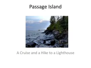
Where to Go • First item is knowing where you would like to go - place of interest, rendezvous, en route in longer passage, medical, maintenance, restocking, re-fuelling, etc.
Information on Destination • Under-keel allowance and clearances • Berths (e.g. fees, space, noise, facilities) • Anchoring (e.g. ground type, space, noise, tender required..) • Tidal constrictions or restrictions • Tidal streams • Weather, forecast and shelter • Local dangers (e.g. rocks, shipping)
Sources of Information 1 • CHS publications - charts, sailing directions, list of lights, tide tables and tidal stream atlas. • Almanacs, port/ marina guides or cruising guides. • Weather services • Official agencies (e.g. harbour masters) • Telephoning or radioing ahead • Past experience
Sources of Information 2 • Crew observation (e.g wind and weather) • Instruments (e.g. log, depth sounder, barometer, wind) • Chart plotter / GPS / radar • Gauges (fuel levels,, battery) • Radio DSC / SSB • Coast Guard radio ? Navigation Warnings • Plotting positions, and estimating positions • Other shipping en route
Assess Feasibility • With destination selected , choose most appropriate route for type of vessel, taking into account weather, time of year, ice, tidal streams. • Keep alternatives en route in mind, for emergencies or simply change of mind.
The Passage Plan • Complete passage plan template of courses, distances, estimated time of arrival at destination, with tidal allowance. • Lay down way-points, alter course positions and expected ETA at alter course, and include danger areas and marks, safe water areas, landmarks and aids to navigation marks, traffics separation schemes, and shipping lanes.
Contingency Plans • Pre plan possible alternative routes to destination, along with alternative way-points. • Indicate decision points with time, where weather changes, tide restricted and / or proximity, dangers may necessitate change of route. • Mark emergency anchorages or turning areas. • Appreciate nearest ports (e.g. medical )
On Passage • Monitor the position of the vessel at frequent enough intervals that any error will not result in putting the vessel in danger. • Generally this means that there will always be one more position fix on the chart before the vessel was placed in danger - if necessary shorten the position fixing period. • Monitor time, speed, course, weather, sea state.
On Passage • Assess crew state of alertness. • Involve all in the safe navigation, and provide input where needed. • Monitor need to activate contingency plans.
Arrival • Increase crew levels and alertness on arrival, and passage in confined waters. • Evaluate changes of weather / tide in confined waters. • Locate berth or anchorage, and evaluate. • Re-evaluate if necessary. • Tie up or anchor. • Shut down navigation systems
Passage Planning 1 • Mark depart point. GIBSONS • Mark destination.BOWEN BAY
Passage Planning 2 • Mark in danger areas for the size and particularly the draught of your vessel.
Passage Planning 3 • Mark main route and alternate routes. • Dangers on alternate route can be marked as well.
Passage Planning 4 • Mark waypoints and note for each a bearing/ distance or Lat/Long.
Passage Planning 5 • Measure courses and distances between waypoints.
Passage Planning 6 • Tabulate courses and distances. • Courses can be converted from True to Compass by applying variation and deviation. • 101T x 1.98nm
Passage Planning 7 • Indicate traffic. • 101T x 1.98nm
Passage Planning 8 • Insert Cross Index Ranges on each course to monitor passage on radar. • In this case 0.225nm to starboard. • 101T x 1.98nm
Passage Planning 9 • Note emergency anchorages. • Behind Hermit, New, Mickey or Ragged Islands • 101T x 1.98nm
Passage Planning 10 • Note any VHF radio channels to be used, such as at reporting point 15C • 101T x 1.98nm
Passage Planning 11 • The plan would be backed up with a written document, which contains all the information not marked on the chart • This would include the course and distance table, weather radio channels, tide heights over the time of the passage, tidal stream directions, Coast Guard Radio channels, and pertinent navigational warnings.
Passage Planning 12 Example
Passage Planning for Rescue Vessels • As rescue vessels can be called out at short notice in adverse conditions, preplan safe routes out to the limits of the station’s area. • If available, preload way-points onto the plotter and construct routes which can be called up in a hurry. • Practice using these routes on all occasions, to build up confidence in them. • BACK UP THIS INFORMATION.
Passage Planning for Rescue Vessels • Use these routes to monitor the safe navigation of the rescue vessel.