Download
1 / 23
230 likes | 442 Views
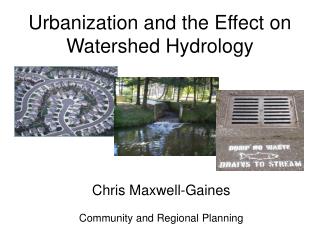
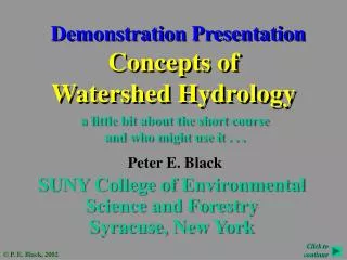
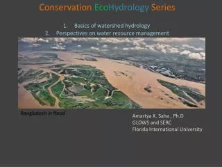
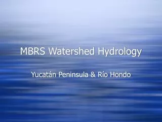
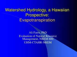
MBRS Watershed Hydrology. Río Motagua, Río Chamelecón and Río Ulúa Paul Kirshen & Ned Spang. Watersheds. “ an area of land within which all waters flow to a single river system ” ---Heathcote 1998

E N D
MBRS Watershed Hydrology Río Motagua, Río Chamelecón and Río Ulúa Paul Kirshen & Ned Spang
Watersheds “an area of land within which all waters flow to a single river system” ---Heathcote 1998 “the specific land area that drains water into a river system or other body of water” ---The World Bank
Features of a Typical Watershed Overland flow Groundwater flow Reef
Río Motagua • Countries: Guatemala, Honduras • Watershed Area: 12,670km2 • Guatemala: 10,529 km2 • Honduras: 2,141km^2 • Average Annual Precipitation: 1,400 mm • Length: 487 km • Average Discharge: 530m^3/sec Source: Gulf of Honduras: Preliminary Transboundary Diagnostic Analysis, Final Draft (August 2003) Abt Associates/ Woods Hole Group, Global Environment Facility--Inter-American Development Bank Project Development Facility (PDF-B), pp. 5-6. Photo Source: www.guate360.com/galeria/postcards.php
Río Motagua: Monthly Flow Hydrograph - 2004 (Morales) Resumen De Estaciones Hidrometricas De La Republica De Guatemala, (2005) INSIVUMEH, Guatemala.
Río Motagua: Water Use/Availability Source: Vorosmarty, C. J., P. Green, J. Salisbury and R. B. Lammers. 2000. Global water resources: vulnerability from climate change and population growth, Science, 289: 284-288.
Station 1a Gualan Puente Orellana Water Quality Stations Rio Hondo: -Station 1a Rio Motagua: -Gualán -Puente Orellana
Río Motagua: Water Quality Lead in Río Motagua Source: adapted from “Calidad de Agua de los Rios de La Republica de Guatemala” (December 2003), INSIVUMEH, Guatemala
Río Motagua: Water Quality 2 Phosphate – P Source: adapted from “Calidad de Agua de los Rios de La Republica de Guatemala” (December 2003), INSIVUMEH, Guatemala
Río Motagua: Water Quality 3 Total Dissolved Solids Turbidity Source: adapted from “Calidad de Agua de los Rios de La Republica de Guatemala” (December 2003), INSIVUMEH, Guatemala
Río Motagua: Water Quality 4 Dissolved Oxygen Saturation (%) Dissolved Oxygen (mg/L) Source: adapted from “Calidad de Agua de los Rios de La Republica de Guatemala” (December 2003), INSIVUMEH, Guatemala
Findings & Stresses: Sufficient water quantity to meet needs Natural hydrology: peak rainfall conducive to high levels of erosion Even the limited water quality shows water quality stress and the value of water quality sampling Potential exists for future water quality problems from point and non-point source threats Climate Change? Interventions: Expand water quantity and quality monitoring Manage land use to respond to present and potential water quality threats Ensure effective management of wastewater Harmonization of transboundary water management Motagua: Conclusions
Río Chamelecón • Countries: Honduras • Watershed Area: 4,350 km^2 • Average Annual Precipitation: 1,445 mm/yr • Length: 256 km • Average Discharge: ~370m^3/sec Source: Gulf of Honduras: Preliminary Transboundary Diagnostic Analysis, Final Draft (August 2003) Abt Associates/ Woods Hole Group, Global Environment Facility--Inter-American Development Bank Project Development Facility (PDF-B), pp. 5-6. Image Source: pr.water.usgs.gov/public/ rt/hn/chamelecon.html
Río Chamelecón: Monthly Precipitation Source: Adapted from GIS Data Disc Provided By Secretaría de Agricultura (SAG), Honduras
Río Chamelecón: Monthly Flow Hydrograph (Chamelecón) Source: Secretaria de Recursos Naturales y Ambiente (SERNA), Direccion General de Recursos Hidricos, Departamento de Servicios Hidrologicos y Climatologicos (1972-1992)
Río Chamelecón: Water Use/Availability Source: Vorosmarty, C. J., P. Green, J. Salisbury and R. B. Lammers. 2000. Global water resources: vulnerability from climate change and population growth, Science, 289: 284-288.
Findings & Stresses: Sufficient water quantity to meet needs Significant lack of water quality data Potential exists for future water quality problems from point and non-point source threats Natural hydrology: peak rainfall conducive to high levels of erosion Climate Change? Interventions: Develop effective water quality monitoring programs Maintain consistent water quantity monitoring Manage land use to respond to potential water quality threats Ensure effective management of wastewater Río Chamelecón: Conclusions
Countries: Honduras Watershed Area: 21,230 km^2 Average Annual Precipitation: 1,510 mm/yr Length: 358 km Average Discharge: ~690 m^3/sec Río Ulúa Source: Gulf of Honduras: Preliminary Transboundary Diagnostic Analysis, Final Draft (August 2003) Abt Associates/ Woods Hole Group, Global Environment Facility--Inter-American Development Bank Project Development Facility (PDF-B), pp. 5-6. Photo Source: http://trurl.acusd.edu/~najmici/zdjecia/pan_am/h_barbara1.jpg
Río Ulúa: Monthly Precipitation Source: Adapted from GIS Data Disc Provided By Secretaría de Agricultura (SAG), Honduras
Río Ulúa: Monthly Flow Hydrograph (Ulúa en Chinda) Source: Secretaria de Recursos Naturales y Ambiente (SERNA), Direccion General de Recursos Hidricos, Departamento de Servicios Hidrologicos y Climatologicos (1972-1992)
Río Ulúa: Water Use/Availability Source: Vorosmarty, C. J., P. Green, J. Salisbury and R. B. Lammers. 2000. Global water resources: vulnerability from climate change and population growth, Science, 289: 284-288.
Findings & Stresses: Sufficient water quantity to meet needs in most areas Significant lack of water quality data Potential exists for future water quality problems from point and non-point source threats Natural hydrology: peak rainfall conducive to high levels of erosion Climate Change? Interventions: Plan for potential supply/demand imbalance in eastern portion of the watershed Develop effective water quality monitoring programs Maintain consistent water quantity monitoring Manage land use to respond to potential water quality threats Ensure effective management of wastewater Río Ulúa: Conclusions