Download
1 / 64
670 likes | 1.04k Views
Atmosphere and Weather. AP Environmental Science Mark Ewoldsen, Ph.D. Dr. E. www.ai.mit.edu/people/jimmylin/pictures/2001-12-seattle.htm. Origin of Modern Atmosphere. original atmosphere surrounded the homogenous planet Earth and probably was composed of H and He

E N D
Atmosphere and Weather AP Environmental Science Mark Ewoldsen, Ph.D. Dr. E www.ai.mit.edu/people/jimmylin/pictures/2001-12-seattle.htm
Origin of Modern Atmosphere • original atmosphere surrounded the homogenousplanet Earth and probably was composed of H and He • second atmosphere evolved from gases from molten Earth • H2O, CO2, SO2, CO, S2, Cl2, N2, H2, NH3, and CH4 • allowed formation of oceans and earliest life • modern Atmosphere • evolved after Cyanobacteria started photosynthesizing • oxygen produced did not reach modern levels until about 400 million years ago www.degginger.com/digitalpage.html
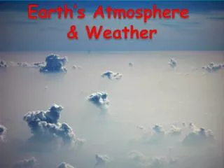
Earth’s Atmosphere • Compared to the size of the Earth (104 km), the atmosphere is a thin shell (120 km). • If the Earth was an orange, the atmosphere would be the pesticides on its peel http://www.gsfc.nasa.gov/gsfc/earth/pinatuboimages.htm
AtmosphereLayers • Exosphere • Thermosphere • (Ionosphere) • Mesosphere • Stratosphere • Troposphere
Stratosphere • extends to 50 kilometers (31 miles) high • dry and less dense • temperature in this region increases gradually to -3 degrees Celsius, due to the absorption of ultraviolet radiation • ozone layer absorbs and scatters the solar ultraviolet radiation • ninety-nine percent of "air" is located in first two layers • every 1000-m 11% less air pressure
Troposphere • 8 to 14.5 kilometers high (5 to 9 miles) • most dense • the temperature drops from about 17 to -52 degrees Celsius • almost all weather is in this region
Composition • Nitrogen (N2, 78%) • Oxygen (O2, 21%) • Argon (Ar, 1%) • myriad of other very influential components are also present which include the Water (H2O, 0 - 7%), "greenhouse" gases or Ozone (O3, 0 - 0.01%), Carbon Dioxide (CO2, 0.01-0.1%),
Humidity • relative humidity is the amount of water vapor in the air compared with the potential amount at the air's current temperature • expressed as a percentage • depends on air temperature, air pressure, and water availability • the Earth has about 326 million cubic miles of water • only about 3,100 cubic miles of this water is in the air as water vapor > clouds > precipitation www.rowcamp.com/photos.htm
Cloud cover • moisture in the atmosphere forms clouds which cover an average of 40% of the Earth at any given time • a cloudless Earth would absorb nearly 20 percent more heat from the sun • clouds cool the planet by reflecting sunlight back into space. This is known as Albedo However • clouds reduce the amount of heat that radiates into space by absorbing the heat radiating from the surface and reradiating some of it back down • the process traps heat like a blanket • “Cloud www.nasm.si.edu/earthtoday/ cloudlg.htm • -Dec-2002 15:52:11 EST
Precipitation • Air containing water vapor cools in atmosphere and therefore condenses to form droplets of liquid water • Rain: liquid, falls, d >0.5 mm (sphere) • Freezing Rain: occurs when drop touches frozen surface • Sleet: ice pellets, d < 0,5 mm, begins as rain but enters air below freezing • Snow: water deposits in hexagonal nuclei below freezing • Snow Pellets: grains of ice, d = 2-5 mm • Hail: 5-190 mm in diameter, concentric rings of ice
Other Factors that effect precipitation: • Prevailing winds • Mountain ranges
Winds • horizontal wind moves from areas of high to low pressure • vertical wind moves from low to high pressure • speed is determined by differences in pressure • Coriolis effect causes winds to spiral from high pressure zones and into low pressure zones www.iiasa.ac.at/Admin/INF/OPT/ Spring98/feature_story.htm
Winds • wind speed is detected by an anemometer • direction is detected by a weather vane • wind direction is based on where the wind is coming from: wind from the east is an easterly • Beaufort Wind Speed Scale is has a range from 0 for calm to 12 for a hurricane with waves greater than 37 feet www.mountwashington.org/notebook/ transcripts/1999/07/07.htm
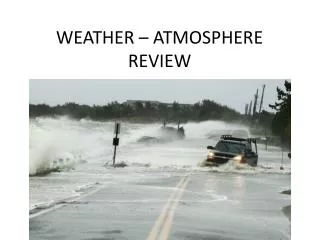
Severe Weather - Thunderstorms • occur from equator to Alaska • may have hail, strong winds, lightning, thunder, rain & tornadoes • moist air rises due to frontal zone lifting causing loss of heat leading to cumulus clouds with updrafts • at 42,000 feet downdrafts and precipitation start • may last an hour • severe thunderstorms occur when cold front approaches warm front (which supplies moisture and energy) • winds over 60 mph • hail > 3/4 inch
Severe Weather - Tornadoes • swirling masses of air with speeds of 300 mph+ • waterspouts occur over water • center of tornado is extreme low pressure which causes buildings to implode • destruction is usually less than 0.5 miles wide and 15 miles long • tornado alley is from Texas to Indiana (usually trailer homes) • Wizard of Oz!
Severe Weather - Hurricanes • cause most property damage and loss of life • winds speeds greater that 74 mph at the center • begin over warm oceans of the tropics • solar insolation (water >80oF) provides energy for huge evaporation, cloud formation, and atmospheric lifting Thorpe, Gary S., M.S., (2002). Barron’s How to prepare for the AP Environmental Science Advanced Placement Exam
Severe Weather - Hurricanes • stages • separate thunderstorms over tropical ocean • cyclonic circulation which causes them to pick up more more moisture and heat energy from ocean • winds speeds of 23 to 40 mph lead to Tropical Depression • Tropical Storms have lower pressure and higher wind speeds (40-75) • center is called the eye • rainfall may exceed 24 inches in 24 hours
The El-Niño Southern Oscillation (ENSO) • Occurs every few years • ENSO’s occur when the prevailing westerly winds weaken or cease and surface waters along the South and North American Coasts become warmer • Upwellings of cold nutrient rich waters are suppressed • Leads to declines in fish populations
ENSO events result from weakening of tropical Pacific atmospheric and oceanic circulation Climatic connections carry these climate effects throughout the globe (e.g., El Niño creates warm winters in AK and lots of rain in California) 2.19
La Nina The opposite of el Nino is La Nina. During La Nina, the winds blowing across the Pacific are stronger than normal and warm water accumulates in the western Pacific. The water near Peru is colder. This causes droughts in the southern United states and excess rainfall in the northwestern Untied States.
Climate • Definitions: Average long term weather of an area • Seasonal variations and weather extremes averaged over a long period (at least 30 years) • 2 Main factors • Temperature • Precipitation • amount • distribution
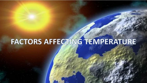
Climate Continued… Factors that effect temperature: • Latitude
Unequal Heating of Earth • This unequal heating is because: • The variation in angle at which the Sun's rays strike • The amount of surface area over which the Sun's rays are distributed • Some areas of Earth reflect more solar energy than others. (Albedo)
Latitude Latitude is the measure of the distance north and south of the equator. Measured in degrees. Areas close to the equator, or 0 degrees latitude, receive the direct rays of the sun. These direct rays provide the most radiant energy. Areas near the equator are warm. Polar regions are cold.
High Latitudes During the year, the high latitudes near the poles have great differences in temperature and daylight hours.
Seasonal Changes • Occur because the earth’s axis is tilted • Creates opposite seasons in the northern and southern hemisphere • Factor that determines global air circulation patterns
Seasons Seasons are short periods of climatic change. Because the Earth is tilted, certain areas of Earth receive changing amounts of radiation throughout the year.
Earth’s Seasons When the north pole tilts toward thesun, it gets more radiation – more warmth during the summer SUMMER (Northern Hemisphere) North Pole Equator Earth When the north pole tilts toward thesun, the south pole tilts away So when it’s summer in the north, it’s winter in the south South Pole WINTER (Southern Hemisphere)
North Pole Equator South Pole Earth’s Seasons Continued…. Tilt of the Earth’s axis towards or away from the sun creates the seasons WINTER (Northern Hemisphere) When the north pole tilts away from the sun, it gets less radiation – So it’s colder during the winter Earth When the north pole tilts away from thesun, the south pole tilts toward it… When it’s winter in the north, it’s summer in the south SUMMER (Southern Hemisphere)
Atmospheric Convection Currents • Air has four properties that determines its movement: • Density- less dense air rises, denser air sinks. • Water vapor capacity- warm air has a higher capacity for water vapor than cold air. • Adiabatic heating or cooling- as air rises in the atmosphere its pressure decreases and the air expands. Conversely, as air sinks, the pressure increases and the air decreases in volume. • Latent heat release- when water vapor in the atmosphere condenses into liquid water and energy is released.
Formation of Convection Currents • Atmospheric convection currents are global patterns of air movement that are initiated by the unequal heating of Earth. • Hadley cells- the convection currents that cycle between the equator and 30˚ north and south. • Intertropical convergence- the area of Earth that receives the most intense sunlight and where the ascending branches of the two Hadley cells converge. • Polar cells- the convection currents that are formed by air that rises at 60˚ north and south and sinks at the poles (90˚ north and south)
Coriolis Effect • As Earth rotates, its surface moves much faster at the equator than in mid-latitude and polar regions. • The faster rotation speeds closer to the equator cause a deflection of objects that are moving directly north or south.