Download
1 / 39
390 likes | 523 Views
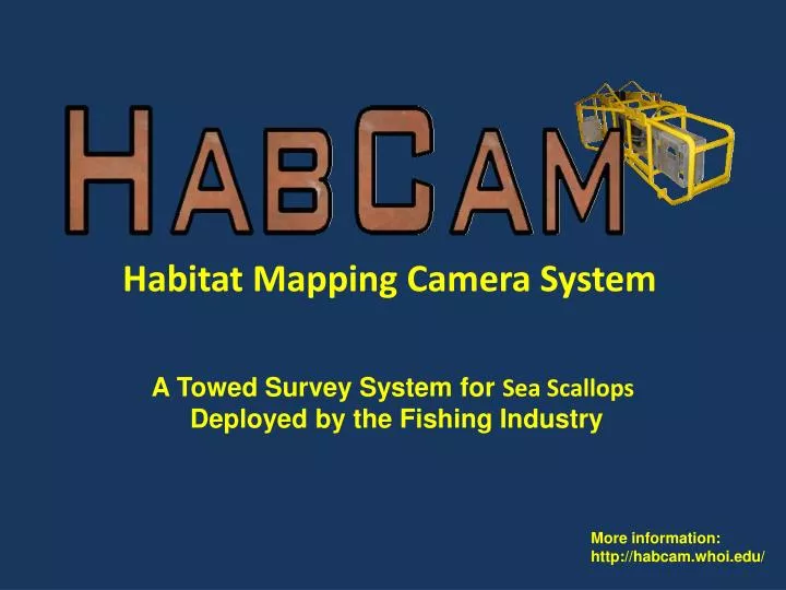
Habitat Mapping Camera System. A Towed Survey System for Sea Scallops Deployed by the Fishing Industry. More information: http://habcam.whoi.edu/. HabCam History: 1. Vehicle and System Development (2002-2005 ): Funded by Northeast Consortium

E N D
Habitat Mapping Camera System A Towed Survey System for Sea Scallops Deployed by the Fishing Industry More information: http://habcam.whoi.edu/
HabCam History: • 1. Vehicle and System Development (2002-2005): • Funded by Northeast Consortium • 2. Research trips (2006-present): • Funded by Scallop RSA
HabCam History: Development (2002-2005) 4 trips ET, GB HAPC, CLAI, WGSC: 100 joint NOAA tows during annual survey Joint tows ET, DMV AST vehicle in SBNMS, Jeffreys Ledge, CLAI, CLAII HAPC, and WGSC HAPC 5 trips: two parts of NLSCA, SE Part CLAII, GB HAPC, CLAI 3 trips: 56 joint tows with R/V Sharp in MAB, GB; Optical surveys: NLSCLA, CLAI, WGSC HAPC 2 trips CLAII, western side of the WGSC HabCam II becomes operational • Vehicle vers. I tested on R/V Oceanus Idea from industry, R&D work with WHOI. 1 trip CLAI and NOAA Survey Leg 3 RSA CLAII and NOAA survey 2002-2003 2004 2005 2006 2007 2008 2009 2010 2011 2012 NOAA Phase I Started joint tows with NOAA Phase III Phase II NE Consortium funding RSA funding
HabCam History: Development (2002-2005) • 2002-2003: • Idea from industry and R&D work with WHOI. • Award from Northeast Consortium of Sea Grant Institutions. • 2004: • HabCam I tested on R/V Oceanus. • 2005: • HabCam II becomes operational.
HabCam History: Research (2006-2008) • HabCam versionII (currently funded by Scallop RSA): • 2006 - Five trips June-October. Two parts of NLSCA, SE Part CLAII, GB HAPC, CLAI. • 2007 - Four trips July-August. 100 joint tows with R/V Albatross IV during dredge survey in ET, GB HAPC, CLAI, and WGSC. • Started joint dredge tow program with NOAA. • 2008 - Joint tows in ET, DMV with the F/V Kathy Marie and the R/V Albatross IV. AST vehicle used for simultaneous optical and acoustic data in SBNMS, Jeffreys Ledge, CLAI, CLAII HAPC, WGSC HAPC.
HabCam History: Research (2009-current) • 2009: 3 RSA trips Jun.-Jul. 56 comparative tows with the R/V Hugh R. Sharp in MAB and GB scallop resource areas comparing dredge catch rates. Optical surveys conducted in NLSCLA, CLAI, WGSC HAPC. • 2010 - 2 RSA trips Jul.-Aug. CLAII, western side of the WGSC; Start of NOAA Project Phase I • 2011 – 1 RSA trip CLAI and NOAA Survey Leg 3 • 2012 – 1 RSA trip CLAII and all of NOAA Survey
2008 Joint Tows: Relative dredge efficiency and variability in multiple scallop resource areas.
2008 Joint Tows: Relative dredge efficiency and variability in multiple scallop resource areas Elephant Trunk 44 joint tows 3 -7 passes DelMarVa 7 joint tows 3 passes
2009 Joint Tows: NMFS Scallop Survey Leg II - NLSCA
2009 Joint ship Tows on NMFS Scallop Survey Leg II - NLSCA R/V Hugh Sharp WGSC, CLAI, CLAII, Canadian Side Nantucket Lightship Scallop Access Area Area: 334 nm2 Trackline length: 348 nm Images Collected: 1,235,251 Images Processed: 123,000 Area Covered: 0.187 nm2 % Area Covered: 0.54 % Time to collect data: 70h, 2.9 days Time to process data: 7 days x 2 = 14 days Survey Efficiency: 334/20 = 17 nm2/day
Nantucket Lightship Scallop Access Area
2010: RSA Grid Survey SE Part GB
RSA Grid Survey - August 2010 * 880 km (475 nm) total * 4.5 days to complete @ 5 kts * 1,760,000 usable images * Manual analysis every 10th image ~170,000 images processed 112 person hours * Automated analysis every image 6 images/sec 8 hours
2010 RSA Survey: Scallop Density 18 / m2 Closed Area II Scallop Access Area
2010 RSA Survey: Scallops and Yellowtail Flounder Yellowtail Closed Area II Scallop Access Area
2012: RSA Grid Survey • CLAII Scallop Access Area • HAPC • 2012 Scallop Survey (all Legs)
Manual annotation tool for measuring and classifying scallops and other targets
Side scan sonar data provides a unique view of what the Seafloor looks like in relation to the images from HabCam 50 m
Quality Assurance and Auditing manual data • Concerns addressed: • outliers • misidentifications • inaccurate measures • scallop false positives, negatives • differences between annotators • detection of unforeseen issues
RSA 2011 QAQC tasks • Review any notes or flags annotators had placed on images. • Review images from the tails of the scallop histogram • Select images at random from the entire dataset • Review of all fish identifications Fish category counts
HabCam (towed underwater camera system): Enhances our knowledge about the scallop resource and helps us contribute to management decisions
For use in sea scallop stock and habitat assessment, the HabCam System collects simultaneous: • high resolution imagery • latitude, longitude • temperature, salinity, chlorophyll • acoustic side scan backscatter • other environmental and sensor data • The HabCam Group: • Arnies Fisheries Inc. • Captain and Crew of the F/V Kathy Marie • Woods Hole Oceanographic Institution • Engineers and Scientists • Independent Researchers
The Northeast Consortium (since 1999) • An organization of New England Sea Grant cooperative programs: • University of Maine • University of New Hampshire • Massachusetts Institute of Technology • Woods Hole Oceanographic Institution • Four objectives: • 1. Develop partnerships between commercial fishermen and scientists, educators, and coastal managers; • Enable participation in collaborative research by commercial fishermen and commercial fishing vessels; • 3. Help bring fishermen's information into the scientific framework needed for fisheries management; • 4. Utilize commercial vessels as research/monitoring platforms. • * Since its nearly 200 projects have been funded by the Consortium.
HabCam: Origin: A cooperative program through the Northeast Consortium Now funded through the Scallop Research Set-Aside Program by participating commercial scallop fishing vessels • The HabCam Group: • Arnies Fisheries Inc. • Captain and Crew of the F/V Kathy Marie • Woods Hole Oceanographic Institution • Engineers and Scientists • Independent Researchers More information: http://habcam.whoi.edu/
Enhancing knowledge about the scallop resource and contributing to management decisions
Acknowledgements • The Northeast Consortium of Sea Grant Institutions • Scallop Research Set Aside Program - Cooperative Research • New England Fishery Management Council and the • Northeast Fisheries Science Center • National Ocean Service • Integrated Ocean Observing Systems IOOS • Sea Grant • Woods Hole Oceanographic Institution (WHOI) • Advanced Habitat Imaging Consortium • Gerry E. Studds - Stellwagen Bank National Marine Sanctuary