Download
1 / 39
390 likes | 538 Views
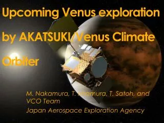
Strategy of meteorological study in Venus Climate Orbiter mission. T. Imamura, M. Nakamura Institute of Space and Astronautical Sciences. Venus Climate Orbiter (Planet-C) project: Status and schedule. The VCO mission was approved by the Space Development Committee of the government in 2001.

E N D
Strategy of meteorological study in Venus Climate Orbiter mission T. Imamura, M. Nakamura Institute of Space and Astronautical Sciences
Venus Climate Orbiter (Planet-C) project:Status and schedule • The VCO mission was approved by the Space Development Committee of the government in 2001. • Budget request for the prototype model study in 2003 is being made. • The spacecraft will be launched in 2008 and arrive at Venus in 2009. • The mission life will be more than than 2 earth years.
Earth and Venus • They have almost the same size and mass. • Surface environments are completely different. • How does the climate system depend on planetary parameters?
Thermal structures of Earth and Venus Earth H2SO4 Cloud Altitude (km) Haze Pressure (atm) Venus Temperature (K)
General circulation of terrestrial planetary atmospheres: how they work? Earth Venus
Angular momentum flux Viscosity? Super-rotation of Venus’ atmosphere Although the period of planetary rotation is 243 days, the atmosphere near the cloud top circles around the planet once every 4 days.
Cyclostrophic balance of Venus’ atmosphere Pole Pole Strong zonal wind Cool Large contrifugal force Weak zonal wind Small contrifugal force Hot EQ EQ These two torques are balanced each other.
Similar wind system in Titan’s stratosphere? Brightness temperature (K) • Rotation period= 16 days • Assuming cyclostrophic balance, the rotation period of the upper atmosphere is 4 days. S.Pole EQ N.Pole
? ? Direct or indirect cells? Momentum carrier? A hypothesis for super-rotation: Gierasch’s mechanism Hadley celltransports angular momentum upward at low latitudes and downward at high latitudes Horizontal viscositytransports angular momentum equatorward Net transport of angular momentum : UPWARD
Meridional circulation Shaded: ClockwiseWhite: Anti-clockwise Venus .. ? Winter Pole EQ Summer Pole Earth: 3-cells exist in each hemisphere
Motion of the sun relative to cloud layer Acceleration Tidal wave Acceleration Tidal wave Acceleration Excitation of eastward-propagating tidal wave accelerates the cloud layer westward. Acceleration by thermal tide Cloud layer Heating region
Model prediction for thermal tide Zonal wind Temperature Meridional wind T×√p Vertical structure of semi-diurnal tide (Takagi, 2001) Vertical wind Phase
Goals of the mission Meteorology • Mechanism of super-rotation • Structure of meridional circulation • Hierarchy of atmospheric motion • Lightning • Cloud physics • Plasma environment • Detection of active volcanism Others
Requirements for meteorological study • Determination of wind field below cloud top • Covering both dayside and nightside Zonally-averaged circulation and momentum flux • Multiple altitude levels including sub-cloud region Vertical structure • Covering from meso-scale to planetary-scale Cross-scale coupling SOLUTION: Continuoushigh-resolutionglobal imaging from a meteorological satellite (like METEOSAT!)
Near-IR windows Visible-UV Leakage of thermal emission from the hot lower atmosphere 2.3mm (Galileo flyby)
Altitude regions to be covered Angular momentum transport Zonal wind Sounding region (km) 100 80 60 40 20 0 Viscosity? Airglow (Visible) Cloud layer SO /Unknown absorber (UV) CO absorption (Near-IR) Cloud top temperature (Long-IR) 2 2 Lower cloud (Near-IR) Radio occultation Lightning CO (Near-IR) 0 50 100 Wind speed (m s-1)
Platform for imaging observation North Solar cell 500N thruster MGA HGA 360 deg ±10 deg cameras 12 deg FOV, 1000x1000 pixels South
Synchronization with the super-rotation detect small deviations of atmospheric motion from the background zonal flow Angle from apoapsis (deg) Air motion at 50 km altitude Orbit: 300 km x 13 Venus radii Inclination 172° Spacecraft motion Orbital period = 30 h Example: Earth cloud movie Time (hours)
Derivation of wind field Continuous global viewing Cloud motion vectors 100-300 km Movement with time Cloud tracked winds on the Earth
What can be seen in high-resolution lower-cloud movie? • Synoptic/planetary-scale waves • Cloud organization • Gravity waves • Other meso-scale phenomena Morphology of lower clouds 2.3mm Images byGround-based observation (Crisp et al. 1991)
Cameras (1) • Near IR camera 1 (IR1) • 1.0 mm (near-IR window) • 1024 x 1024 pixels, FOV 12deg, SiCCD • Cloud distribution, fine structure of lower cloud (dayside) • Surface emission including active volcanism (nightside) • Near IR camera 2 (IR2) • 1.7, 2.3, 2.4 mm (near-IR window), 2.0 mm (CO2 absorption) • 1040 x 1040 pixels, FOV 12deg, PtSi • Cloud distribution and particle size (nightside) • Cloud top height (dayside, 2.0mm) • Carbon monooxide (nightside) Galileo (2.3mm)
IR2 thermal test model Optics Filter wheel Detector housing Aperture Stirling cooler Dayside Nightside Venus image taken with IR2 test filter (Okayama Astronomical Observatory)
Cameras (2) • UV camera (UVI) 280, 320 nm • 1024 x 1024 pixels, FOV 12deg, SiCCD • SO2 and unknown UV absorber near the cloud top (dayside) • Longwave IR camera (LIR) • 9-11 mm • 240 x 240 pixels, FOV 12deg, Uncooled bolometer • Cloud top temperature (day/night) • Lightning and Airglow camera (LAC) • 777, 551, 558 nm • 8 x 8 pixels, FOV 12deg, Photo diode • High-speed sampling of lightning flashes (nightside) • O2 / O airglows (nightside) Mariner 10 PVO (North pole)
Operation of cameras 12 deg FOV • Whole disk in the field of view over 70% of the orbital period Development/decay of planetary-scale features in both hemispheres Precise mapping of each pixel onto planetary surface • Acquisition every few minutes- few hours (nominal: 2 hours) • Spatial resolution is <16 km • Near-IR (dayside) • Ultraviolet • Long-IR • Near-IR (nightside) • Lightning/Airglow
Radio occultation (USO) • Temperature profiles at two opposite longitudes in the low latitude • Zonal propagation of planetary-scale waves • H2SO4 vapor profile • Ionosphere To the earth Pole Spacecraft motion Atmosphere
3-D viewing Dayside Nightside Temperature, H2SO4 vapor (Radio occultation) Airglow (Visible) 90 km SO2, Unknown absorber (UV) Cloud top temperature(Mid-IR) Cloud top height (Near-IR) 70 km Lower clouds (Near-IR) 50 km CO (Near-IR) 35-50 km Cloud motion vectors 0 km Lightning (Visible) Surface (Near-IR)
Optical sounding of ground surface • Search for hot lava erupted from active volcano by taking global pictures at 1.0mm every half a day • Emissivity distribution of the ground surface
Summary • The spacecraft will be launched in 2008, arrive at Venus in 2009, and observe meteorological processes more than 2 years. • The mission is optimized for observing atmospheric dynamics in the low/mid-latitudes. • Science payloads will be multi-wavelength cameras covering wavelengths from UV to IR, USO, plasma detectors, and magnetometer. • Collaboration with complementary VEX measurements is strongly needed.
VEX and VCO • Optimization: Spectroscopy Imaging • Orbit: Polar Equatorial • Global images: High latitudes Low latitudes
Possible collaboration • Complementary information on the general circulation and cloud chemistry
Chemical species related with cloud formation (VEX) Spatial correlation between cloud top height and UV contrast (VCO) • Origin of ultraviolet contrast • Cloud height or UV absorber • Mechanism of producing inhomogeneity
Possible collaboration • Complementary information on the general circulation and cloud chemistry • Cloud morphology in both low and high latitudes • To constrain the VCO sounding region using the VEX spectroscopic data • Collaboration in receiving downlink (Radio science) • Mutual comparison of the tools for data analysis • Radiative transfer code • Cloud tracking algorithm • General circulation model • European instruments onboard VCO
Model predictions for “horizontal viscosity” Two-dimensional turbulence in Venus-like mechanical model (Iga, 2001) Phase velocity-latitude cross section of meridional momentum flux u’v’ in Venus-like GCM (Yamamoto and Takahashi, 2003)
Venus? Energy cycle of Earth climate system Disturbance potential energy 15.6x10⁵ J/m2 Axi-symmetric potential energy 33.5x10⁵ J/m2 1.5 W/m2 Solar energy 0.7 W/m2 Solar energy 1.5 W/m2 2.2 W/m2 0.2 W/m2 Dissipation 1.9 W/m2 Dissipation 0.1 W/m2 Disturbance kinetic energy 8.8x10⁵ J/m2 Axi-symmetric kinetic energy 3.6x10⁵ J/m2 0.3 W/m2
Planetary waves driving the circulation Equatorial waves Meridional transport of trace gases Meridional transport of trace gases VEX VCO Forbes (2002) Gravity waves at low latitude (radio occult.) Gravity waves at high latitude (radio occult.) Polar collar Polar dipole H2SO4 vapor at high latitude by radio occult. H2SO4 vapor at low latitude by radio occult. Meridional drift velocity at low latitude Meridional drift velocity at high latitude