Download
1 / 1
10 likes | 165 Views
AGU, December 2010. Modeling the mass b alance of the Wolverine Glacier, Alaska USA using the PTAA model. David L Korn, NSIDC, University of Colorado, Boulder, dkorn@nsidc.org.

E N D
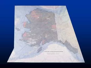
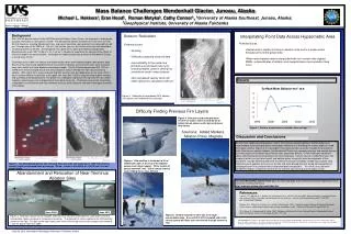
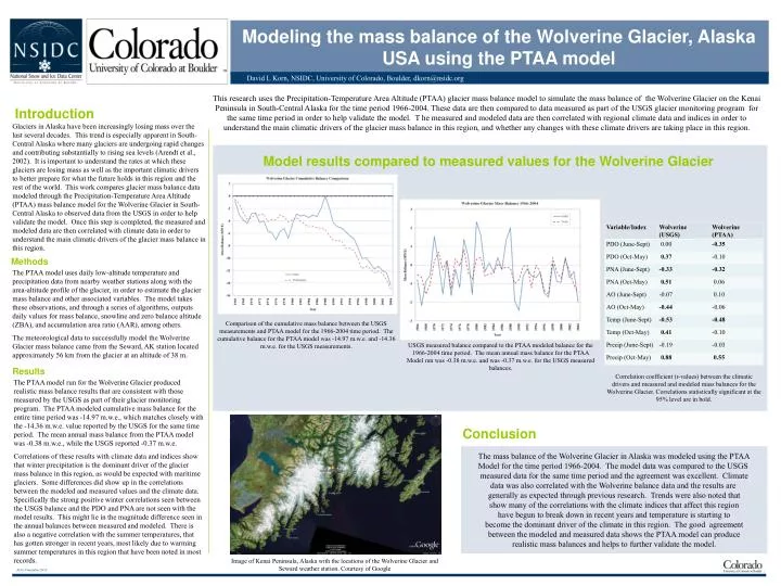
AGU, December 2010 Modeling the mass balance of the Wolverine Glacier, Alaska USA using the PTAA model David L Korn, NSIDC, University of Colorado, Boulder, dkorn@nsidc.org This research uses the Precipitation-Temperature Area Altitude (PTAA) glacier mass balance model to simulate the mass balance of the Wolverine Glacier on the Kenai Peninsula in South-Central Alaska for the time period 1966-2004. These data are then compared to data measured as part of the USGS glacier monitoring program for the same time period in order to help validate the model. T he measured and modeled data are then correlated with regional climate data and indices in order to understand the main climatic drivers of the glacier mass balance in this region, and whether any changes with these climate drivers are taking place in this region. Introduction Glaciers in Alaska have been increasingly losing mass over the last several decades. This trend is especially apparent in South-Central Alaska where many glaciers are undergoing rapid changes and contributing substantially to rising sea levels (Arendt et al., 2002). It is important to understand the rates at which these glaciers are losing mass as well as the important climatic drivers to better prepare for what the future holds in this region and the rest of the world. This work compares glacier mass balance data modeled through the Precipitation-Temperature Area Altitude (PTAA) mass balance model for the Wolverine Glacier in South-Central Alaska to observed data from the USGS in order to help validate the model. Once this step is completed, the measured and modeled data are then correlated with climate data in order to understand the main climatic drivers of the glacier mass balance in this region. Model results compared to measured values for the Wolverine Glacier Methods The PTAA model uses daily low-altitude temperature and precipitation data from nearby weather stations along with the area-altitude profile of the glacier, in order to estimate the glacier mass balance and other associated variables. The model takes these observations, and through a series of algorithms, outputs daily values for mass balance, snowline and zero balance altitude (ZBA), and accumulation area ratio (AAR), among others. The meteorological data to successfully model the Wolverine Glacier mass balance came from the Seward, AK station located approximately 56 km from the glacier at an altitude of 38 m. Comparison of the cumulative mass balance between the USGS measurements and PTAA model for the 1966-2004 time period. The cumulative balance for the PTAA model was -14.97 m.w.e. and -14.36 m.w.e. for the USGS measurements. USGS measured balance compared to the PTAA modeled balance for the 1966-2004 time period. The mean annual mass balance for the PTAA Model run was -0.38 m.w.e. and was -0.37 m.w.e. for the USGS measured balances. Results Correlation coefficient (r-values) between the climatic drivers and measured and modeled mass balances for the Wolverine Glacier. Correlations statistically significant at the 95% level are in bold. The PTAA model run for the Wolverine Glacier produced realistic mass balance results that are consistent with those measured by the USGS as part of their glacier monitoring program. The PTAA modeled cumulative mass balance for the entire time period was -14.97 m.w.e., which matches closely with the -14.36 m.w.e. value reported by the USGS for the same time period. The mean annual mass balance from the PTAA model was -0.38 m.w.e., while the USGS reported -0.37 m.w.e. Correlations of these results with climate data and indices show that winter precipitation is the dominant driver of the glacier mass balance in this region, as would be expected with maritime glaciers. Some differences did show up in the correlations between the modeled and measured values and the climate data. Specifically the strong positive winter correlations seen between the USGS balance and the PDO and PNA are not seen with the model results. This might lie in the magnitude difference seen in the annual balances between measured and modeled. There is also a negative correlation with the summer temperatures, that has gotten stronger in recent years, most likely due to warming summer temperatures in this region that have been noted in most records. Conclusion The mass balance of the Wolverine Glacier in Alaska was modeled using the PTAA Model for the time period 1966-2004. The model data was compared to the USGS measured data for the same time period and the agreement was excellent. Climate data was also correlated with the Wolverine balance data and the results are generally as expected through previous research. Trends were also noted that show many of the correlations with the climate indices that affect this region have begun to break down in recent years and temperature is starting to become the dominant driver of the climate in this region. The good agreement between the modeled and measured data shows the PTAA model can produce realistic mass balances and helps to further validate the model. Image of Kenai Peninsula, Alaska with the locations of the Wolverine Glacier and Seward weather station. Courtesy of Google