Download
1 / 10
110 likes | 309 Views
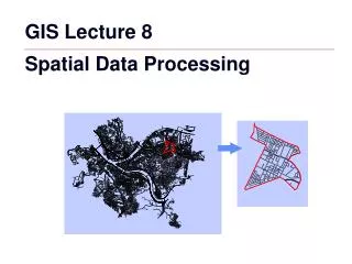
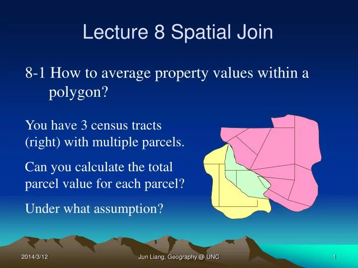
Lecture 8 Spatial Join. 8-1 How to average property values within a polygon?. You have 3 census tracts (right) with multiple parcels. Can you calculate the total parcel value for each parcel? Under what assumption?. 8-1 How to Average Property Values Within a Polygon? (Cont.).

E N D
Lecture 8 Spatial Join 8-1 How to average property values within a polygon? You have 3 census tracts (right) with multiple parcels. Can you calculate the total parcel value for each parcel? Under what assumption? Jun Liang, Geography @ UNC
8-1 How to Average Property Values Within a Polygon? (Cont.) Answer – If parcels in the same tract (polygon) have the same color (attribute), we can select them out and average their property value. What if we do not know about this? Further solution: Join the parcel map to the census tract map – it is a multiple to 1 join (why). Jun Liang, Geography @ UNC
8-2 Join Two Feature Datasets Two ways you can join a table to another table: • Join by attribute • Join by location Which way should we choose? Jun Liang, Geography @ UNC
8-3 Spatial Join What can you do with a spatial join? A spatial join joins the attributes of two layers based on the location of the features in the layers. With a spatial join, you can find: • · The closest feature to another feature. • · What's inside a feature. • · What intersects a feature. • · How many points fall inside each polygon. Jun Liang, Geography @ UNC
8-3 Spatial Join (Cont.) Examples: • Suppose you wanted to tell a customer where they can find the nearest branch office of your business, or • You want to compare different wildlife species with information about the habitats they live in. • Average property value for each census tract. These types of queries can be answered with a spatial join. Jun Liang, Geography @ UNC
8-4 How Does a Spatial Join Work? Like joining two tables by matching attribute values in a field, a spatial join appends the attributes of one layer to another. You can then use the additional information to query your data in new ways. While you can also select features in one layer based on their location relative to another layer, a spatial join provides a more permanent association between the two layers because it creates a new layer containing both sets of attributes. Jun Liang, Geography @ UNC
8-5 How to Join the Attributes of Features by Their Location Options for join one feature dataset to another dataset by their location: • Finding the nearest feature • Finding what's inside a polygon • Finding what intersects a feature Jun Liang, Geography @ UNC
C B C1 A 8-5 How to Join the Attributes of Features by Their Location (Cont.) Finding the nearest feature The nearest feature is defined as the feature that is geographically closest to another one. Proximity is based on straight line distance between features. Bold Red Line - Straight distance between tract B and C1. Jun Liang, Geography @ UNC
8-6 Steps for Spatial Join in ArcMap 1. Right-click the layer to which you want to join attributes, point to Joins and Relates, and click Join. 2. Click the first dropdown arrow and click Join data from another layer based on spatial location. 3. Click the layer dropdown arrow and click the name of the layer whose attributes you want to join. Jun Liang, Geography @ UNC
8-6 Steps for spatial join in ArcMap (Cont.) If the layer is not currently part of the map, click the Browse button to search for it on disk. 4. Click Each point will be given all the attributes of the line that is closest to it, and a distance field showing how close that line is. 5. Type the name of the output shapefile or feature class. 6. Click OK. Jun Liang, Geography @ UNC