Download
1 / 13
130 likes | 133 Views
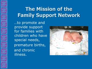
Protect, restore, and manage coastal and ocean resources. Enhance society's ability to plan and respond to climate variability and change. Support weather and water information needs. Ensure safe and efficient transportation.

E N D
Mission support Presented by Timothy J. Schmit
Requirement, Science, and Benefit Mission Goals • Protect, Restore, and Manage the Use of Coastal and Ocean Resources through an Ecosystem Approach to Management • Understand Climate Variability and Change to Enhance Society’s Ability to Plan and Respond • Serve Society’s Needs for Weather and Water Information • Support the Nation’s Commerce with Information for Safe, Efficient, and Environmentally Sound Transportation Science • STAR works with many (internal, external and international) to further the mission goals Benefits • National Weather Service and their customers (Emergency planners, General public, Numerical Weather Prediction, etc.) • Aviation • Air Quality • Department of Defense • International users (Central America, South America, Pacific, etc.) • Broadcasters, Etc.
Outline • Goals: Continuity and Improved Services • STAR supports NESDIS and NOAA in their mission to assess current conditions and predict future changes on the Earth, and to understand long-term changes in the environment. • The STAR mission is to transfer satellite observations of the land, atmosphere, ocean, and climate from scientific research and development into routine operations, and to offer state-of-the-art data, products and services to decision-makers. • STAR develops a diverse spectrum of complex, often interrelated, environmental algorithms and software systems. These systems are developed through extensive research programs, and transitioned from research to operations when a sufficient level of maturity and end-user acceptance is achieved. • NOAA interactions (examples via oral presentations, etc.) • NASA interactions (examples via posters) • Other/International interactions (examples via posters)
Ecosystem Mission GoalResearch Areas • Advancing understanding of ecosystems to improve resource management • Exploring our oceans • Forecasting ecosystems events • Developing scenarios and building capacity to support regional management Harmful Algal Blooms in Chesapeake Bay
Climate Mission Goal Research Areas • Develop an integrated global observation and data management system for routine delivery of information on the current state of the climate • Document and understand changes in climate forcings and feedbacks, thereby reducing uncertainty in climate projections • Improve skill of climate predictions and projections and increase range of applicability for management and policy decision • Understand impacts of climate variability and change on marine ecosystems to improve their management • Enhance NOAA’s operational decision support tools to provide climate services for nationalsocio-economic benefits. The interannual variability in high cloud averaged over the month of July for 1983, 1988, 1993 and 1998. Areas with large amounts of high cloud are red; areas with less high cloud are blue.
Weather & Water Mission GoalResearch Areas Smoke Smoke Smoke Smoke • Improve weather forecast and warning accuracy and amount of lead time • Improve water resources forecasting capabilities • Provide information to air-quality decision makers and improve NOAA’s national air quality forecast capability • Improve NOAA’s understanding and forecast capability in coasts, estuaries and oceans MODIS Color Composite
Commerce & Transportation Mission Goal Research Areas Ash Cloud Mass Loading (ton/km2) Ash Height (km) 0 5 10 15 20 • Explore, develop and transition emerging technologies and techniques to enhance marine navigational safety and efficiency • Provide accurate, timely and integrated weather information to meet air and surface transportation needs • Improve accuracy of positioning capabilities to realize national economic, safety and environmental benefits • Develop the information and tools to make reliable decisions in preparedness, response, damage assessment and restoration
Global Precipitation Measurement (GPM) Mission – Example of NOAA-NASA Collaboration NOAA’s Steering Group on Precipitation Measurement from Space • NOAA will greatly benefit by advanced precipitation products generated by GPM • Weather and Water, Climate goals • NOAA’s participation in GPM is guided by a SG as per NRC (2007) recommendation • Cross LO involvement (NESDIS, NWS, OAR) • NOAA engaging with NASA for past 6 years: • Precipitation Measurement Missions (PMM) Science Team • Cutting edge R&D • Joint ground validation • Exchanging satellite assets • Ad-Hoc meetings • NOAA involvement in NASA White papers, review panels, steering groups, international planning workshops, etc. • STAR and OSD leads NOAA GPM programmatic activities • R2O plans being developed • Working PPBES/Budgets
NASA/NOAA GOES-14 Post-launch Testing GOES-14 GOES-12 The Geostationary Operational Environmental Satellites (GOES)-14 post-launch check-outs are examples of NASA and NOAA and others (Cooperative Institutes) working together. For all GOES check-outs, the goals of the Science Test include the following: • To assess the quality of the GOES radiance data. • To generate products from the GOES data stream and compare to those produced from other satellites. • Rapid-scan imagery of interesting weather cases are collected with temporal resolutions as fine as every 30 seconds. The 13.3 um band 6 of the GOES-12 (left panel) has an 8 km IGFOV (Instantaneous Geometric Field of View); while the same band on the GOES-14 (right panel) has a 4 km IGFOV. Note the finer resolution of the cloud edges and the ‘cleaner’ image.
Private sector GOES-R Benefit analysis Beyond Current GOES Series 1 Discounted at 7% ABI-related incremental benefit of $4.6 B Other Potential Benefits ??? Improved Sounder Updated CBA (HES) $2.3B TC Forecast (HRSS) ABI-Related $1.9B $4.2B Updated CBA (ABI) $2.2B $2.4B TC Forecast (ABI) $4.6B Many applications and users were not included in this limited study.
GSICS is an international example • Global Space-based Inter-Calibration System (GSICS) • Goal - Enhance calibration and validation of satellite observations and to intercalibrate critical components global observing system • Part of WMO Space Programme • GSICS Implementation Plan and Program formally endorsed at CGMS 34 (11/06)
Summary • STAR works with many (internal, external and international) to further the mission goals • Within agency • NWS, NOS, etc. • With other agencies • NASA, FAA, EPA, DoD, etc. • With other governmental entities • State, tribal, etc. • With other countries • EUMETSAT, Japan, Canada, China, India, Russia, Brazil, etc. • international groups (WMO, GEOSS, CEOS, etc.)