Download
1 / 34
340 likes | 552 Views
CHAPTER 14 WEATHER FORECASTING. Favorable conditions for tornadoes. Example from book. In addition to moisture, instability, and lifting, we need strong wind shear At low levels, southerly winds bringing warm, moist air into the area Aloft, advection of dry air adds to instability

E N D
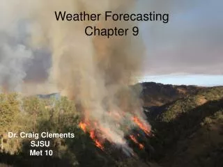
CHAPTER 14 WEATHER FORECASTING
Favorable conditions for tornadoes Example from book • In addition to moisture, instability, and lifting, we need strong wind shear • At low levels, southerly winds bringing warm, moist air into the area • Aloft, advection of dry air adds to instability • Upper-level divergence leads to low-level upward motion
What do we need to forecast? • Temperatures (high/low/average/changes) • Precipitation (will it rain or snow, and how much?) • Wind (speed and direction) • Cloud cover • Severe/hazardous weather (tornadoes, hurricanes, floods, etc.) • Fire weather • Marine weather (forecasts for ships at sea) • Pollution/smog/air quality • Much more…
Timescales of forecasts • Short-term forecasts (aka “nowcasts”): minutes to a couple hours in advance • What time will the severe storm affect my area and how intense will it be? • Short-range forecasts: 6 to 60 hours in advance • How likely is it to rain tomorrow? • Mid-range forecasts: 3-10 days in advance • Will it be warm or cold next weekend? • Climate predictions: months or seasons in advance • Will we have above normal or below normal precipitation for the next ski season?
Who makes forecasts? • National Weather Service • 122 weather forecast offices (WFOs) located around the country • NWS issues a variety of forecasts, warnings, and other products for a local area • We are covered by the WFO in League City (south of Houston) • http://weather.gov • http://www.srh.noaa.gov/hgx/
Who makes forecasts? (cont’d) • National Centers for Environmental Prediction • NCEP headquarters collects observations and runs numerical models to make forecasts http://www.ncep.noaa.gov • Storm Prediction Center, Norman, OK (Severe thunderstorm and tornado watches) http://www.spc.noaa.gov • National Hurricane Center/Tropical Prediction Center, Miami, FL (official hurricane forecasts, watches and warnings) http://www.nhc.noaa.gov • Hydrometeorological Prediction Center, Camp Springs, MD (precipitation and flood forecasts) http://www.hpc.ncep.noaa.gov • Climate Prediction Center, Camp Springs, MD (seasonal outlooks, El Niño predictions) http://www.cpc.noaa.gov • Private Companies • TV and radio stations, The Weather Channel, AccuWeather, WeatherNews, many others
What is a good forecast? • Depends on the user/customer • For the general public, getting the high/low within a few degrees is probably good enough • For an energy company, an error of a few degrees can be very costly • Transportation departments need very accurate snowfall forecasts: will plows need to be deployed? Should highways be closed? • Aviation industry needs to know cloud cover, where storms are moving, turbulence, etc. • Human forecasters need to provide skill • Anyone could forecast “80 and sunny” every day of the year in LA and be pretty close 90% of the time • It’s the other 10% where a skilled forecaster earns his/her salary
Manual forecasting techniques • Before computers, forecasts were mainly limited to predicting the movement of existing weather (“It snowed yesterday in Minnesota, so it will snow today in Wisconsin”) • Pattern recognition was (and still is) used by experienced forecasters – after looking at the weather every day, you gain an “instinct” for certain weather patterns • Ingredients-based forecasting • Will there be moisture, instability, and lift? • “Rules of thumb” • If air temperature is 14°C colder than water temperature, lake effect snow is possible • For high temperature (in summer): take forecast 850-mb temperature at 0000 UTC, add 15°C
Weather forecast models • North American Mesoscale (NAM, previously called Eta): Primary model used for forecasting in the U.S. • Run every 6 hours (00, 06, 12, 18 UTC) out to 84 hours, 12-km horizontal grid spacing • Global Forecast System (GFS): Covers the entire globe • Run every 6 hours, 35-km horizontal grid spacing to 180 hours, 70-km grid to 384 hours (16 days) • Rapid Update Cycle (RUC) • Run every hour out to 12 hours – for short-term forecasts • Mesoscale models: Weather Research and Forecasting (WRF), Regional Atmospheric Modeling System (RAMS), Mesoscale Model version 5 (MM5) • Run by forecast offices, universities, etc., on a regional basis • Climate Prediction Models
Where to get numerical forecasts? • http://www.rap.ucar.edu/weather/model/ (National Center for Atmospheric Research) • http://www.nco.ncep.noaa.gov/pmb/nwprod/analysis/ (National Centers for Environmental Prediction) • http://hdwx.tamu.edu/wxdata.php (if on campus network; this site is still under construction!) But, interpret this information with caution until you have a good sense for how it works – for official forecasts and warnings, use weather.gov (they’re experts in interpreting numerical forecasts!)
PREDICTING LONG-TERM WEATHER AND CLIMATE PATTERNS • El Niño, La Niña and Southern Oscillation • ENSO is a combined atmosphere and ocean phenomenon. • Originally, referred to unusually warm waters off of NW coast of S. America. • Reverse of pressure difference between Tahiti and Darwin is SO, Walker Cell reversal • This was found to be part of a large system which also includes shift of convective max, changes in the upper ocean structure and currents. • All together - ENSO • Weather all over planet impacted - teleconnections • Asia • Australia • South America • Caribbean • North America
http://www.cpc.ncep.noaa.gov/products/analysis_monitoring/lanina/enso_evolution-status-fcsts-web.pdfhttp://www.cpc.ncep.noaa.gov/products/analysis_monitoring/lanina/enso_evolution-status-fcsts-web.pdf
Also, Atlantic hurricane season “modulation”. El Niño years tend to be less active seasons, La Niña enhanced. Fig. 14.17, p. 421
PREDICTING LONG-TERM WEATHER AND CLIMATE PATTERNS • The other oscillations • Pacific Decadal Oscillation (PDO) • Similar to ENSO, 20-30 cycles, W. Coast impacts • North Atlantic Oscillation (NAO) • Large impact on European weather, some on E. U.S. • Affects tropical storm tracks • Arctic (AO) • Close cousin of NAO