Download
1 / 14
150 likes | 392 Views
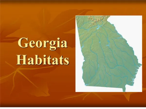
Where is Georgia?. Hemispheres -Northern and Western Continent – North America Nation - United States Region – Southeastern U.S. Bordering states – Florida, S.C., N.C. Alabama, Tennessee. Appalachian Plateau. Smallest region Northwest corner of state TAG Corner

E N D
Where is Georgia? • Hemispheres -Northern and Western • Continent – North America • Nation - United States • Region – Southeastern U.S. • Bordering states – Florida, S.C., N.C. Alabama, Tennessee
Appalachian Plateau • Smallest region • Northwest corner of state • TAG Corner • Sandstone, shale, and limestone • sandy soil not good for farming (small amount of corn and soybeans) • Hardwood forests and pasture • Only known source of coal in Georgia • Two flat-top features – Sand Mountain and Lookout Mountain
Ridge and Valley • Valley floors used for farming and pasture • 210-220 days growing season supports variety of crops – corn, soybeans, wheat, cotton, fruits • Hardwood and pine timber • Sandstone ridges are forest-covered • Textile manufacturing and carpet industry
Blue Ridge • Brasstown Bald – highest point in Georgia at 4,784 feet • Springer Mountain – beginning of Appalachian Trail • Receives most precipitation – warm, moist air from Gulf of Mexico cooled by height of mountains • Source of many rivers, such as Savannah and Chattahoochee, due to large amounts of rainfall • Most of erosion in state because of steep slopes and heavy rainfall • Less than 1% of Georgia’s farmland – farms are small • Apples and some vegetables • Hardwood timber and pine
Piedmont • Red clay • “foot of the mountains” • Most populated region • Granite , gneiss, marble • Gently rolling hills • Rivers and streams – most flowing north to south • Navigation impossible for large boats • Well suited for agriculture – large farms • Extensive pine forests
Coastal Plain • Largest region – about 60% of the state • Covered entirely by ocean in prehistoric era • Relatively flat • Rivers entering the Coastal Plain flow slowly from the north; pick up speed at Fall Line; become wider closer to the coast • Coastal areas – poorly drained soil and swampy • Inland areas – well-drained soil and very fertile (peanuts, peaches, pecans • Okefenokee Swamp • Barrier Island
Okefenokee Swamp“land of the trembling earth” • Largest freshwater wetland (any area of low-lying land covered by water all or part of the time and where special types of flora and fauna are found) in Georgia – 700 miles • Largest swamp in North America • Land of the trembling earth
Barrier Islandsform a barrier • Chain of sea islands several miles off the coast • Block ocean waves and wind from directly hitting the mainland • Often called the “Golden Isles” • Protected by state or federal authorities • Beaches are on seaward side of outer islands
Fall Line Features • Hilly or mountainous lands meet the coastal plain • Runs from Columbus (west) through Macon to Augusta (east) • Many waterfalls caused by water from the hills cutting channels into the softer soil of the plains • Fall Line waterfalls provide power source for several Georgia communities
Georgia’s Rivers • Twelve principle river systems • Savannah, Ogeechee, Altamaha (which combines Oconee and Ocmulgee), and Satilla rivers flow into Atlantic Ocean • Chattahoochee and Flint Rivers become part of Gulf of Mexico • Oostanaula and Etowah Rivers form the Coosa River, which flows through Alabama to the Gulf. • Alapaha, Suwannee, and St. Mary’s form the Georgia-Florida border
Appalachian Mountains • The northeast mountains of the Blue Ridge regions are part of the Blue Ridge Mountain Range. • The range is a long string of mountains in the Appalachian Mountain Range stretching from northeast Georgia to southern Pennsylvania.
Effect of Climate on Georgia • Climate: Weather averaged over a long period of time (usually 30 years) • Georgia is broken up into three climatic regions: • The Mountains: cool summers, cold winters • The Piedmont Plateau: hot summers, mild winters • The Coast: hot, humid summers, mild winters
Effect of Climate on Georgia • Cool summers in the northern regions attract many new residents to the area. • Mild winters in the southern part of the state have contributed to a continuing population migration into Georgia. It has also attracted the military, because it allows for outdoor training. • The climate also allows for longer growing seasons in the south.