Download
1 / 33
360 likes | 606 Views
SPADAT Program and Visual Sample Plan (VSP) Update. Pacific Northwest National Laboratory (PNNL) Brent Pulsipher, John Wilson, Lisa Newburn, Landon Sego, J. Hathaway, Brett Matzke, Chris Murray, Scott Dowson, Nancy Hassig. Outline.

E N D
SPADAT Program and Visual Sample Plan (VSP) Update Pacific Northwest National Laboratory (PNNL) Brent Pulsipher, John Wilson, Lisa Newburn, Landon Sego, J. Hathaway, Brett Matzke, Chris Murray, Scott Dowson, Nancy Hassig.
Outline Why Systematic Planning and Data Assessment Tools and Training (SPADAT) Program? VSP Background and Applications Past and Planned VSP Training New DOE Sponsored Methods and Features Leveraging Off Other Agency Investments Upcoming Additions
Why SPADAT Program? All DOE Sites Obtain Samples for Variety of Purposes Decommissioning and Decontamination Environmental Characterization and Remediation Environmental Monitoring (in process and long term) Process/Quality Control and Health Monitoring SPADAT Exists To: Ensure There are Methods/Tools for Gathering the Right Type, Quality, and Quantity of Data to Support Confident Decisions Facilitate Statistically Defensible Data Analyses Provide Training on Available Tools Decreased Costs, Increase Defensibility While Managing Uncertainty
What is Visual Sample Plan (VSP)? Data Quality Objectives (DQO) based systematic planning software Determines the number and location of samples/transects Ensures confident, statistically defensible decisions Performs statistical and data quality assessment in support of decision making process. Sponsored by DHS, DOE, EPA, DoD, UK, CDC Free VSP Download at http://vsp.pnl.gov/ >5000 Users
Current VSP Applications Identification, Delineation, and Remediation of UXO Sites Within-Building Bio/Chem/Rad Terrorist Event Environmental Remediation Decontamination and Decommissioning Long-Term Legacy and Groundwater Monitoring Natural Disaster Assessments Outdoor Bio/Chem/Rad Terrorist Event Item audits and surveillance. Wherever Sampling Is Used to Support Decisions
VSP Screen Shot Maps, Photos, Images, Floorplans can be imported/exported with sample areas defined and samples displayed. Diagnostic interactive graphics can be manipulated to quickly see effects on design of changing DQO inputs Detailed 3-15+ page report automatically generated documenting design, assumptions, maps, equations, DQOs, analyses Sample location coordinates listed and available for output for use in the field (w/GPS) 6
DOE-HS VSP Objectives • Must Be Useful for DOE Sites • Decrease Costs • Increase Defensibility • Directly Applicable to DOE Site Issues • Be Practical • Easy to Use • Facilitated Technology Transfer • Many of the SPADAT tasks are focused on making VSP more easily applied in the real world and expanding the methods and tools to address complications that are always present in the real world. 7
More Oak Ridge DOE Site Applications Many More…. > 100 Oak Ridge VSP Users. 9
General Benefits of Using VSP • Statistically defensible sampling designs • Statistical rigor hidden… designed for non-statistician • Quantified confidence • Real-time cost/benefit tradeoff evaluations • Just enough sampling • Visualization supports communication • Streamlined acceptance by regulators • Leveraging off multi-agency investments 10
Current VSP Sponsors • U.S. Environmental Protection Agency (EPA) • Office of Solid Waste and Emergency Response • Office of Environmental Information • U.S. Dept. of Energy (DOE) • HSS, LM, EM • U.S. Dept. of Defense (DoD) • Navy • SERDP/ESTCP • U.S. Dept. of Homeland Security (DHS) • Technical Support Working Group (TSWG) • Chemical and Biological Countermeasures • United Kingdom Atomic Weapons Establishment • U.S. Centers for Disease Control (CDC/NIOSH) Tools Integration and Leveraging Off All Investments 11
VSP Decision Objectives • Supports many decision objectives • How will data be used/summarized to support a decision? 13
Indoor Surface Sampling and Analysis • Accurate 3-D Representations • Zoning of Areas • Indoor Coordinate System • Furniture Placement/Sampling • Sample Results Visualized • Wipe or Point Samples • DXF or SHP Files Imported/Exported 14
Outdoor Sampling and Analysis • Maps, Photos/Images • Maintains Coordinate System • Output For GPS • Multiple Analytes and Sample Areas 15
Item Sampling • How Many Items Should I Sample? • Drums, Folders, Property, Equipment, Widgets…. • X% Confident that Y% Are Acceptable • 4 Options Available • Using Prior Knowledge • Judgment w/ Random • Probabilistic Only • Allow Some Unacceptable
Sampling and Analysis Over Time • Sample requirements for confidently detecting trends • Fitting linear and exponential trends • Evaluating consistency of trends over time • Projections of when target concentration will be obtained • Adjustments for seasonal effects • Sampling frequency reduction analyses 17
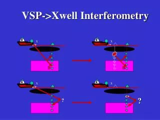
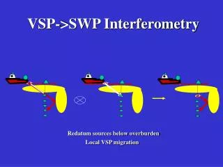
Spatial Sampling and Analysis • Geospatial Kriging • Spatial sample/well redundancy analysis • Optimization of sample/well placement • Maps of probability of exceeding concentration threshold 18
Unexploded Ordnance Sites • Transect design for detection of target areas • Target area flagging, delineation, anomaly density mapping and estimation • Post-remediation verification sampling 19
VSP Training Courses 3.5 Day Format 2 Days of General Training 1.5 Days of Advanced Training Completed during FY11: DOE and EPA in Vegas Feb 22-25, 2011 DOE at LANL Aug 23-26, 2011 DOE Affiliated Tribes Sep 14-15, 2011 DoD Environmental (Baltimore, Huntsville) Jan/Mar, 2011 5 other DoD /UK/NRC Courses Upcoming: DOE Paducah/Portsmouth & Air Force Winter FY12 DOE Oak Ridge Winter FY12 NRC (CA & DC) Jan/Oct FY12 DoD UXO Courses Jan & Apr FY12 Cost Sharing Funding for DOE courses
FY10-11 DOE-HS Funded Activities Sentence Style User Dialogs Composite (Multiple-Increment) Sampling For Hotspots Hotspot Delineation and Remediation Cost Estimator Effluent Monitoring Method -- Trend Change Detection (control charts) Better Support for Multiple Analytes Unaligned Grid Sample Placement 3.5 Day Training Courses 21
Sentence Style User Dialogs Before After 22
Multiple Increment Hotspot Sampling • MI Sampling is great for mean estimation, but loses spatial info • By combining increments by row / column, elevated areas of contamination can still be detected with fewer analyses • Example shows 20 analyses vs. 100; Ability to locate contaminated area retained 23
Multiple Increment Hotspot Sampling (cont.) • Once analysis is performed for each row / column, test statistics can be calculated for each increment location • Test statistic shows areas more likely to contain contamination. 24
Hotspot Delineation and Remediation Cost Estimator • Manual or geostatistical hotspot delineation • Provides estimates of cubic feet and total remediation costs given user cost/layer input 25
Process Monitoring Control Charts(Effluent Monitoring) Possible Process Changes • Monitoring processes or wells over time • Detects out-of-the-ordinary changes • Flexible setup options • Individual and moving range charts 26
Enhanced Support for Multiple Analytes • Import / copy / paste entire analyte lists • Enter or input design parameters in tabular format • Customizable input columns 27
Unaligned Grid Sampling • Random placement with good spatial coverage 28
Leveraging Off Other Agency Investments Quality Assurance V&V Checker (DHS & DoD) Furniture Library and Placement (CDC) Sample Area and Image Transparency (DHS) Target/Hotspot Area Delineation (DoD) Bayesian Stratified Sampling (DHS) Improved CJR Sampling Algorithm (DHS) Optimal Addition of Well/Spatial Sample (DOE-LM) Training Course Case Studies (NRC) Many More…. DOE Gets Much Bigger Bang for Buck!
Quality Assurance (QA) Checker Tool • Users have requested a verification tool that will test the outputs produced by a local installation of VSP to provide assurance that it is functioning correctly • QA Checker runs a series of the most commonly used statistical methods in VSP and compares the outputs produced with known correct outputs • Produces a log file and optional saved project files that can be used to provide evidence of correct operation of VSP. • Available for download at http://vsp.pnnl.gov 30
What’s On the Horizon? • Piles and Subsurface Volume 3-D Sampling • Multiple Sample Designs Saved Into Same Project • Support for MARSAME (max. survey unit size, etc.) • Stream and Piping Sampling (sampling alone a line) • Collaborative Sampling for UTL Objective • Expert Mentor for Buildings • Retrospective Power Curves • Support For Uneven Topology, Bottoms Of Water Bodies • …Many Other Additions/Improvements on Wishlist • VSP 6.2 in Mid CY12 32
Continued Appreciation A Huge Thanks to George Detsis for his continued leadership and support!