Download
1 / 39
390 likes | 556 Views
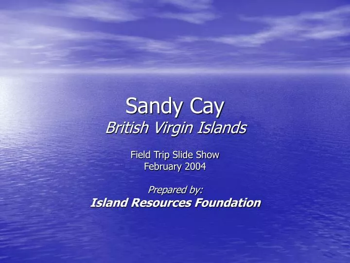
Sandy Cay British Virgin Islands. Field Trip Slide Show February 2004 Prepared by: Island Resources Foundation. Sandy Cay / southwest beach. Sandy Cay/ south shore and rocky ridge to the east. Workshop on trail maintenance and vegetation control.

E N D
Sandy CayBritish Virgin Islands Field Trip Slide Show February 2004 Prepared by: Island Resources Foundation
Workshop on trail maintenance and vegetation control R. Walker (NPT), B. Donath (JVD Preservation Society), K. Grant (NPT), and Roy Thomas
Demonstration of pruning techniques along trail sides Chris and Roy Thomas
Keith Grant (NPT) takes his turn at pruning overhanging branches
Trail Management Issues • Erosion along the southeast • shoreline is threatening to • encroach on the trail. • Site #1 on the right shows that • a 1m buffer barely separates the • trail from the high water mark. Foot traffic
Site #2: Further to the east, dead tree limbs and exposed roots are the result of ongoing erosion and foot traffic from and to the beach.
Site #3: Berm/dune formation is breached at two locations by shoreline erosion and foot traffic. The section of trail will have to be relocated and site restored.
Another area of concern is along the western shoreline as shown by this isolated palm tree stranded 1 meter away from the vegetation line.
Rat Monitoring Program Camping and monitoring gear associated with the post eradication program.
Rat Monitoring Program / Permanent Bait Station #6 along the south shore
Permanent Bait Station #6 consist of the bait box (in black) affixed to a metal stake (re-bar) and PVC pipe to prevent crabs from climbing. Old station mount (green 1gallon can) to the left will be removed. Access to the bait is via side entrances (red arrows).
Permanent Bait Station #14 installed on new mount. Old station mount to the right.
Damaged environment along the northeast area of the rocky ridge. Zone in the foreground apparently cleared by a film crew to allow for a better coastal view. Damaged Area
Tropicbird Damaged Area Looking away from the cliff. The impacted area is exposed to prevailing northeasterly winds which will make it difficult for vegetation to re-colonize. Along the edge of the cliff is a small nesting colony of Tropicbirds.
Little Jost Van Dyke Green Cay Damagedarea
Sandy CayBritish Virgin Islands Selective Nature Scenes February 2004 Prepared by: Island Resources Foundation
Surf spray along the southeast rocky headland. Tortola in the background.
Pipe Organ Cactus (Pilocosereus royenii) A Closed flower B Fruit (green stage) C Fruit (ripe stage) B C A
Pipe Organ Cactus fruit turns from green to purplish red when ripe. It’s a favorite for Bananaquits, Humming birds and even Yellow warblers.
Pipe organ cactus community dominate the rocky ridge landscape.
A view of the south shoreline from mid-way up the rocky ridge.
The salt pond in the interior of the island consist of a mud flat and a thick mat of sea purslane (Sesuvium portulacastrum). In the perimeter, lies dense cover of buttonwood (Conocarpus erectus) and white mangrove (Laguncularia racemosa).
Tree Cactus (Opuntia rubescens)
The Tree Cactus is uncommon on Sandy Cay. They can only be found in the north east corner of the island.
Prickly Pear Cactus bearing fruit. (Opuntia dillenii)
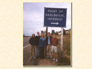
Field Trip Participants Joseph Smith-Abbott / NPT Nancy Woodfield / NPT Ray Walker / NPT Keith Grant / NPT Finfun Peters / NPT Rob Power / HLSCC Bill Moody / RBF Bruce Donath / JVD Preservation Society Tessa Callwood / JVD Preservation Society Foxy Callwood / JVD Preservation Society Roy Thomas / Resortscapes Chris Thomas / Resortscapes Susanna Henighan / Freelance Reporter Chris Howell / IRF Jean-Pierre Bacle / IRF Photo Credits Jean-Pierre Bacle Chris Howell