Download
1 / 62
640 likes | 956 Views
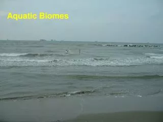
Aquatic Biomes. Nature of Aquatic Systems. 71% Saltwater 22%Freshwater. Geographers divide the earth’s body of water into four large areas: Pacific Ocean – The largest of the four. Contains more than ½ of the earth’s water and covers 1/3 of the earth’s surface. Atlantic Ocean Artic Ocean

E N D
Nature of Aquatic Systems • 71% Saltwater • 22%Freshwater
Geographers divide the earth’s body of water into four large areas: • Pacific Ocean – The largest of the four. Contains more than ½ of the earth’s water and covers 1/3 of the earth’s surface. • Atlantic Ocean • Artic Ocean • Indian Ocean
What determines the distribution of aquatic organisms? • The distribution of many aquatic animals is determined largely by the water’s salinity?
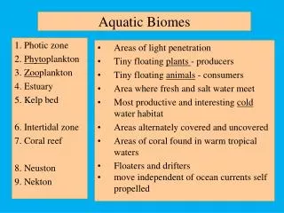
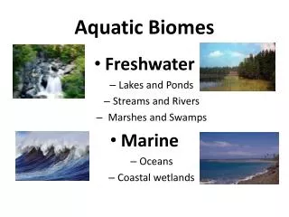
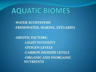
Aquatic Life Zones Aquatic life zones are classified into two major types: • Saltwater/Marine • Oceans • Estuaries (Actually a mix of freshwater and saltwater – Known as Brackish) • Coastal Wetlands • Shorelines • Coral Reefs • Mangrove Forests
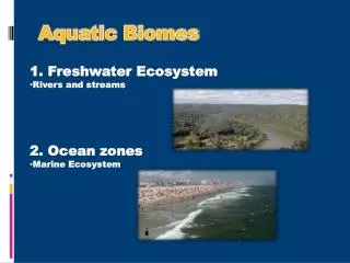
Freshwater – Less than 1% salt concentration • Lakes • Ponds • Rivers • Streams • Inland Wetlands
What vital roles do aquatic systems play ? • Increase biodiversity • Effects climate • Increases biological productivity • Effects biogeochemical cycles • Provides fish and shellfish • Minerals • Recreation • Transportation Routes • Many more goods and services
4 Major Types of Organisms Found in Aquatic Life Zones • 1 - Plankton – Free floating, weakly swimming organisms • Phytoplankton – Greek for “drifting plants” • Primary producers that support most aquatic food webs • Includes many types of algae • Zooplankton – Greek for “drifting animals” • Primary consumers that feed on phytoplankton • Secondary consumers that feed on other zooplankton • They range from single-cell protozoa to large invertebrates such as jellyfish • Ultraplankton – Extremely small plankton made up of photosynthetic bacteria.
Why is Plankton so Important? • Gross Primary Productivity – Rate at which an ecosystem’s producers capture and store chemical energy. • Net Primary Productivity – Rate at which all plants in ecosystems produce useful chemical energy. • Ultraplankton is responsible for 70% of primary productivity near the ocean surface
Why is GPP and NPP Important? Think – 30 seconds Write – 60 seconds Pair – 90 seconds Share – 30 seconds
2 – Nekton – Strongly swimming consumers such as fish, turtles and whales. • 3 – Benthos – Bottom dwellers such as oysters, clams, worms, lobsters and crabs. • 4 – Decomposers – Most bacteria that break down waste and organic compounds in dead organisms. • These nutrients are then used by aquatic primary producers.
What are the Key Factors that Determine Where Aquatic Organisms Are Found? • Most forms of aquatic life are found in the surface, middle and bottom layers. • The factors that determine what layer they are found in are: • Temperature • Dissolved Oxygen • Food Availability • Availability of Light • Availability of nutrients such as NO3, CO2 PO4
In deep aquatic systems (oceans) photosynthesis is largely confined to the upper layer. • Nutrient overloads can cause algal blooms which can reduce the depth of upper layers. • Algal blooms also causes the water source to be cloudy, this cloudiness is called TURBIDITY. • Turbidity can result from disturbances such as clearing of land.
In shallow systems such as open streams and lake edges, there is an ample supply of nutrients. • Ample nutrients = More primary producers=More NPP • In most open oceans, nutrients are in short supply. • Limited nutrients = limited # of primary producers = limited NPP
Quick Check • Name two economic services of aquatic biomes. • Name two ecological service of aquatic biomes. • Name three factors that determine the types and numbers of organisms found in the layers of the life zones. • Distinguish among nekton, benthos and decomposers and give an example of each. • What would be the implications if plankton were killed off due to turbidity?
MARINE/SALTWATER • Marine life is found in 3 major life zones: • Coastal Zone • Estuaries • Coastal Wetlands • Intertidal Zone • Open Sea • Ocean Bottom
Depth in meters High tide Sun Open Sea Low tide Coastal zone Sea level 0 50 Photosynthesis Euphotic Zone 100 Estuarine Zone Continental shelf 200 500 Bathyal Zone Continental 1,000 1,500 Slope 2,000 Abyssal Zone 3,000 Darkness 4,000 5,000 10,000 Major Life Zones and Vertical Zones
Coastal Zone • Warm, nutrient rich shallow water that extends from the high tide mark on land to the gently sloping, shallow edge of the continental shelf. • Makes up less than 10% of the world’s ocean area but contains 90% of all marine species. • The site of most large commercial fisheries • Includes: • Estuaries • Coastal Wetlands • Mangrove Forests • Coral Reefs • Receives ample sunlight and plant nutrients that flow from the land and are distributed by wind and ocean currents. High NPP per unit of area
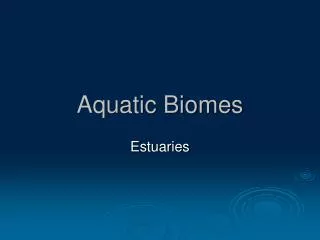
Estuaries • Where rivers meet the sea. • Partially enclosed bodies of water where seawater mixes with freshwater as well as nutrients and pollutants from streams, rivers, and runoff from the land.
Coastal Wetlands • Coastal land areas covered with water all or part of the year. • Includes river mouths, inlets, bays, sounds and salt marshes in Temperate Zones. • Includes mangrove forests in Tropical Zones. • Some of the earth’s most productive ecosystems because of • High nutrient inputs from rivers and nearby land • Rapid circulation of nutrients by tidal flows • Ample sunlight penetrating the shallow waters. • Life in these ecosystems is harsh due to • Significant daily and seasonal changes in tidal and river flows • Water temperatures and salinity • Runoff of eroded sediment • Pollutants from land
Mangrove Forests • The tropical equivalent of salt marshes. • Found in the sloping sandy and silty coastlines in tropical and subtropical regions, especially Southeast Asia. • 69 different tree species that can grow in salt water. • They have extensive root systems that extend above water. • These root systems allow the trees to obtain oxygen and supports the trees during periods of changing water levels. Why Are Mangroves Important? • They filter toxic pollutants, excess plant nutrients, sediments and other pollutants. • They provide food, habitats, and nursery sites for aquatic and terrestrial species. • Reduces storm damage and coastal erosion by absorbing waves and storing excess water. • Supplies timber and fuelwood to coastal communities.
Intertidal Zone • Area of the shoreline between low and high tides. • The gravitational pull of the moon and stars causes tides to rise and fall about every six hours in most coastal areas. • Organisms living in this zone must be able to: • Avoid being swept away or crushed by waves. • Deal with being immersed (in water) during high tides and left high, dry and hotter at low tides. • Survive changing levels of salinity. • Organisms that live in these zone usually hold on to something, dig in or hide in protective shells.
Types of Coastlines • Rocky Shores (See Page 160) • Barrier Beaches or Sandy Beaches (See Page 160) • Generally have one or more rows of natural sand dunes in which the sand is held in place by plant roots. • These dunes are the 1st line of defense against the ravages of the sea. • When these barriers are removed (by humans for real estate development) large storms can flood and even sweep away seaside buildings and severely erode sandy beaches.
Coral Reefs • Marine equivalent of tropical rain forests. • Formed by massive colonies of tiny animals called polyps that secrete a protective crust of limestone around their soft bodies. • When the polyps die, their empty crusts remain behind as a platform for more reef growth. • Coral reefs are the result of mutualism between polyps and a tiny single celled algae.
Why are Coral Reefs Important? • They help moderate atmospheric temperature by removing CO2. • Act as natural barriers from waves and storms. • Provide habitats for ¼ of all marine organisms. • Produce 1/10 of the global fish catch. • ¼ of the catch for developing countries • They provide jobs and building materials for some of the world’s poorest countries. • Supports important fishing and tourism industries.
Open Sea and Ocean Floor • Open Sea – The sharp increase in water depth at the edge of the continental shelf . • Divided into three vertical zones: • Euphotic Zone – Brightly lit upper zone • Phytoplankton carry out about 40% of the world’s photosynthetic activity. • Nutrient levels are low • Levels of dissolve oxygen are high • Large fast-swimming predatory fish such as swordfish, sharks & tuna populate this zone • Bathyal Zone – Dimly lit zone • Receives very little sunlight • Does not contain photosynthesizing producers • Zooplankton & other smaller fishes populate this zone.
Quick Check • Abyssal Zone – Deepest zone • Dark and very cold • Very little dissolved oxygen • Contains enough nutrients to support a large number of species, even though there is no sunlight to support photosynthesis. • Most organisms of the deep waters and ocean floor get their food from Marine Snow - showers of dead and decaying organisms. Why does the open sea have a low net primary productivity?
Which two of the ecological and economic services do you think are the most important? Why • Which two of the threats to marine systems do you think are the most serious? Why?
Show What You Know • What makes a water source “saltwater”? • Name two ecological service of aquatic biomes. • Name all factors that determine the types and numbers of organisms found in the layers of the life zones. • What would be the implications if plankton were killed off due to turbidity? • What determines the distribution of aquatic animals? • What is turbidity? • Why is plankton important? • What is an estuary? • Which aquatic life zone would contain the most phytoplankton? • Why is the NPP in the open ocean so low?
Quick Check • Give one fact about coastal wetlands • Give one fact about intertidal zones • Give one fact about the open sea • Where is most of the world’s freshwater located? • Describe a lotic body of water and give an example. • What two things are used to define the four distinct zones of a deep lake? • What zone of the lake is considered the photosynthetic body? • Give two ecological services of freshwater systems. • Give two economic services of freshwater systems. • How are lakes classified? Give an example.
Freshwater • 97-98% of all water on Earth is found in oceans. • 2-3% is found in freshwater sources. • Of that 2-3%, Most freshwater is trapped in glaciers and ice caps. • The rest can be found as surface water (lakes, rivers, streams, etc.)
Freshwater Life Zones • Lentic bodies of water – standing bodies of water such as lakes, ponds, and inland wetlands. • Lotic bodies of water – flowing bodies of water such as streams and rivers.
Lakes • Large natural bodies of standing freshwater formed when precipitation, runoff or groundwater seepage fills depressions in the earth’s surface. • Supplied by water from rainfall, melting snow and streams. • Deep lakes have four distinct zones that are defined by their depth and distance from shore. • Littoral Zone • Limnetic Zone • Profundal Zone • Benthic Zone
Littoral Zone • Top layer, near shore • Shallow, sunlit waters • Depth is determined by point at which rooted plants stop growing • High biodiversity due to ample sunlight • Ample nutrients from surrounding land • Rooted plants • Turtles, frogs, crayfish, bass, perch, carp, etc can be found here
Limnetic Zone • Open, sunlit surface area away from shore • Depth is determined by penetration of sunlight • Main photosynthetic body of lake • Produces food and oxygen that support most of the lake’s consumers • Abundant microscopic phytoplankton and zooplankton • Some large fishes
Profundal Zone • Deep, open water • Too dark for photosynthesis • Dissolved oxygen levels are often low • Fish who are adapted to cooler and darker water can be found here
Benthic Zone • Bottom of lake • Decomposers, detritus feeders and some fishes are found here • Nourished mainly by dead matter from upper layers and sediment that washes into the lake
How are Lakes Classified? • Lakes are classified according to their nutrient content and primary productivity. • Oligotrophic Lakes – “Oligo” means little + “trophic” means nourishment =Poorly nourished • Small supply of plant nutrients • Glaciers and mountain streams supply water • Very little sediment or microscopic life • Crystal clear water • Small populations of phytoplankton and fishes • Low levels of nutrients = low NPP
Mesotrophic Lakes – “Meso” means middle + trophic = Medium amount of nutrients • Great for fishing • Have clear water with some algal blooms in the summer • Stratify (separate) into layers in the summer • Eutrophic Lakes – “Eu” means true + trophic = Truly nutrient rich • Large supply of nutrients needed by producers • Shallow • Murky brown or green water with high turbidity • High NPP
Lake Stratification http://faculty.gvsu.edu/videticp/stratification.htm • Large bodies of water often have layers with different temperatures. Turn to page 166 • In the summer, the top layer (epilimnion) is warmer than the bottom layer (hypolimnion). • Because of this the bottom layer becomes anoxic and more fish move to shallow waters. • The boundary between the upper and lower layers is called the thermocline. • Winter approaches and the upper layer cools, eliminating the thermocline. • Winds create circulation and the top and bottom regions will mix (called fall overturn). • In the spring, the temperature of the upper layer (now the coolest layer) warms and the layers mix in what is called the spring overturn. • The mixing of oxygen and other nutrients between the upper and lower regions during seasonal overturns supplies essential ingredients for organisms in lake ecosystems.
Why is it important to understand lake stratification? Think – 30 seconds Write – 60 seconds Pair – 90 seconds Share – 30 seconds
Where Does Freshwater Come From? • Streams begin in mountains • Starts off cold, clear & swiftly flowing • Large amounts of dissolved oxygen • Waterfalls and rapids • Lacks nutrients, Low NPP • Streams become wider, deeper & warmer • Fewer obstacles • More turbidity • Slower flowing and less dissolved oxygen • Supports more producers • Streams join to form rivers • Higher temperatures, less dissolved oxygen • Slow moving • Large population of producers • Muddy due to runoff and erosion • High concentrations of silt See Page 168
Where Else Does It Come From? • Some precipitation infiltrates the ground and percolates downward through spaces in soil, gravel & rock until an impenetrable layer of rock stops it – The water in these spaces is called groundwater. • One of our most important sources of freshwater. • Zone of Saturation – Spaces below a certain depth that are completely filled with water. • Water Table – Upper surface of the zone of saturation • Rises and lowers based on the amount of ground water available. • Aquifers – Underground caverns and porous layers of sand, gravel and bedrock through which groundwater flows. http://www.eoearth.org/article/Aquifers_of_Texas
More On Aquifers • Most aquifers are replenished naturally by precipitation that percolates downward through soil and rock, this is called natural recharge. • Others are recharged from the side by nearby rivers and streams, this is called lateral recharge. • Most aquifers recharge very slowly. • Nonrenewable aquifers are found deep underground and were formed tens of thousands of years ago. • These aquifers get very little, if any, recharge.
Surface Water Watershed • Precipitation that does not sink into the ground or evaporate becomes surface water. • This surface water flows across the earth’s land surface into rivers, streams, lakes, wetlands, estuaries and eventually to the oceans. • The surface water becomes surface runoff when it flows into streams. • A watershed or drainage basin is the land area that delivers runoff, sediment, and dissolved substances into a stream.