Download
1 / 5
60 likes | 88 Views
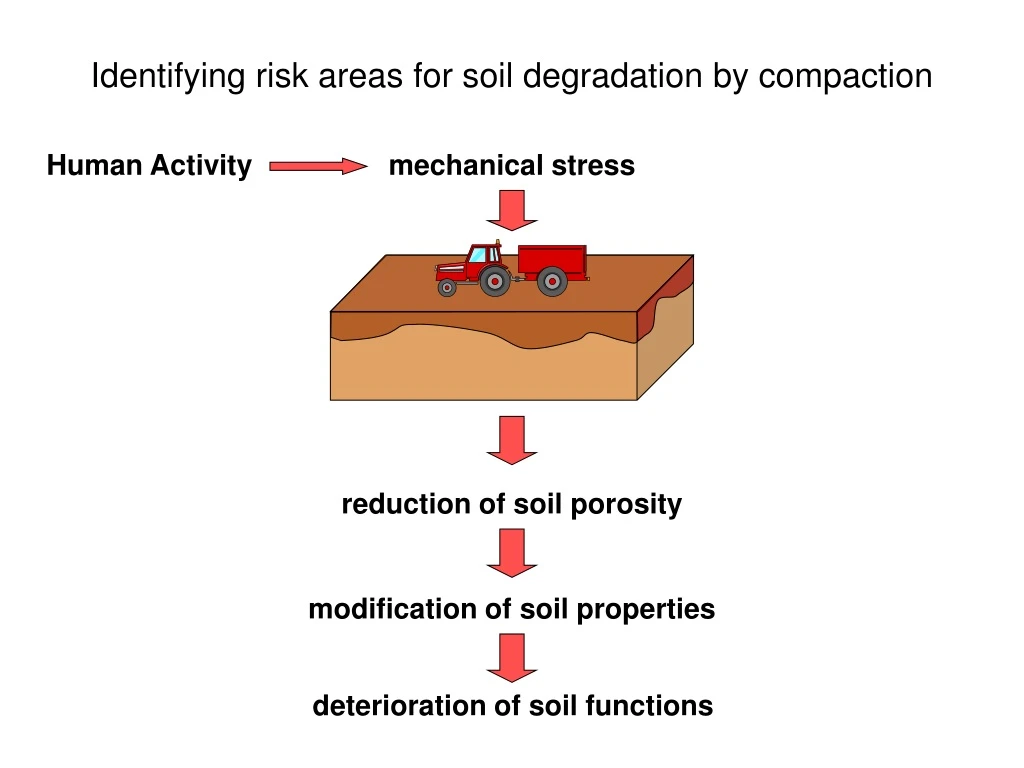
Identifying risk areas for soil degradation by compaction. Human Activity. mechanical stress. reduction of soil porosity. modification of soil properties. deterioration of soil functions. Relief. Stress. climate. Agricultural practices. Soil wetness. Identifying factors. Land use.

E N D
Identifying risk areas for soil degradation by compaction Human Activity mechanical stress reduction of soil porosity modification of soil properties deterioration of soil functions
Relief Stress climate Agricultural practices Soil wetness Identifying factors Land use Time
Stress Sensitivity of soil to compaction Soil compaction Texture Structure OM content etc. Soil wetness Soil mechanical properties
Stress Sensitive soil Risk identification Land use Land cover Relief Agricultural practices Farming systems Risk areas SMU/STU delineation STU properties Climate Time
Common criteria Tier 1 Tier 2 Land use statistical data NUTS 3 statistical data NUTS 4 Land cover spatial data 250 m spatial data 100 m Agricultural practices Farming systems expert typology survey data Relief DTM 250 m DTM 90 m national level regional level SMU/STU delineation particule size + measurement data representative profiles texture class + PTR or PTF STU properties average year montly or 10-day data NUTS 3 20 to 30 years daily data 10 km Climate