Download
1 / 35
360 likes | 556 Views
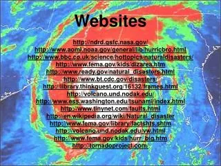
Websites. http://www.teachertube.com/viewVideo.php?video_id=188367&title=Map_Projections_Intro. Warm-up #6 Jan. 13. Topography. What types of problems would a mapmaker have when designing a flat map of the globe?. Maps that show elevation of the Earth’s surface by means of contour lines

E N D
Websites • http://www.teachertube.com/viewVideo.php?video_id=188367&title=Map_Projections_Intro
Warm-up #6 Jan. 13 Topography What types of problems would a mapmaker have when designing a flat map of the globe? • Maps that show elevation of the Earth’s surface by means of contour lines • Can also show the presence of bodies of water, roads, and buildings. • Who might find these maps beneficial ?
Chapter 1 Maps and Mapping
Warm-up #10 Jan. 24 • On a topographic map, contour lines that form a circle indicate a hill. • Lines with hatch marks indicate a depression. Question • How could two points 35 degrees north of the equator – one in N. America and the other in china – be distinguished using map coordinates?
Finding Locations of Earth • Latitude – imaginary parallel lines that measure angular distance north and south of the equator • Longitude – imaginary lines that measure angular distance east and west
Great Circles • Any circle that divides the globe into halves. • Used often in navigation because a great circle is the shortest distance between two points on a sphere.
Map Projections • A flat map that represents the three dimensional surface of a globe. • Four common projections • Mercator • Gnomonic • Conic • Robinson
Mercator Projection • If you were to wrap a cylinder of paper around a lighted globe the Mercator projection is what you would see. • Has advantages and disadvantages. • What do you think are some disadvantages?
Gnomonic Projection • A sheet of paper touching a lighted globe at only one point produces a gnomonic projection. • There is little distortion at the point of contact, but unequal spacing between parallel lines causes distortion on both direction and distance further out.
Conic Projection • A paper cone placed over a lighted globe so that the axis of the cone aligns with the axis of the globe will produce a conic projection.
Robinson • One of the most widely used • Very similar to the Mercator • Less distortion than Mercator
Map Projections • Mercator: accurate direction, distortion of size and distance. • Gnomonic: accurate at point of tangency, large distortion further out. • Conic: accurate over a small region, inaccurate over long range. • Robinson: accurate in direction, less distortion of size and distance than mercator.
Sample Maps • http://maps.google.com/maps?hl=en&tab=wl • Google Earth
Reading a Map • Symbols: used to represent items on the map • Legends: explains the symbols • Map Scale: Ratio that shows the proportions of the map • 1:300 means that one of the measuring units equals 300 of that unit. • 1 cm on the map = 300 cm on actual surface
Topographic Maps • Shows surface features • Topography is the study of these features • Contour lines tell you the difference in elevation • The ones that form a circle represent a hill • They should never touch or intersect
Playdoh Mountain Lab • READ THE DIRECTIONS CAREFULLY • On the back, create a side view diagram of your mountain (just like the one on the worksheet) • In your journals: • Describe your landmass • What type of intervals did you use? • What does it mean when your lines are closer? Farther apart? • Answer Step 6
Warm-up #7 Jan. 19 Meridians • Used to establish east-west locations • They are semi-circles reaching around the earth from pole to pole True North • The direction of the geographic North Pole Do you think that a compass points to the true north? If not then what?
Review • What do the these lines represent?
Tropics • What are the two tropic lines of latitude that surround the equator? • Tropic of Cancer • 23 °North of the Equator • Tropic of Capricorn • 23 ° South of the Equator • Where does the Prime Meridian lie? • 0 ° Longitude
Review • Great Circles • Cuts the world in halves • Used for navigation because they show the shortest distance between 2 points
Review • Remember your 4 map projections • Mercator • Gnomonic • Conic • Robinson
Topography • What are these maps used for? • Elevation, surface features • What do the contour lines represent? • The elevation at that point • The difference in elevation between one contour line and the next is the contour interval
Warm-up #8 Jan. 20 • How to Read Longitude/Latitude Lines: • Always list the latitude degrees (N and S) followed by the longitude degrees (E and W) • Ex: The white house is located at 36° N, 86° W • Angular distance between the equator and the north pole is 90 degrees • What about between East and West of the Prime Meridian?
Tax Maps • In your journals, I want you to describe the surface features where you live: • Elevation • Wooded area/ roads/ streams • Etc. • Look at both topo and arial maps • When you are done compare where you live with the person next to you
Finding Direction • What’s one way to find direction? • A magnetic compass works because earth has magnetic properties
Geomagnetic Poles • Points on the earth’s surface just above the poles of the imaginary magnet are called the geomagnetic poles. • Because of the tilt, geomagnetic poles and geographic poles are in different places
Magnetic Declination • The angle between the direction of the geographic pole and the direction the compass needle points is called magnetic declination
Magnetic Declination • If you move East of the Mississippi River, the magnetic north pole will pull your compass needle further to the West of geographic north • The angle of compass declination is West Declination • Moving west of that line will pull your compass needle further to the East • East Declination
TICKET OUT THE DOOR • What lines measure distances North of South of the equator? • What is the line of longitude at 0°? • What are the four types of map projections? • What information is shown on a topographic map?