Download
1 / 28
280 likes | 411 Views
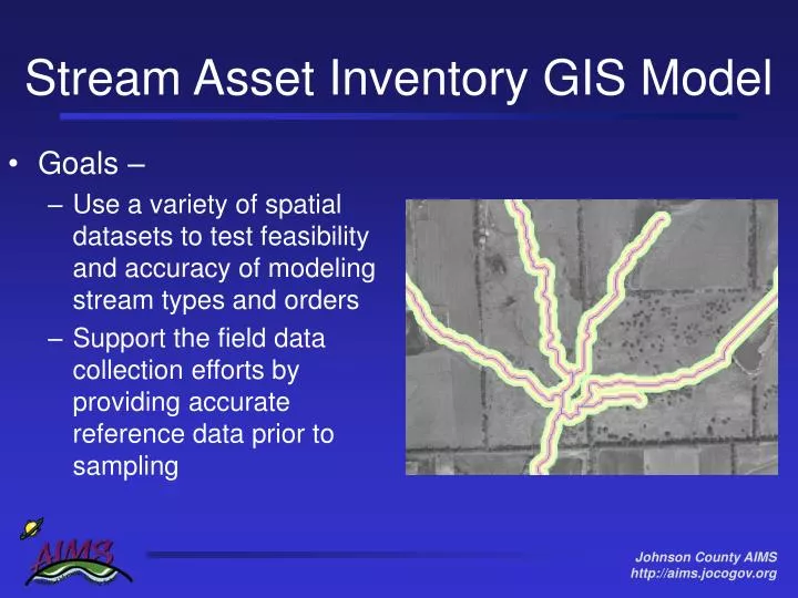
Stream Asset Inventory GIS Model. Goals – Use a variety of spatial datasets to test feasibility and accuracy of modeling stream types and orders Support the field data collection efforts by providing accurate reference data prior to sampling. Pilot Study.

E N D
Stream Asset Inventory GIS Model • Goals – • Use a variety of spatial datasets to test feasibility and accuracy of modeling stream types and orders • Support the field data collection efforts by providing accurate reference data prior to sampling
Pilot Study • Test watershed is Blue River in southeast corner of Johnson County • Approx. 100 mile2
Process • Use spatial analysis and hydrological modeling tools to model stream network and environmental conditions • Solid DEM is basis of accurate results • Majority of hydrologic products derived from DEM including the streams, subwatersheds, slope, etc
Tools • Free extensions packaged with Arc8 and AV3.x • Hydrology Modelling, HydroAnalyst • Free 3rd party extensions for use with ESRI products • ArcHydro, Strahler Stream Order…
Additional Attributes • Slope – Average • Sinousity – Curve/Line • Slope/Sinousity – Gives Condition Index • Channel Stability (Erodiblility) – Slope/Soil
Challenges of Watershed Delineation • Not an exact science and there’s no standard • Typically done with 30 meter DEM • We’re not hydrologists • Testing the various inputs to generating • watershed data • Contour vs. Masspoint • Burning In Streams • Establishing Input Parameter Thresholds • Handling high resolution data • Handling Anomalies
Next Steps Subwatersheds & Streams • Env. Conditions • Impervious surface • Soil • Veg Cover • etc… Develop classification of streams and subwatersheds Sensitive Impacted Non-supporting Restorable
Layers for Analysis • Helpful • Vegetative Cover • Road Crossings • Sewer Lines • Developable Land • Wetlands • Soils • Pollution Sources • Essential • Impervious Surfaces • Current Land Use • Future Land Use
Obstructions Bridges Soils Veg Cover Landuse etc… Contours DEM Filled DEM Flow Direction Flow Accumulation Masspoints Slope Streams Subwatersheds StreamOrder Sinousity StreamOrder
Data Collection • Custom forms on pocket pc • GPS wired to pocket pc for data capture • Sync nightly through internet back to master database