Download
1 / 8

E N D
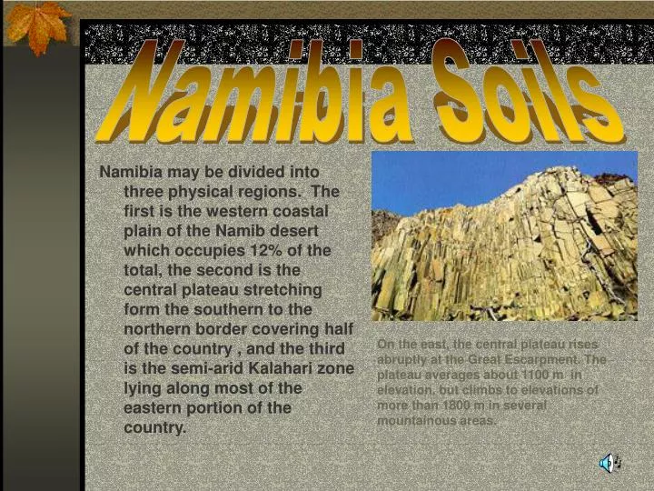
Namibia Soils Namibia may be divided into three physical regions. The first is the western coastal plain of the Namib desert which occupies 12% of the total, the second is the central plateau stretching form the southern to the northern border covering half of the country , and the third is the semi-arid Kalahari zone lying along most of the eastern portion of the country. On the east, the central plateau rises abruptly at the Great Escarpment. The plateau averages about 1100 m in elevation, but climbs to elevations of more than 1800 m in several mountainous areas.
Kalahari Zone • The Kalahari zone is covered by sand of varying thickness. • The unsaturated zone plays an important role in the terrestrial water balance; it is a controlling factor of plant growth as well as for the quantity and quality of the recharge waters and of the resultant groundwater. • in the arid zone 95% of what goes on there hydrologically is governed by processes in the unsaturated zone. • It is the dominance of the arid regions by the unsaturated zone that make them special Granite mountains stand isolated like steep islands on the plains of the inner Namib, one of them - the Brandberg massif - the highest in Namibia at a height of 2579m.This granite pluton rises 1900 m above the surrounding desert plains and covers an area of 650 square kilometers.
Western Coastal Plain • The western coastal plains are largely composed of mobile dunes,gravel and sandy plains • approximately 250 km north west of Windhoek a broad belt of large igneous complexes, extend from the coast north east to central northern Namibia. • these complexes are silica undersaturated and alkaline, and therefore have unusual mineralogy • extensive plains, are barren near the west coast, colonized by low grasses and scrub further inland and thornbush becomes predominant in central northern Namibia In the Etosha National Park an elephant on its way to a water hole. These springs are fed by water reserves in porous bedrock. Groundwater and pedogenic regolith carbonates, and evaporative chemical sediments dominate the regolith materials.
Central Plateau • The central plateau comprises mountains, highland areas and the Great Western Escarpment. • The semi-arid southern region consists of sunbaked savanna with its yellowish-brown tints and characteristic euphorbia and aloe plant species • The central plateau, which runs from north to south, has an average altitude of between 1000 and 2000m • This plateau gradually falls away towards the east where a sandy strip of land merges into the level expanse of the Kalahari desert Situated in Namibia’s central highlands, Windhoek,the capital is an attractive city surrounded by clusters of hills and the impressive Auas and Eros mountains.
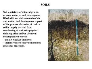
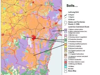
Soil Properties • The countries soils have 97% clay content of less than 5% and thus have a very low water holding capacity • they are generally deficient in most of the major nutrients, and also deficient in micro-nutrients such as manganese, iron and zinc • unconsolidated sand and shallow, weakly developed soils on bedrock characterize the main groups of soils in this semi-arid to arid country • soil types include acrisols, alkaline soils, alluvial soils, arenosols, arid soils, calcareous soils, cambisols, clay soils, ferralsols,gleysols, lateritic soils, luvisols, regosols, saline soils, sandy soils, vertisols • soil drainage is free, impeded, seasonally waterclogged
Soil Erosion • The Namib Desert covers some 15% of Namibia with dune seas, gravel plains and deeply eroded canyons such as the Fish River Canyon which is 160km in length, up to 27km wide and reaches a depth of 550 meters • A period of erosion occurred, removing the overlying rocks and leveling this complex to be the floor of a vast shallow sea, covering most of what is now southern Namibia. • about 650 - 500 million years ago various sediments, were deposited by the sea to the floor, building up into what is now called the Nama Group of rocks. This picture shows the erosion of the Fish River Canyon. The base rocks of the Fish River Canyon, now at the bottom nearest the river, are shales, sandstones and lavas which were deposited about 1,800 million years ago.
Soil Pollution Effects on the Namibian Environment • In a dry environment such as that of Rossing radioactive dust from mining operations and mill tailings can present a special problem, despite the practice of sprinkling the tailings to keep dust levels down. A second environmental problem is water borne radioactivity from the tailings reservoir. The tailings area is about 250 meters higher than the Khan River, only about 6 kilo meters away • A third environmental problem is the high demand for water at many stages of the operations and the possible lowering of the water table and rivers in a large area around the mine as a result.