Download
1 / 23
260 likes | 547 Views
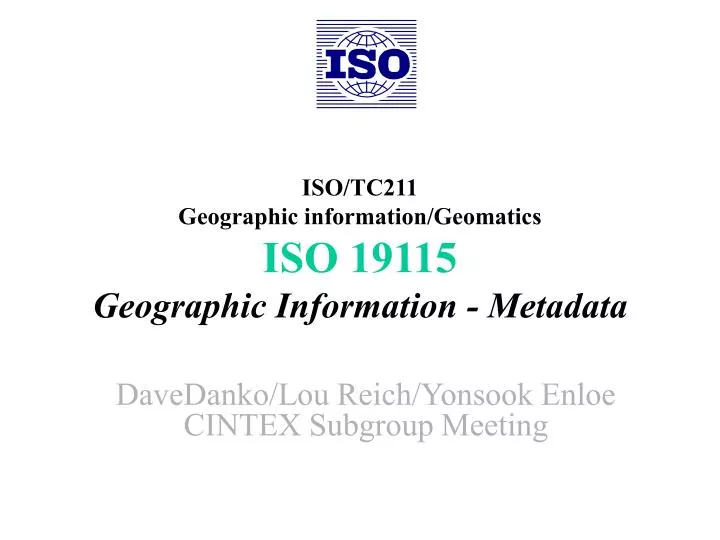
ISO/TC211 Geographic information/Geomatics ISO 19115 Geographic Information - Metadata. DaveDanko/Lou Reich/Yonsook Enloe CINTEX Subgroup Meeting. Briefing Agenda. ISO 19115 Overview Scope Background Schedule Version 3 Technical Overview Basic Concepts ISO 19115 Profiles Summary

E N D
ISO/TC211Geographic information/GeomaticsISO 19115Geographic Information - Metadata DaveDanko/Lou Reich/Yonsook Enloe CINTEX Subgroup Meeting
Briefing Agenda • ISO 19115 Overview • Scope • Background • Schedule • Version 3 Technical Overview • Basic Concepts • ISO 19115 Profiles • Summary • Technical Summary • Potential Inpacts to CINTEX/CIP
Work Item 15-MetadataScope • ...the schema required for describing geographic information and services. • ...information about the identification, the extent, the quality, the spatial and temporal schema, spatial reference, and distribution of digital geographic data. • ...applicable to the cataloguing of datasets, clearinghouse activities, and the full description of datasets for a wide range of geographic applications. • …applicable to geographic datasets, dataset series, and individual geographic features and attributes • ...may be used for other forms of geographic data such as map, charts, textual documents
ISO Metadata Foundation • Regional metadata standards • ANZLIC Working Group on Metadata: Core Metadata Elements Guidelines Draft 7, Australia and New Zealand Land Information Council, November 1995, Sydney. • the Canadian Directory Information Describing Digital Geo-referenced Data Sets, Canadian General Standards Board, July 1994, Ottawa. • Standard for Geographic Information - Metadata,European Committee for Standardisation (CEN), September 1996,Brussels. • Content Standard for Geospatial MetadataFederal Geographic Data Committee, June 8, 1994, Washington DC • Other influential documents • Digital Geographic Information Exchange Standard (Digest), Version 1.2. Digital Geographic Information Working Group, January 1994, • IHO Transfer Standard for Digital Hydrographic Data,International Hydrographic Bureau, October 1995, Monaco • Spatial Data Transfer Standard (SDTS),US Department of Commerce, August 1992, Gaithersburg, MD • Application Profile for the Government Information Locator Service (GILS), US Department of Commerce, December 1994, Gaithersburg, MD • Cartographic materials: A manual of interpretation for AACR2, Anglo-American Committee on Cataloguing of Cartographic materials, 1982, Chicago • USMARC Format for Bibliographic Data, US Library of Congress, 1988, Washington, DC
Who is Involved • 33 ISO TC211 Principle Member countries • 14 Observing/Corresponding Member countries • 10 Internal Liasons (other ISO committees) • 14 External Liasons • CEOS is an External Liason
Australia Canada China Finland France Germany Japan Korea Malaysia Norway South Africa Spain Sweden United Kingdom United States DGIWG OGC CEOS Primary Participants
Development Cycles • Working Drafts • Version 1.0 - March 1996 -FGDC/CEN • Version 1.1 - October 1996 • Version 1.2 - December 1996 • Version 2.0 - January 1997 -IDEF1X-ER model, Full Imagery md • Version 2.1 - June 1997 • Version 3.0 - September 1997 -Remove Full Imagery metadata • Version 3.1 - December 1997 • Version 4.0 - February 1998 Significant CIP based input • Committee Drafts • Version 1.0 - July 1998 - Levels of conformance (962 comments) • Version 2.0 - November 1999 - UML Object Model (1422 comments) • Version 3.0 - June 2000 - Single comprehensive profile Actual metadata elements have remained generally consistent since WD 1.0
ISO 19115 Committee Draft 3.0
ISO 19115 CD 3.0Requirements Clause • Metadata application • UML model defining how metadata applies to datasets, aggregate datasets, features and attributes • Metadata packages • Metadata package and entity relationship • Metadata datatypes • Extent, citation, and responsible party information • Recommended core metadata for geographic datasets • Simple natural language short list of recommended metadata elements
Normative Metadata schemas Abstract Object Model (UML) Data dictionary and code lists Extensions and profiles Abstract test suite Comprehensive dataset metadata application profile Informative Metadata Extension Methodology Metadata Implementation Hierarchical Levels of Metadata Implementation Examples ISO19115 CD3.0Annexes
ISO 19115 CD 3.0Geographic Metadata Packages • Identification Information • Resource Constraint Information • Data Quality Information • Maintenance Information • Spatial Representation Information • Reference System Information • Content Information • Portrayal Catalog Information • Distribution Information • Metadata Extension Information • Application Schema Information • Metadata Datatypes • Citation • Responsible Party • Extent • On-line Resource • Address
Metadata Application GF_FeatureType DS_DataSet 0..* 1..* 1..* MD_Metadata FE_Feature 1..* 0..* 1..* GF_PropertyType 0..* 0..* 0..* 1..* <<Abstract>> DS_Aggregate FE_FeatureAttribute 0..* 0..* DS_Series DS_Initiative DS_OtherAssociation DS_StereoMate
<<DataType>> CI_Citation title alternateTitle date edition editionDate identifier identifierType citedResponsibleParty presentationForm seriesName issueIdentification otherCitationDetails collectiveTitle page ISBN ISSN <<CodeList>> MD_ProgressCode completed historicalArchive obsolete onGoing planned required underDevelopment Name DomainCode Definition MD_ProgressCode ProgCode status of the resource completed 001 production has been completed historicalArchive 002 data has been stored offline obsolete 003 data is no longer relevant onGoing 004 data is continuously being ... planned 005 fixed date has been established… required 006 data needs to be generated or ... underDevelopment 007 data is currently in the process... DataTypes and CodeLists
Dataset title Dataset reference date Dataset responsible party Geographic location of the dataset (by four coordinates or by geographic identifiers) Dataset language Dataset character set Dataset topic category Scale of the dataset Abstract describing the dataset Dataset format name Dataset format version Additional extent information (vertical and temporal) Spatial representation type Reference system Lineage statement On-line resource Metadata file identifier Metadata standard name Metadata standard version Metadata language Metadata character set Metadata point of contact Metadata time stamp Recommended core metadata for geographic datasets • Mandatory In CIP element/attribute sets
Comprehensive datasetmetadata profile • Basic profile applicable to a broad range of information communities • Defines complete range of metadata required to identify, evaluate, extract, employ and manage geographic datasets • Defines a comprehensive metadata application schema (UML model) which provides an implementable profile • Provides a XML DTD based on the application schema
XML DTD XML Document Comprehensive profileXML Encoding XML DTD • The Document Type Definition (DTD) defines the tags, constraints, attributes, structure, domains etc • The XML document defines the content (the dataset metadata) • The DTD can be located: • within the document • within the same folder/computer/server • C:\My Documents\My Metadata.dtd • within the Internet • http://www.opengis.net/geographicMetadata.dtd XML Document 1 XML Document 2
NATO Specific.dtdVMap 1-NL.xml NATO cataloging profile which includes ISO recommended core plus additional selected metadata elements. The NATO DTD defines NATO specific metadata and code lists Comprehensive ProfileApplication ISO-Comprehensive Geographic Metadata.dtd DCW.xml Recommended Core Metadata Schiphol Environmental Impact data.xml Full comprehensive metadata comprised of over 300 metadata elements North Sea Soundings.xml only 12 mandatory metadata elements
Proposed Implementations • US FGDC • Edition 3 will be a profile of ISO 19115 • ANZLIC • developing ISO compliant ANZLIC profile • Saudi Arabia • Ar-Riyadh Development Authority developed draft profile of ISO19115.2 • NATO • STANAG 7148 Catalog Metadata for Geographic Information (under development)
ISO 19115 development based on a solid foundation of national, regional, and information community standards has broad global participation has gone through formal development cycles ISO 19115 Standard based on a harmonized object model designed to fill a broad range of requirements extensive use of codelists -language interoperability recommended core with a full comprehensive profile Metadata that is absolutely essential for all aspects of spatial data handling Locate Evaluate Extract Employ Metadata in a global standard Allows expanded networks Provides a common understanding Global Interoperability Summary Metadata: the foundation for a Global Spatial Data Infrastructure
Impact to CINTEX/CIP • Formal review of next version • Discuss creation of a CIP/CEOS Profile • Do we need a CIP 3 or a CIP 2.5 • Alignment of Code lists and Keywords