Download
1 / 19
190 likes | 395 Views
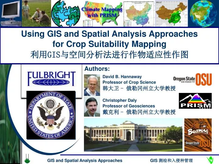
Using GIS and Spatial Analysis Approaches for Crop Suitability Mapping 利用 GIS 与空间分析法进行作物适应性作图. Authors:. David B. Hannaway Professor of Crop Science. 韩大卫 - 俄勒冈州立大学教授. Christopher Daly Professor of Geosciences. 戴克利 - 俄勒冈州立大学教授. 利用 GIS 与空间分析法进行作物适应性作图.

E N D
Using GIS and Spatial Analysis Approaches for Crop Suitability Mapping 利用GIS与空间分析法进行作物适应性作图 Authors: David B. Hannaway Professor of Crop Science 韩大卫 - 俄勒冈州立大学教授 Christopher Daly Professor of Geosciences 戴克利 - 俄勒冈州立大学教授 GIS and Spatial Analysis Approaches
利用GIS与空间分析法进行作物适应性作图 GIS-based species suitability mapping • 过去的方法 • 新方法-对气候和土壤进行建模和测绘并定量决定容限,据此进行匹配 • USDA-FAS-EMP项目提供具体气候测绘的经费 • USDA-FAS-RSED项目提供土壤测绘的经费 • PRISM小组为量化容限评估开发IMS应用程序 • 组合测绘 • 田间实验验证 • Historical approaches • New approach – modeling and mapping climate and soil and defining quantitative tolerances, then matching • USDA-FAS-EMP project provided funding for detailed climate mapping • USDA-FAS-RSED project provided funding for soil mapping • PRISM group developed IMS application for quantitative tolerances evaluation • Combination mapped • Field trials used for validation GIS and Spatial Analysis Approaches
Before current computer tools were available for generating GIS-based maps, general adaptation zone maps were used: Typically, these maps were: Produced by a graphics artist working with an agronomist Based on broad groupings of climate and soils Not able to be combined with multiple sources of information Of minimal value for decision making 过去的方法 在使用计算机进行GIS测绘的方法出现以前,一般适应区地图被广泛采用。 这些地图的特点是: Historical approaches … • 由平面设计师和农学家合作完成 • 对气候和土壤只进行大致分类 • 无法整合多种信息资源 • 对决策支持的作用小 GIS and Spatial Analysis Approaches
GIS manipulate and display layers of spatially variable data, including: geo-physical features (topography, soil traits, waters) climate spatial data (rainfall, temperature, radiation) biological characteristics (plant or animal tolerances) geo-political information (political boundaries, urban centers, transportation infrastructure). 新方法… GIS可以细致展现随空间变化的各项数据,包括: New approach … • 地理物理特性(地形,土壤特性,水文) • 气候空间数据(降雨,气温,辐射) • 生物特性(植物/动物 容限) • 地理行政信息(行政边界,城市中心,基础交通) GIS and Spatial Analysis Approaches
数字高程模型 Digital Elevation Model: GTOPO 30, 1 km resolution GIS and Spatial Analysis Approaches
中国年均降水量 Annual Precipitation GIS and Spatial Analysis Approaches
中国一月平均最低气温 January Minimum Temperature GIS and Spatial Analysis Approaches
中国七月平均最高气温 July Maximum Temperature GIS and Spatial Analysis Approaches
土壤pH值 Soil pH GIS and Spatial Analysis Approaches
Traditional approach has been qualitative New quantitative approach uses spatial data layers and integrates with crop tolerance values Tolerance values have been mapped Internet Map Server used for developing and mapping tolerances 量化研究方法和IMS Quantitative Approach and IMS • 传统方法是定性的 • 新的定量的方法使用空间数据层,并将农作物容限值融入其中 • 容限值也已被测绘 • 使用网络地图服务器来完善数据,测绘容限 Current quantitative, dynamic approach. GIS and Spatial Analysis Approaches
Species suitability mapping: Internet Map Server物种适应性测绘:网络地图服务器http://prism.nacse.org/gis/forages GIS and Spatial Analysis Approaches
Species Max. Temp (°C) Min. Temp. (°C) Annual Precipitation (mm) Well Adapted Tall Fescue 22 - 32 -10 625 Orchardgrass 22 - 31 -7.5 625 Perennial Ryegrass 22 - 30 -5 625 Moderately Adapted Tall Fescue 20 - 34 -15 450 Orchardgrass 20 - 33 -12.5 490 Perennial Ryegrass 20 - 32 -10 525 Marginally Adapted Tall Fescue 18 - 36 -20 300 Orchardgrass 18 – 35 -17.5 375 Perennial Ryegrass 18 - 34 -15 450 量化气候标准 Quantitative Climate Tolerances GIS and Spatial Analysis Approaches
Species suitability mapping: Internet Map Serverhttp://prism.nacse.org/gis/forages 物种适应性测绘:网络地图服务器 GIS and Spatial Analysis Approaches
高羊茅的适应性地图 Species suitability maps: Festuca arundinacea Schreb. GIS and Spatial Analysis Approaches
高羊茅的适应性地图 Species suitability maps: Festuca arundinacea Schreb. GIS and Spatial Analysis Approaches
Validate maps with field-based trials Link advanced technologies with traditional approaches Enlist local experts to assist with development and validation Species suitability maps: Validation 物种适应性地图:验证 • 田间实验验证地图 • 将先进技术和传统方法联系起来 • 邀请当地专家协助开发和验证 GIS and Spatial Analysis Approaches
项目成果 Project products • Research-based and validated, GIS-based – climate, soil, and species suitability maps: • Web – Forage Information System, PRISM Group, • Printed – “China Map Atlas” • Tools for optimal matching of forage, soil conservation, and turf grasses with specific locations and intended uses: • Information System for DSS approaches • Internet Map Server for creation of new maps • 经过研究和验证的GIS 气候、土壤和物种适应性地图: • 网络牧草信息系统, PRISM • 《中国地图集》 • 为特定地区和用途的牧草,土壤保持和草坪优化开发的工具: • DDS信息系统 • 用以开发新地图的网络地图服务器 GIS and Spatial Analysis Approaches
Y=106.97*exp(-0.5*((x-6.68)/1.54)^2) (R^2= 0.99) 目前和以后的工作 Current and future work • 继续完善每项指标,包括温度、降水、pH值、排水、盐份等 • 完善建立空间经济模型的方法 • 应用到生物能源和生物作物中去 • 探索应用到入侵物种中的可能性 • Developing functions for each factor (temperature, precipitation, pH, drainage, salinity, etc.) • Developing approaches for spatial economic modeling • Applying to bioenergy and bioproducts crops • Exploring potential for use with invasive species applications Spartina alternaflora GIS and Spatial Analysis Approaches
Optimal matching of species and varieties to environment and management as a key to long-term success. Involves change from qualitative to quantitative ecology approach. Combining new computer-based tools with traditional field-based techniques to solve real-world, practical problems. 小结 Using GIS and Spatial Analysis Approaches to Species Suitability Mapping 利用GIS与空间分析法进行作物适应性作图 Summary • 物种/品种与环境和管理的优化匹配是取得长期成功的关键 • 从定性到定量的生态方法的转变 • 将计算机等新工具和传统的田间技术结合起来,解决实际问题 Additional details can be found on web segment http://forages.oregonstate.edu/ GIS and Spatial Analysis Approaches