Download
1 / 44
440 likes | 630 Views
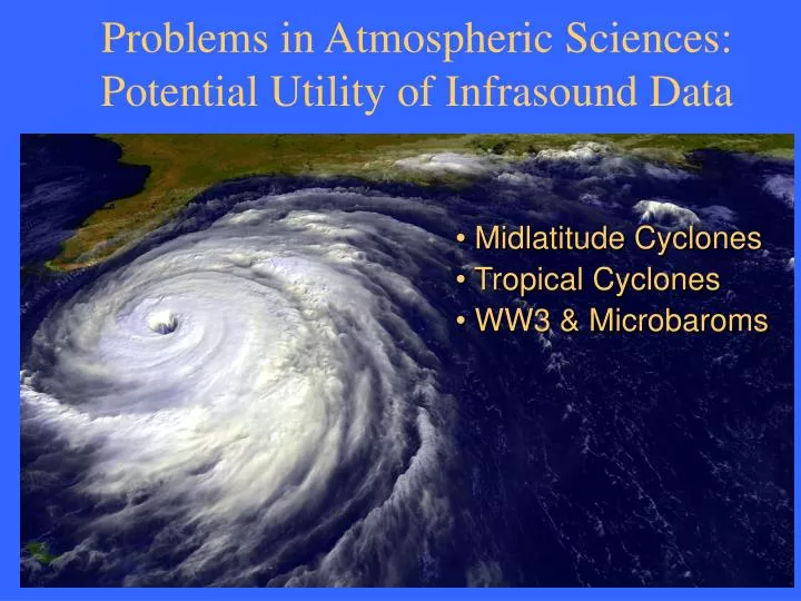
Problems in Atmospheric Sciences: Potential Utility of Infrasound Data. Midlatitude Cyclones Tropical Cyclones WW3 & Microbaroms. Forecast Errors over Pacific. West Coast Forecast Bust a Costly Embarrassment in Eugene, Ore. Forecast Errors over Pacific. L. 976.

E N D
Problems in Atmospheric Sciences: Potential Utility of Infrasound Data • Midlatitude Cyclones • Tropical Cyclones • WW3 & Microbaroms
Forecast Errors over Pacific West Coast Forecast Bust a Costly Embarrassment in Eugene, Ore.
Forecast Errors over Pacific L 976 NCEP Eta model 24-hr (solid) and 48-hr (dashed) SLP forecast (mb) for 00 UTC on 3 March 1999 and GOES infrared satellite image.
Forecast Errors over Pacific 24-hr (top) and 48-hr (bottom) SLP forecast errors (mb) for period 11/01-04/02.
Forecast Busts Model 48-hr forecast (solid) and analysis (dashed) of Sea Level Pressure (every 2 mb) for 14 December 2001 Eta AVN UKMO NOGAPS
Forecast Errors over Pacific Model storm forecast central SLP errors (mb) and storm position errors for period 00 UTC 14 Dec 2001.
Lightning Detection This noise can be detected by a network of special receivers located on remote Pacific islands.
Lightning Detection Project (ONR) Noise from lightning measured by PACNET can be used to estimate the rainfall rate.
Pacific Extratropical Cyclone Sea-level Pressure Map at 18 UTC (left panel) and Long Range Cloud-to-ground Lightning Detected between 1453 and 1753 UTC (right panel) 18 December 2002.
Pacific Extratropical Cyclone Sea-level Pressure Map at 3 UTC (left panel) and Long Range Cloud-to-ground Lightning Detected between 2353 and 0253 UTC (right panel) 18-19 December 2002.
Pacific Extratropical Cyclone Sea-level Pressure Map at 6 UTC (left panel) and Long Range Cloud-to-ground Lightning Detected between 0253 and 0553 UTC (right panel) 19 December 2002.
Pacific Extratropical Cyclone Sea-level Pressure Map at 9 UTC (left panel) and Long Range Cloud-to-ground Lightning Detected between 0553 and 0853 UTC (right panel) 19 December 2002.
Pacific Extratropical Cyclone Sea-level Pressure Map at 12 UTC (left panel) and Long Range Cloud-to-ground Lightning Detected between 0853 and 1153 UTC (right panel) 19 December 2002.
Pacific Extratropical Cyclone Sea-level Pressure (SLP) Map at 12 UTC (left panel) and Eta SLP Forecasts valid at 12 UTC (24 and 12 hr forecasts shown in middle and far right panels, respectively) 19 December 2002.
Forecasting a Kona low AVN Forecast Pressure Traces
Winter Storm Summary • Large short-term (0-48 hr) forecast errors (>10 mb) occur 10-15 times each winter over the northeast Pacific in the Eta model. • Large initialization errors over the Pacific still occur in all operational forecast systems and are major contributors to short-term forecast failures. • Occasionally small initial errors grow into large forecast errors. • Large position errors of surface low centers contribute to large forecast errors of SLP at coastal locations. • Forecast failures over the eastern Pacific Ocean propagate downstream and can contribute to large forecast errors over the eastern half of the U.S. • Is there a role for infrasound in toward solving this problem?
The Hurricane Problem What do we know about hurricanes?
Hurricane Track Forecasting Track forecasts from numerical and statistical models are compared to come up with the best forecast track.
Hurricane Track Forecasting Hurricanes track forecasting has made significant gains in the past 30 years due to faster computers and better observations of storm steering currents by aircraft and satellite instruments.
Hurricane Intensity Forecasting Hurricanes intensity forecasting has made almost no gains in the past 30 years despite faster computers and better observations of storm environment by aircraft and satellite instruments. Part of problem is a lack of understanding of energy transfer from ocean to atmosphere, which in turn depends on the particulars of the boundary layer structure and circulation.
Doppler Velocity Radar Analysis A ‘residual’ velocity for each elevation is obtained by subtracting the 0th order (sinusoidal) component of the velocity field as observed by the radar along a conical scan of set elevations. VAD Velocity Residual Velocity
Boundary Layer Rolls Characteristics Schematic depicting hurricane boundary layer rolls, showing the mean values for 142 BL rolls observed during four hurricane landfalls (142 cases).
Developing a Hurricane Balloon to study Lagrangian enegetics of airflow
Developing a Hurricane Balloon • GPS position • Satellite cellular telephone for communication • Lift control • Lots of sensors • Microphone?
Developing a Hurricane Balloon Release in Hawaii
What are microbaroms? • Microbaroms signals, like microseisms, are believed to be created by the nonlinear interaction of ocean surface waves • The microbarom peak near 0.2 Hz is right on the detection frequency band for 1 kt explosions • IMS arrays with large apertures (> 1 km) were supposed to render microbaroms incoherent, but distinct coherent bursts may still be detected • Microbaroms may be generated in open ocean or by reflections with coastline and islands, and are prominent on island stations • Theoretical energy peak of microbarom radiation is near vertical, but this energy is lost • Sufficient energy is radiated near the horizontal, where most microbarom arrivals are detected • Study microbarom statistics at I59US and global distribution of microbarom signal levels
Microbaroms: 2002 N Swells, Aleutians Trade and S Swells
Theory: Arendt and Fritz, 2000 • Assumptions: • Wave height small relative to wavelength of ocean wave • Distance greater than acoustic wavelength • Solution: • For a prescribed surface wave displacement g(x,t) and vertical velocity uz(x,t), the acoustic pressure is:
Theory • Consider a ocean surface wave displacement spectrum A, The radiated acoustic spectrum would be
Wave Watch 3 (WW3) • WAVEWATCH III (Tolman 1997, 1999a) is a third generation wave model developed at NOAA/NCEP. • WAVEWATCH III solves the spectral action density balance equation for wavenumber-direction spectra. The implicit assumption of these equations is that the medium (depth and current) as well as the wave field vary on time and space scales that are much larger than the corresponding scales of a single wave. Furthermore, the physics included in the model do not cover conditions where the waves are severely depth-limited. This implies that the model can generally by applied on spatial scales (grid increments) larger than 1 to 10 km, and outside the surf zone. http://polar.ncep.noaa.gov/waves/wavewatch/
Middle Age Swell case (4-6 days old) All with identical forcing
Old Swell case (6-10 days old) All with identical forcing
Atmospheric Forcing Surface winds associated with January 2003 Case
Wave Watch 3 (WW3) Wave height and dominant period
January 2003 Case Wave Spectra
January 2003 Case Microbarom arrivals
Fig. 2 Observed infrasonic arrival azimuth for microbarom signals (0.1-0.5Hz) in comparison with azimuth from Hawaii to Hurricane Daniel’s core (Red Line). Fig. 1 Hurricane Daniel as seen by GOES 10 on July 26, 2000. ISLA will attempt to accurately depict the wind/wave field produced by Hurricane Daniel in order to model microbaroms produced by the nonlinear interaction of Daniel’s ocean surface waves.
Evaluating the Theoretical Model The Wave Watch 3 model outputs the variance density , F, of the surface wave field as a function of frequency, f, and propagation direction,q. The variance density can be integrated over angle and frequency to provide the total wave energy E, The peak source pressure occurs when k = -k’, w = w’ For preliminary amplitude estimates, we use Whitaker’s relationship
Microbarom Conclusions and future work • All IMS infrasound arrays, and particularly those close to the ocean, are susceptible to microbaroms • Surface wave spectrum from Wave Watch 3 global model • Algorithm to evaluate a theoretical source pressure field induced by the open ocean surface wave field • Used simple relationship to estimate global infrasonic field • Need to add atmospheric specifications, attenuation losses, and direction of arrival information • Need to incorporate better propagation algorithms to provide time dependent and frequency dependent estimates of the propagating infrasonic field • Need to add reflections with coastline and islands – mesoscale problem, site dependent and not trivial • Approach can be adapted to microseisms