Download
1 / 8
90 likes | 348 Views
World Regional Geography. Ohio Northern University Introduction. Roots of the discipline. Geo / graphy : “description of the earth.” a science that deals with the description, distribution, and interaction of the diverse physical, biological, and cultural features of the earth's surface

E N D
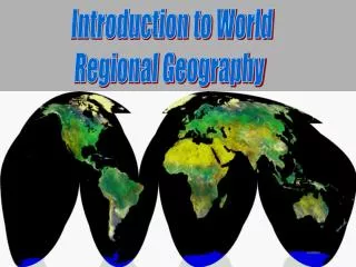
World Regional Geography Ohio Northern University Introduction
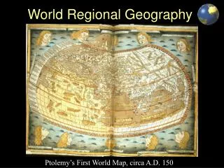
Roots of the discipline • Geo / graphy: “description of the earth.” • a science that deals with the description, distribution, and interaction of the diverse physical, biological, and cultural features of the earth's surface • study the locationand distribution of features on the Earth’s surface. • Oldest of the sciences • Herodotus: father of modern geography • “Historia” mid-fifth century BC • Aristotle (384-322 BC): physical geography • Eratosthenes(276-196 BC): measures Earth circumference • Strabo (64 BC – AD 24): “Geographica” • Ptolemy (~AD 150) early cartographer, map maker
What is a map? • A map is defined as a representation, usually on a flat surface, of a whole or part of an area. • The job of a map is to describe spatial relationships of specific features that the map aims to represent. • There are many different types of maps that attempt to represent specific things. Mapmakers, also known as cartographers, use a variety of tools to make maps
Basic Geographical Concepts • Location • Absolute location (grid system) latitude / parallel lines longitude / meridians • Relativelocation • Size, shape, and scale
Basic Geographical Concepts • Physical & cultural connections. Examples: • El Nino, • Colombia & cocaine, • Columbus & Great Columbian Exchange • The Potato
Basic Geographical Concepts • Spatial interaction: a. Distance: distance decay b. Accessibility c. Connectivity • Europeas an example: a. Complementarity b. Transferability c. No intervening opportunity
Characteristics of regions • Regions have location(s) • Regions have area • Formalregions • Homogeneity (sameness) prominent • Boundariesnot always clear • Functional regions / spatial systems • system: set of objects & their mutual interaction • core / periphery relationships