Download
1 / 20
200 likes | 398 Views
Houston: in harmony with flooding. Houston: general.

E N D
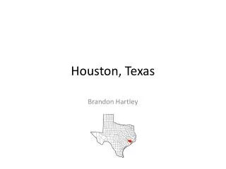
Houston: general Houston, Texas is the largest city in the state of Texas and fourth largest in the nation. The city was founded in 1836 and has grown steadily since that time. The city currently has a population of 2.14 million within its city limits and nearly four million in the metropolitan area. The city itself has grown , now encompassing 579 square miles with a population density of 3,371.1 people per square mile. The median household income is $36,616. Since its inception the city has had a very close relationship with the system of bayous that drain rainwater. In the coming years the city of Houston’s inhabitants will have to make very important decisions about how the city will respond to its water.
My plan: society Water must become a central part of the city’s culture, the society that has turned its back on the bayous must embrace it in the future. Water must become central to the lives of people in the city so that during times of flooding the presence of more water than normal becomes an amenity and opportunity to the local culture. Currently water is filtered through the city of Houston via the bayou system. The bayous are neglected to such a great degree in the city planning that often there is no indication that there are any bayous at all. This lack of design in this area creates an unfortunate situation in which the presence of any water outside the bayou can only be a negative. Houston exists because of its close relationship with these bayous, therefore it is necessary to bring this city’s culture back into close contact with water. With proper design the presence of water can have a positive affect on the culture. The built environment can become a framework that forces water into the culture. Being forced to interact with water in more situations than just flooding will create a new relationship with water.
My plan Until recently Houston has been dealing with this issue by treating it as a problem that can be solved with large scale civic works such as widening the bayous. Houstonians themselves have ignored water and view it as a nuisance to be dealt with only when absolutely necessary. Viewing water as a nuisance to be dealt with is not feasible as a long term, sustainable solution. Houston is located in a geographic area that is flood prone, in order to properly deal with this issue the city must embrace water and in extension flooding. Water must become a central part of the city’s culture, the society that has turned its back on the bayous must embrace it in the future. Water must become central to the lives of people in the city so that during times of flooding the presence of more water than normal becomes an amenity and opportunity to the local culture.
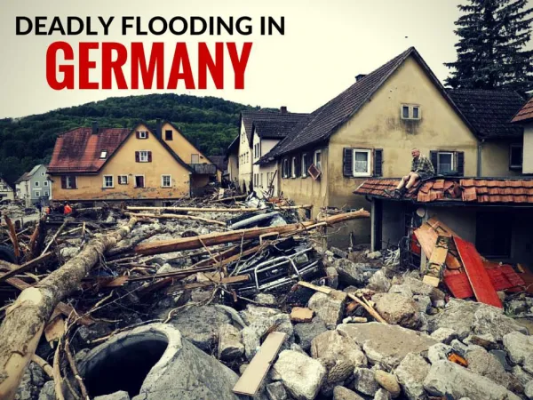
Current conditions Our research showed that for most of its history Houston has ignored its water and only seen it as a problem to be dealt with when it overflows its natural boundaries. Apart from the Galveston area the city basically ignores the presence of water. The bayous which form the main high volume drainage system of the city overflow very quickly in a major rain event. Because of the city’s geographical flatness the bayous cannot move the collected water into the ocean quickly enough and often overflow their banks. Another large part of this problem is high amount of impervious cover already existing in the city, and the fact that more is added every year. This impervious cover changes the drainage characteristics of the area it is placed on, forcing more water into the bayous at a higher rate, thus adding to the already drastic drainage issues in the bayou.
History Current drainage schemes address problems as they arise. The current policies do very little to address the long term problems, the typical process is dealing with problems after they have boiled over. Bayous exist as an alternative to ground absorption Development of land creates more impervious surfaces that funnel rainfall to collection points more quickly than is natural. This leads to flooding when water collects at a relief point and builds up, eventually flooding the surrounding areas. Short, intense periods of rain are more likely to cause flooding because they are more likely to overwhelm the carrying capacity of an area. • Drainage issues were merged into one organization to deal with drainage issues as a whole for the good of all areas of the city. • 1937- Harris County Flood Control District was established. • Bayous concrete lined based on the belief that this will control flooding. • 1973- Restrictions put in place to restrict development of the flood plain • 1980- “no downstream impact policy” all upstream development must return water to the system at the same rate that it did before development. This led to an increase of large holding areas for excess water. • The current plans for the system will require miles of additional drainage canals and nearly a billion dollars of investment to shore up the system.
My plan To encourage this new relationship the built environment must change. New developments can both bring culture in more direct contact with water, and aid the bayous in flood drainage. An overall system will be set in place where new development along the bayous becomes central nodes become collection points for water from existing flood prone areas in the city. The central nodes take the water from upstream and slow it down enough so that the bayou is allowed to drain normally and flood prone areas are spared. For existing developments near the bayou that cannot be reconditioned, a smaller scale strategy can be implemented to contain only the water for that particular area.
My plan This strategy’s intent is to create nodes of designed space along the bayou that collect water and slow it down. This will place less pressure on flood prone areas and allow water to keep flowing efficiently without overflowing the banks. The water that falls over the majority of the city in residential and light commercial areas is allowed to flow away from these areas as quickly as possible, towards the developed areas on the bayou that are designed to flood. Specific nodes of designed urban space are placed at appropriate places along the bayou. In these spaces the built environment takes an active role in water management. Buildings become active participants in directing the water’s flow. Creating streams, reservoirs, and even a smaller bayou. All building in these areas are required to be water resistant. The spaces they create to hold water are to be able to be inundated with water for hours or days at a time, and still be suitable for public use.
My plan: terracing A major part of this plan will be to divide the developed area into terraces. The circulation pathways through this area will be the main terraced elements, with public courtyards as secondary terraces. The main circulation terraces will be the main path of water through the designed areas. The courtyards and public spaces along the pathways will be terraced down from the main pathways to provide overflow from the main areas. Because of the terracing the water flowing down the main circulation spaces the water’s path will be impeded and the time that it takes to get to the bayou will be impeded. The terracing affect will also force water into the center of the built environment where people live, work, and play. This will force people to adapt to water’s presence instead of ignoring it.
My plan: the built environment In order for this strategy to be effective the buildings in the area must be designed to be impervious to water. The built environment must respond to the flooding in Houston by accepting it within its program when necessary without damage. The built environment will provide its normal function to the people living there when dry, when water is present its program will expand to adapt to new these new conditions.
My plan: active water use in building Buildings can also bring water into them to be used in new ways.
My plan: soil aeration One of the greatest problems with this area is the high imperviousness of the city. As land is developed great amounts of previously natural landscape are removed from the natural drainage cycle. The naturally high clay content of the soil also presents another challenge as it forms another natural barrier to water drainage during heavy rainfall, trapping the water in the first 18 inches of soil. A major part of the design solution will involve using site planning and design to help aerate the soil. The addition of plants and grass instead of concrete allows for a drainage rate on the site to be closer to that of undeveloped landscape.
context: context Context is the central aspect of this approach. The context of the site will dictate how my approach will be adapted. Different aspects of the site and its relationship to the rest of the city will inform the designers of how they should approach the site. Each site will need to be analyzed on a case by case basis to adapt a design solution based on my system.
context: industrial Site: These areas are sparsely populated and are grouped together in certain areas of the city. They are secluded from populated areas and often have large unused spaces. The functions of these areas are vital to the future of the city and must be protected from flooding. There is a great opportunity in the large, open spaces to contain vast amounts of water. The terracing approach can be added to these areas to provide a great deal of surface area detention along the bayou. Because of the operations performed in the buildings in these areas the built environment cannot accept water into them. By making them waterproof they can aid in the detain age process. These areas can form the backbone of the overall drainage plan for the city. Because of their high volume and strategic locations they can hold a great deal of overflow from elsewhere in the city. The industrial areas near downtown can carry much of the overflow from the Buffalo Bayou and allow other areas of city to drain quickly.
context: new development A large area of concern for the future of the city is in new development. Currently these new developments are not designed in an environmentally conscious
context: historical This strategy’s intent is to create nodes of designed space along the bayou that collect water and slow it
context: built areas that can be changed This strategy’s intent is to create nodes of designed space along the bayou that collect water and slow it
context: public areas This strategy’s intent is to create nodes of designed space along the bayou that collect water and slow it
context: heavy urban devevlopement This strategy’s intent is to create nodes of designed space along the bayou that collect water and slow it