Download
1 / 18
230 likes | 1.35k Views
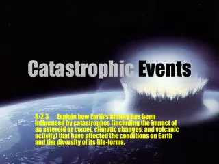
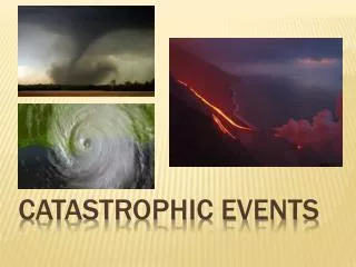
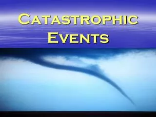
Texas Eco-Regions and Catastrophic Events project. Created by: N & G. Credits. Tornado. Drought. Panhandle Plains. Floods. Prairies and lakes. Piney Woods. Big Bend. Hill Country. Gulf Coast. South Texas Plains. Hurricane. Wildfires. END. Texas Map. Panhandle Plains.

E N D
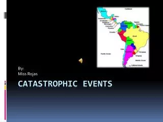
Texas Eco-Regions and Catastrophic Events project Created by: N & G
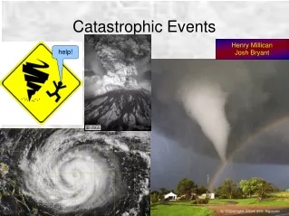
Credits Tornado Drought Panhandle Plains Floods Prairies and lakes Piney Woods Big Bend Hill Country Gulf Coast South Texas Plains Hurricane Wildfires END
Texas Map Panhandle Plains • A famous landform in the Panhandle Plains is the Palo Duro Canyon. • The climate in the Panhandle Plains is from 15 to 28 inches of rain per year. There is more rainfall in the eastern half. • The Panhandle Plains vegetation consists of flat grasslands and few trees, like Sugarberry, Salt Bush, Prairie Crabapple, and a lot more. • Some of the catastrophic events in the Panhandle Plains are wildfires, tornadoes, and earthquakes. Palo Duro Canyon
Texas Map Prairies and Lakes • The climate in this eco region is mild to cool winters and hot, humid summers. • Wildfires, tornadoes, and flooding are some different catastrophic events that generally occur in this eco region. • The vegetation type is Pecan, Black Hickory, and Sycamore trees. • Cedar Hill State Park Is a land formation they created from a big grassland to a park.
Texas Map East Texas Piney Woods • The Climate in the Piney Woods is never too hot in the summers and never too cold in the winters. • The different catastrophic events that generally occur in this eco-region are wildfires and flooding. • Trees, shrubs, woody vines, and Herbaceous are some different kinds of vegetation. • The Sulpher River was created by weathering, erosion and deposition.
Texas Map Gulf Coast Prairies and Marshes • A famous landform in the Gulf Coast Prairies and Marshes is Brazos River. • The climate in the Gulf Coast Prairies and Marshes can range from 40 to 60 inches of rain per year. • In the Gulf Coast Prairies and Marshes there is only a little vegetation. Some of the vegetation consists of Salt Grass Marshes, Water Oak, American Elm, Holly, Short-leaf Pine, and many more. • Some of the catastrophic events in the Gulf Coast Prairies and Marshes are hurricanes, tornadoes, and flooding.
Texas Map South Texas Plains • The climate in the South Texas Plains is very dry mostly all year round. It has very little rain fall. • Wildfires and flooding are the different catastrophic events that generally occur in this area of Texas. • Sugarberry, Brasil, Retama, and Honey Mesquite are SOME of the many different kinds of vegetation. • The Rio Grande Valley is a landform that was created by weathering, erosion, and deposition.
Texas Map Hill Country • A famous landform in the Hill Country is the Enchanted Rock. Today it is now a state park. • The climate in the Hill Country ranges from 15 to 34 inches of rain per year. • The Hill Country’s vegetation consists of many rolling hills with tall and short grasses. Some of the specific vegetation is switch grass, Mesquite, Juniper, Black Willow, and a lot more. • Some of the catastrophic events in the Hill Country are wildfires and flooding.
Texas Map Big Bend Country • A famous landform in the Big Bend Country is the Guadalupe Mountain. • The climate in the Big Bend Country ranges from 8 to 20 inches of rain per year. • The Big Bend Country’s vegetation varies from desert plants, trees in the mountains, and wetland grasses. The desert consists of Yucca bushes, Agave Ponderosa Pine, Chisos Red Oak, Cottonwood, Alkali, and a lot more. • Some of the catastrophic events in the Big Bend Country are wildfires and earthquakes.
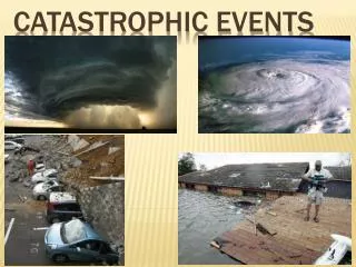
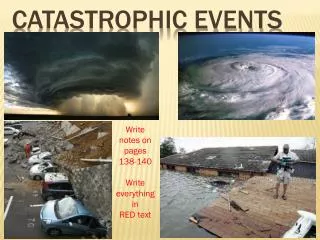
Texas Map Drought • A drought is a period of time where an area of land goes with out water. • It is formed when there hasn’t been any rainfall in long periods of time, which causes a drought and dries up the land. • Drought generally occurs in all of the eco-regions.
Texas Map Hurricanes • A Hurricane is a huge storm that is formed when you gather heat and energy through contact with warm ocean waters. • Hurricanes generally occur in the Gulf Coast. • Hurricane Katrina was the deadliest and most destructive Atlantic hurricane of the 2005 Atlantic hurricane season.
Texas Map Floods • Floods results from days of heavy rain and from melting snow, and when rivers rise and go over their banks. • Floods happen when rivers overflow or from heavy rainfall • Floods generally occur in the Hill Country, South Texas Plains, and Prairies and Lakes.
Texas Map Wildfires • A wildfire is a large, destructive fire that can spread quickly. It can burn down many things. • A wildfire can form when lightning strikes, when a human is careless and lights something, or when it’s a hot day outside and the grass just catches on fire. About 4/5 of the wildfires are caused by humans. • Wildfires mainly occur in the Big Bend Country Eco region.
Texas Map Tornadoes • A Tornado is a violent rotating column of air extending from a thunderstorm to the ground. • Tornadoes form from cool, dry air from Canada, and warm, humid air. When they meet they create instability in the atmosphere. • Tornadoes mostly occur in the Panhandle plains and the Prairies and Lakes.
Credits Page 1 Credits • http://www.century21parkone.com/fish/infish/images/statemaps/intexn1.gif • http://weatherwizkids.com/ • http://www.tpwd.state.tx.us/kids/about_texas/regions/ • http://texastreeid.tamu.edu/content/texasEcoRegions/ • http://www.worldatlas.com/webimage/countrys/namerica/usstates/txland.htm • http://www.google.com/imgres?q=prairies+and+lakes&um=1&hl=en&safe=active&client=safari&sa=N&rls=en&biw=1024&bih=598&tbm=isch&tbnid=ebMuVFe01q_X_M:&imgrefurl=https://www.tpwd.state.tx.us/learning/resources/activities/regions/prairie_teacher.phtml&docid=P18kKpEgwYlK3M&imgurl=https://www.tpwd.state.tx.us/learning/resources/publications/images/blackland_prairie600.jpg&w=600&h=366&ei=uM6KUKWdIJPKqQHkvYGIDw&zoom=1&iact=hc&vpx=218&vpy=312&dur=775&hovh=175&hovw=288&tx=152&ty=126&sig=108595299257226079727&page=1&tbnh=137&tbnw=212&start=0&ndsp=15&ved=1t:429,r:11,s:0,i:103&surl=1
Credits Page 2 • http://www.google.com/imgres?q=prairies+and+lakes&um=1&hl=en&safe=active&client=safari&sa=N&rls=en&biw=1024&bih=598&tbm=isch&tbnid=k1Wgn0Ny89mCYM:&imgrefurl=http://www.allacrosstexas.com/outdoors/van-alstyne-lakes.htm&docid=OPnz-YdpXKARyM&imgurl=http://www.allacrosstexas.com/photos/outdoors/eagle-mountain-lake/eagle-mountain-lake.jpg&w=495&h=295&ei=uM6KUKWdIJPKqQHkvYGIDw&zoom=1&iact=rc&dur=311&sig=108595299257226079727&page=4&tbnh=127&tbnw=206&start=52&ndsp=16&ved=1t:429,r:42,s:20,i:260&tx=94&ty=70&surl=1 • http://www.google.com/imgres?q=east+texas+piney+woods&um=1&hl=en&safe=active&client=safari&sa=N&rls=en&biw=1024&bih=598&tbm=isch&tbnid=nCFX8CAiVsC8MM:&imgrefurl=http://ms.houstonisd.org/GregoryLincoln/Tyris%2520Johnson/Johnson,%2520T%252002-10-09%2520Page%2520index.html&docid=7PuCbTWYJiJ8LM&imgurl=http://ms.houstonisd.org/GregoryLincoln/Tyris%252520Johnson/Piney.jpg&w=800&h=600&ei=adCKUOzeNcajrAHRnYGACA&zoom=1&iact=rc&dur=627&sig=108595299257226079727&page=1&tbnh=134&tbnw=172&start=0&ndsp=14&ved=1t:429,r:1,s:0,i:73&tx=70&ty=74&surl=1 • http://www.tpwd.state.tx.us/kids/about_texas/regions/pineywoods/big_kids/ • http://www.tpwd.state.tx.us/kids/about_texas/regions/south_texas/big_kids/
Credits Page 3 • http://texastreeid.tamu.edu/content/texasEcoRegions/SouthTexasPlains/ • http://geology.com/hurricanes/hurricane-names.shtml • http://eo.ucar.edu/webweather/hurricane2.html • http://www.weatherwizkids.com/weather-tornado.htm • http://www.azgs.az.gov/hazards_floods.shtml • http://www.northern.lancs.sch.uk/Weather.html • http://serc.carleton.edu/eslabs/drought/index.html • http://www.treehugger.com/corporate-responsibility/drought-around-the-world-atlanta-in-perspective.html • http://www.qtp.ufl.edu/news/2005/news.shtml
Texas Map • http://www.environment-agency.gov.uk/homeandleisure/floods/31620.aspx • http://www.osuit.edu/news_stories/ • http://www.kudufm.com/site/index.php?option=com_content&view=article&id=1215:china-facing-starvation-due-to-droughts&catid=43:international&Itemid=65 • http://www.tpwd.state.tx.us/kids/about_texas/regions/panhandle/big_kids/ • http://www.tpwd.state.tx.us/kids/about_texas/regions/gulf_coast/big_kids/ • http://www.tpwd.state.tx.us/kids/about_texas/regions/hill_country/big_kids/ • http://www.tpwd.state.tx.us/kids/about_texas/regions/big_bend/big_kids/ • http://www.weatherwizkids.com/weather-wildfire.htm • http://campuses.fortbendisd.com/campuses/documents/Teacher/2011%5Cteacher_20110908_0942.pdf