Download
1 / 11
110 likes | 257 Views
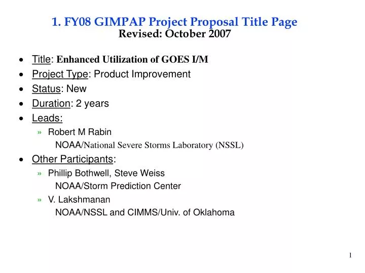
1. FY08 GIMPAP Project Proposal Title Page Revised: October 2007. Title : Enhanced Utilization of GOES I/M Project Type : Product Improvement Status : New Duration : 2 years Leads: Robert M Rabin NOAA/ National Severe Storms Laboratory (NSSL) Other Participants :

E N D
1. FY08 GIMPAP Project Proposal Title PageRevised: October 2007 • Title: Enhanced Utilization of GOES I/M • Project Type: Product Improvement • Status: New • Duration: 2 years • Leads: • Robert M Rabin NOAA/National Severe Storms Laboratory (NSSL) • Other Participants: • Phillip Bothwell, Steve Weiss NOAA/Storm Prediction Center • V. Lakshmanan NOAA/NSSL and CIMMS/Univ. of Oklahoma
2. Project Summary • Work closely with the NSSL and NESDIS, the Cooperative Institutes (CIMSS & CIRA), MDL and SPC on several projects, which utilize satellite observations to mitigate deficiencies in the national radar network. • Incorporation of storm tracking, satellite winds, and fire products into N-AWIPS to meet the needs of the NOAA/Storm Prediction Center (SPC). • Incorporation of existing satellite rainfall algorithms into National grid (NMQ) and evaluation in collaboration with OHD, NESDIS, CREST. • Implementation of precipitation efficiency algorithm and mesoscale winds at the NESDIS SAB • Collaboration with CIRA on microphysical storm severity techniques. • Consulting and training on the use and interpretation of satellite data with emphasis on the SPC and NSSL.
3. Motivation/Justification • Support NOAA Mission Goal(s): Serve society's needs for weather and water information. • Develop applications to enhance utilization of GOES I/M in conjunction with Doppler radar & other data sources for the detection and forecasting of hazardous weather. • Optimize synergistic use of national satellite and radar networks • Explore new uses of current sensors • Future application to enhanced features of GOES-R • Collaboration of NOAA/OAR and NESDIS/ORA on NOAA wide efforts
4. Methodology • Implement GOES-based storm tracking and 1-hr forecasts (storm relative applications). • Monitor fires with rapid scan data, collaboration with E. Prins & SPC • Maintain and improve mesoscale winds and fire products in N-AWIPS at the SPC and SAB. • Explore use of high temporal resolution data in product development (1 –min GOES-10 and GOES-13 datasets). • Explore the use of Cloudsat data as validation for cloud-top heights. • GOES rainfall verification with radar and gauges. • Apply SCAMPR to radar & multispectral satellite data • Probabilistic QPE using radar and satellite data as predictors • Apply sounder and imager cloud products to radar quality control • Evaluation of precipitation efficiency techniques during winter season • Further development storm severity techniques and evaluation • Possible implementation to web-based tools and N-AWIPS
5. Summary of Previous Results • Processing and archiving of mesoscale satellite winds: real-time web page, workstations at Synoptic Analysis Branch, and N-AWIPS at SPC. • role of jet streak on Greensburg KS storm (F5 tornado): need for high resolution • Web-based tool for storm tracking has been maintained for real-time access and archival. • application to CREST nowcasting project. • Tracking of overshooting tops with super-rapid scan began (collaboration with NASA). • Comparison of storm top heights with CloudSat began (collaboration with CIRA, CHMI). • Application of GOES WF_ABBA at SPC, winter fire studies, first exploration of utility of rapid scan for fire evolution. • Study of ash plume effect on cloud formation and convection. • Real-time output of GOES Hydroestimator into National QPE analysis system (NMQ) and PDA web-page. • Real-time input of GOES imager data into NSSL multi-sensor rainfall algorithm and display and evaluation in NMQ. • GOES sounder cloud-top products used in quality control of WSR-88D for QPE. • Dendritic ice-growth algorithm using GOES sounder cloud-top products for identification of heavy snow potential: evaluation at NESDIS SAB. Winter storm study: use of radar profiles for freezing level. • Consulting at the NSSL and SPC on the use of GOES data continued: interaction with SPC personnel on questions concerning current and future GOES data.
Greensburg, KS Storm 05 May 2007 WV 0215 UTC VIS 0115 UTC
6. Expected Outcomes • Improved tracking tool for MCS including 1-hr nowcast • link storm attribute and environmental information from Doppler radar and satellite • storm top features (e.g., warm-cold couplet, 4 micron reflectivity) vs. storm intensity • web-based, output to N-AWIPS (possibly AWIPS). • Additional applications of MWV including combined wind analysis with WSR-88D VWP and divergence profiles, storm relative wind flow, use of rapid-scan data. • Wind fire intensity product, possible combination with wind estimation from smoke plume tracking, and WSR-88D data. • New techniques to diagnose storm intensity • Benchmark for QPE skill, short-term QPF, precipitation efficiency. • Storm top studies: synergism with research satellites (CloudSat, etc).
7. Major Milestones • FY08 • improved MCS tracking tool developed for web (to include time trends and 1-2 hr forecast) • improved mesoscale wind analysis to utilize new first guess and visible winds (GFS model) • improved latency of fire products and inclusion of RISOP data at SPC & collaborate with CIMSS on development of fire intensity product. • further develop new techniques for storm intensity • evaluation and improvement of existing QPE techniques, 1-hr forecasts • evaluate storm height comparisons with GOES, WSR-88D and CloudSat. • FY09 • testing of improved MCS tracking and nowcasting tool in N-AWIPS • development of combined real-time mesoscale wind analysis (WSR-88D and GOES) • testing the utility of fire intensity product (comparison with surface winds)
Funding Sources Procurement Office Purchase Items FY07 FY08 FY09 $32 $32 $32 GIMPAP 0 0 0 0 0 0 Other Sources $28K $59 $21 $20K $21 $21 0 $38 0 $8K 0 0 NASA 8. Funding Profile (K) GOES-R3 NOAA-HPCC • Summary of leveraged funding • FY-07 GOES-R3: $20K: Shared development of nowcasting and precipitation tracking • FY-07/08 NOAA-HPCC: $38K (pending): Investigate use of environmental conditions for nowcasting MCS intensity trends. • FY-07/08 NASA Sensor-web: $8K: Development of enhanced-V, overshooting top algorithm development for possible use in nowcasting. • FY-07/09 OAR/NSSL: Use of IT resources at NSSL
9. Expected Purchase Items • FY08: • BOP to NSSL • Salary: R. Rabin, V. Lakshaman (CIMMS, Univ. Okla) $21,000 • Travel: R. Rabin. Norman,OK-Madison,WI;approx 12 trips) $4,000 • IT support (NSSL) $7000 • Total $32,000 • FY09: • NSSL – Salary, travel, IT support - $32,000