Download
1 / 18
190 likes | 327 Views
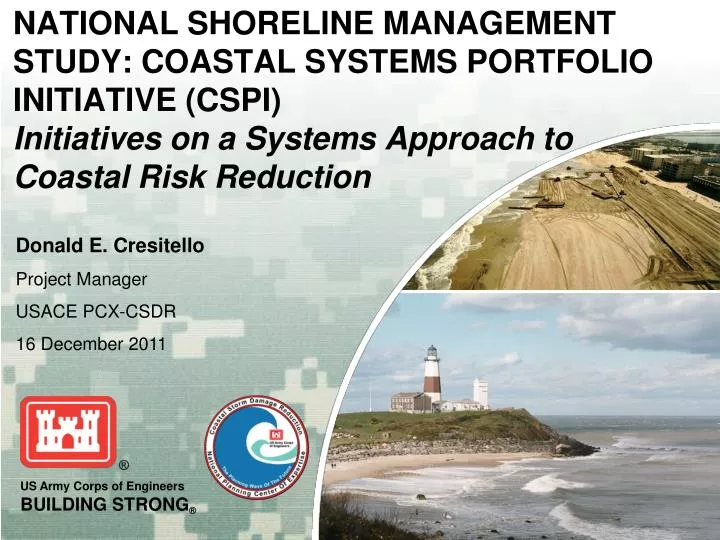
NATIONAL SHORELINE MANAGEMENT STUDY: COASTAL SYSTEMS PORTFOLIO INITIATIVE (CSPI) Initiatives on a Systems Approach to Coastal Risk Reduction. Donald E. Cresitello Project Manager USACE PCX-CSDR 16 December 2011. Overview. Impetus for Study Defining the CSPI

E N D
NATIONAL SHORELINE MANAGEMENT STUDY: COASTAL SYSTEMS PORTFOLIO INITIATIVE (CSPI)Initiatives on a Systems Approach to Coastal Risk Reduction Donald E. Cresitello Project Manager USACE PCX-CSDR 16 December 2011
Overview • Impetus for Study • Defining the CSPI • Implementing a Systems Approach to Coastal Risk Reduction • Primary Study Products • How Can MARACOOS Help? • Shared Flood Risk Management • Summary
Impetus for Study • Following 2004 Hurricane Season Congress charged USACE toassess damages prevented across a system of projects and to improve the way we do business. • General Strock challenged USACE to implement systems approach for coastal risk reduction. • CERB to guide the development of a systems approach. • North Atlantic Division (NAD) Commander volunteered to prototype the systems approach. • Congressman Frank Pallone (NJ) at the Fall 2006 CERB • Projects not managed as a system and projects not budgeted for as a system. • Take regional approach to improve efficiencies and effectiveness of our projects. Source: Coastal Planning & Engineering
Defining the Coastal System Portfolio • Coastal System Portfolio is a system of systems – shore protection, navigation and coastal ecosystem restoration, that exploits the connectivity among each system. • Examples of ways to define systems: • Technical (i.e. sediment transport) • Environmental • Geographical • Political • Commercial • Within NY, NJ, and DE, five systems along the Atlantic Coast have been identified based upon sediment transport: (1) Southern shore of Long Island (2) Northern New Jersey (Sea Bright to nodal point in Mantoloking) (3) Southern New Jersey (nodal point in Mantoloking to Cape May) (4) Northern Delaware (5) Southern Delaware to Maryland/Virginia border
Implementing a Systems Approach to Coastal Risk Reduction • Requires a paradigm shift for managing shore protection projects. • Current Way of Doing Business: • Projects are budgeted based upon individual needs, on a project by project basis. • Each business line is budgeted independent of another. • Projects are funded by Congressional interests specific to the project location. • Utilizing the Systems Approach to accomplish coastal risk reduction: • Optimizes funding to optimize benefits delivered by projects across an entire region. • Requires crossing multiple business lines (shore protection, navigation, and coastal ecosystem restoration). • Requires increased flexibility to allocate funds where needed. • i.e. Receive an allotment of funds for a specific region instead of receiving project specific funding. • More effectively buys down risk by applying the regional allotment of funds to the area(s) with the most critical need.
Primary Study Products • Technical Review Document • Website Database • Multi-agency Coordination • Pilot Studies
Website Database URL: http://projects.rsm.usace.army.mil/CSPI http://cspi.usace.army.mil Click Map It! To view this project in Google Earth. Shore Protection projects database details: overview, initial construction, reports, renourishment, cost summary, and risk.
Multi-Agency Coordination • Held Workshops at Monmouth University, June 2008 and Stevens Institute of Technology, July 2009 • Identify information needs, policy impediments and partnership opportunities that improve coordination and collaboration to meet shore protection project needs. • Inform discussions within Corps, NOAA, and FEMA and state agencies on implementing a regional systems approach to coastal storm and flood risk management. • Develop recommendations to improve consistency between federal and state shoreline management policies and programs, and the operations and maintenance by local coastal communities. • Develop recommendations for consistent, comprehensive risk management and communications framework. • Develop approaches to generate long term support for project implementation in the Mid-Atlantic region to provide for comprehensive coastal management. • Consolidate the knowledge, guidance, tools, and successes across the region in support of successful relationships. • Included a broad spectrum of attendees representing different interests USACE: NAN, NAP, NAB, NAO, NAD, SAM, IWR; FEMA; NOAA; NYSDEC; NJDEP; DNREC; TNC; Sea Grant; Stevens Institute, Richard Stockton State University, etc
How Can MARACOOS Help? • USACE needs MARACOOS to work with us to combine expertise of the oceans with USACE knowledge of coastal risk and storm damage reduction through renourishment and maintenance of beaches. • USACE has the authority to reduce coastal risk and storm damages from Montauk Point to the MD/VA border - not talking about how we can build new projects, we’re talking about investigating how we optimize the existing projects. • USACE is working to make the current program more cost effective, trying to accomplish more with less. Better data will help! • In order to improve the project efficiencies and effectiveness we need help from MARACOOS. • Once we figure out how to manage our projects within systems it will become more obvious what data we need from MARACOOS to improve our systems approach. • USACE needs improved storm suites to perform analysis for our coastal studies. • USACE needs to be able to quickly assess how extreme an event really was. Specifically, how was it extreme in terms of causing beach erosion. This is crucial to emergency rehabilitation following major storm events. • Near term and long term data is essential. • Working together will help optimize USACE’s coastal program for the future.
NY Pilot Study • Vision – Create regional authority to identify sand sediment resources and sand sediment needs. • Mission – Institutionalize sediment management along the South Shore of Long Island. • Scope - Sequence shore protection, navigation and coastal ecosystem restoration projects over five-years to identify the most cost effective way to “maximize sediment management”. • Beneficial Outputs: • Reduction in costs like dredging mob/demob, contracting and project management expenses • Increases in output such as improved navigational safety and servitude, costal risk reduction • Increased sediment management outputs include most effective use of sediment resources, more productive interagency coordination of combined projects • Potential for reduction of environmental disturbances • Significant Outcomes: • Draft Language for a new Federal Regional Sediment Management Authority implementing RSM as a new authority • Create an Engineering Plan to implement the new RSM Authority.
NJ Pilot Study • Develop a five-year plan to manage and fund Federal coastal projects in New Jersey to “maximize risk reduction”. • The study will attempt to optimize limited fiscal resources, while maximizing the overall reduction of risk. • Funding projects in any one year will be dictated by the level of risk associated with each project. • Connectivites between projects (i.e. shore protection and navigation) will be exploited to improve efficiency. • The effort includes 20 shore protection and coastal ecosystem restoration studies and projects along with 8 federal navigation projects along the Sandy Hook and Raritan Bay, Atlantic Ocean, and Delaware Bay shorelines. • Four sub regions have been identified to enable implementation of a more specific systems approach: • Sandy Hook and Raritan Bay Coastline • Atlantic Ocean Coastline - Sea Bright to Mantoloking • Atlantic Ocean Coastline - Mantoloking to Cape May • Delaware Bay Coastline
DelMar Pilot Study • A system of projects in Delaware and Maryland will be analyzed to demonstrate “maximizing regional benefits” for the DelMar coast. • Rather than assessing project benefits based on local, municipal, or District geographic boundaries, developing and analyzing benefits of the coastal system will involve analyzing benefits of individual shore protection, navigation, and coastal ecosystem restoration projects within the DelMar system as well as analyzing collective benefits of the system as a whole. • This study will involve interagency coordination to identify benefits to other Federal, State, and as applicable, local governments and agencies. • The following categories of benefits are expected to be analyzed for each project and collectively for the system of projects: • Economic • Navigation • Flood Risk Reduction • Shoreline Protection • Ecosystem and Natural Resouxrces • Social and Cultural • Interagency
Shared Flood Risk Management“Driving Down the Risks with an Informed and Engaged Public “ Initial Risk Lessons Learned from Hurricane KATRINA Outreach Federal / State / Local Natural Storage Federal / State / Local Structural Federal / State / Local Non – Structural Federal / State / Local Risk Contingency Plans Federal / State / Local / Individual Building Codes State / Local Zoning Local Insurance Individual / NFIP Residual Risk All Stakeholders contribute to reducing risk !
Summary • Effectively implementing a regional systems approach will require a major shift in the way USACE does business. • A new paradigm must be identified to manage shore protection and other types of projects within the coastal zone, as a system of projects. • The goal of the CSPI effort is to implement a regional systems approach to program management and funding thus allowing for more efficient and effective coastal risk reduction and management. • Achieving the goal will allow for improved project effectiveness and efficiencies with less environmental impacts to a region.
For More Information, Contact: Donald E. Cresitello USACE Planning Center of Expertise for Coastal Storm Damage Reduction New York District, Planning Division 917-790-8608 donald.e.cresitello@usace.army.mil Coastal Systems Portfolio Initiative Project Web Database http://projects.rsm.usace.army.mil/CSPI http://cspi.usace.army.mil