Download
1 / 32
320 likes | 503 Views
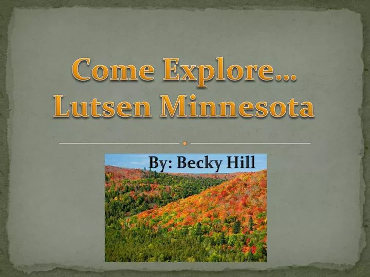
Come Explore … Lutsen Minnesota. By: Becky Hill. Location. Lutsen Minnesota is about 90 minutes northeast of Duluth Minnesota. It is right along the shore of Lake Superior . . Lake Superior. Lutsen is located in Cook County as indicated by the star above . Lake Superior. The Laurentide

E N D
Come Explore…Lutsen Minnesota By: Becky Hill
Location Lutsen Minnesota is about 90 minutes northeast of Duluth Minnesota. It is right along the shore of Lake Superior. Lake Superior Lutsen is located in Cook County as indicated by the star above. Lake Superior
The Laurentide Ice Sheet -The picture to the left shows just how enormous the Laurentide Ice Sheet really was. It covered basically all of Canada and a portion of the north United States. All of Northern Minnesota was completely covered. Below- Glaciers around the World (Star indicates where Northern Minnesota was) -The picture on the left shows how winds played a role in how the glaciers of North America were affected. The Laurentide Ice Sheet moved down from Canada to the United States.
Glacial Striations -As the glaciers of North America flowed over the bedrock it left large scrapes in the rock. These scrapes are called glacial striations. The ice was very powerful and could cut right through the rock without much effort. These striations took an extremely long time to form, for the ice moved so slowly. Glacial Ice Bedrock
Moraines Moraines are rock debris that has been accumulated by an alpine glaciers. There are many different types of moraines. There are lateral, terminal, and medial moraines. Lateral Moraine Medial Moraine
How Volcanoes formed Rocks Volcanoes actually formed much of the rock that is in Lutsen MN. Especially along the shore of Lake Superior. After the lava from the volcano cooled it formed to create rock. The type of rock formed from lava is typically igneous rock.
Rocks of Lutsen Mostly Igneous rock makes up the majority of the Lutsen area. The rock the lies here is actually the oldest rock found in the state of Minnesota. The two circles on the map indicate where the Igneous rock is mainly located in the state .
This map shows that in theLutsen area, the main rock type here was formed by volcanoes.
What is there to do in the Summer There are so many activities to do in the summer while you visit Lutsen as the slide after shows. Different resorts and companies offer different activities such as: -Waterfall Tours -Rock Climbing -Alpine slides-Canoe Lessons -Canoe lessons -Kayak Lessons Some of the above activities you could do on your own as well as the following: -Fishing -Hunt for rocks along Lake Superior -Swimming shore -Viewing the sites -Have a picnic -Hiking -Agate Hunting -Camping
Winter Activities
What is there to do in the Winter • The slide after this one shows that there are many activities to do in the winters in Lutsen Minnesota . • -Resorts and other companies can set you up with the following activities if you need assistance: • -Snowboarding • -Skiing • Ride in a horse drawn sleigh • -Take a snowmobile ride • Take a snowshoe walk through a trail • Ride on a dog sled • -You could even have a winter picnic
Take a Gondola Ride Gondola rides are offered through a number of companies throughout Lutsen. They are not only used for getting up a mountain to ski or snowboard but to site see as well!
Solbakken Resort Cascade Lodge Resorts There are many different resorts in the area. Such as the Caribou Highlands Lodge, Cascade Lodge and Restaurant , Lutsen Resort, Solbakken Resort and Lakeshore Cabins, and many many more! Lutsen Resort
The Rock Cycle -As you can see by the rock cycle Igneous rocks are formed by lava or (magma). Before the time of the ice age there was a volcano in the Lutsen area. That volcano spilled lava , the lava cooled and then created Igneous Rocks.
Agates of the North Shore -Along the North Shore including, Lutsen there are many rock beaches where agates can be found.
How Lake Superior Agates were Formed Long before the ice age the North American continent began to split apart. Lava flows then came up to the surface of the earth. These lava flows were rich with iron. Carbon dioxide and tiny water vapers actually became trapped in the cooled lava. Later chalcedony (fine-grained quartz) filled into the air pockets. After much time passed the ice age fell upon Minnesota. The glacier came through and picked up many of the agates that were on the ground’s surface. Many of these agates were transported by the glacier to the south. It is said that the glacier actually acted as a giant rock tumbler by polishing the agates. The lake superior agates actually have a different color scheme then other agates found in different parts of the world. Lake Sperior agates are usually colored yellow, orange, and red. The color of an agate is actually determines by the amount of iron and the oxidation.
The soil *The pH level in the soil of this area is between 5.2 and 5.1. This means that the soil is slightly acidic. On the pH scale neutral is 7. A pH of % is more on the Acidic side. *The soil in the Lutsen area is fairly moist. It holds moistures fairly good as well.
Clay Till Till is deposited by glaciers. It is composed by glacial sediment. This may made up of one specific type of clay or be a mixture of a few different kinds. Sand and gravels may actually be apart of the clay as well. Till is usually deposited in the moraines of the glacier. Large amounts of till is said to be, in a scene, washed away as outwash in rivers. Large rocks and boulders mixed in with the till.
Cascade River -The Cascade River between Lutsen and Grand Marais. There is a state park actually in Lutsen called the Cascade River State Park. In both the upper right picture and the one on the left you can see that the river is slowly eroding the rock. -The bottom left-hand picure is pointing out a point bar. The river is a curve at this point. The river isn’t at the same water level that it used to be. The river has deposited sand in that lower part. Point bar
Temperance River State Park The Temperance River is actually between Schroeder and Lutsen, Minnesota as indicated on the map above. This state park runs along the temperance river and has many trails for hiking. The opening of the Temperance River is beautiful as it joins Lake Superior. To get there travel on Cook County Rd. 1 (Cramer Rd.) to Temperance River Wayside on Hwy. 61
Climate Lutsen Minnesota is considered to be in a snowy-forest climate. This area is also well known for having moist winters. It is a moist climate with a decent amount of rainfall throughout the entire year. Lutsen has no true dry season. It has a fairly warm summer season with a cooler winter season. This climate is also sometimes called a moist continental climate.
Rainfall in Lutsen -The lowest monthly average for rainfall is in the month of February. -In February Lutsen gets an average of approximately 1.18 inches of rainfall during the month -The highest monthly average for rainfall is in July In July Lutsen gets an average of approximately 3.96 inches of rainfall during this month
WinterTemperatures Summer temperatures -The average high temperature for Lutsen MN in July is 72 degrees Fahrenheit - The average low temperature for July is 53 degrees Fahrenheit - - The average high temperature for Lutsen MN in January is 16 degrees Fahrenheit - The average low temperature for January is -5 degrees Fahrenheit
Red Fox Bald Eagle Wildlife in Lutsen Deer Grey Wolves Squirrel As you can probably already tell by the pictures, there are many different types of animals that roam around in Lutsen Minnesota. Bald Eagle Cardinal Wild Rabbit
Vegetation Canada Hawkweed -Lutsen has a wide variety of vegetation. Part it’s vegetation is flowers. There are multiple wild flower types here. -This slide shows the more common types of wildflowers that are native to this area. You may even stumble upon a rare Showy Lady Slipper (the state flower). Twin Flower Thin Leaved Coneflower Showy Lady Slipper Orange Hawkweed
Main Tree Types Fir Trees Lutsen is a part of the coniferous-hardwood forest zone of Minnesota. This area has a lot of spruce and fir trees. It is mainly made up of Mixed Pines and Aspen trees as indicated by the map below. Maple trees are also quite abundent in the area with some oak as well. Maple and Oak Trees Lutsen MN Spruce Trees
Lake superior just happens to be the largest freshwater lake on earth. Lake Superior actually has 10% of all the freshwater in the world. The surface area of Lake Superior is 32,000 square miles. -The map on the bottom shows the different depth levels in the lake. As you can see, along the outer edges of the lake it is more shallow. Near the middle of the lake it gets much deeper. Lutsen MN
Lake Superior Water Lake Superior’s average annual water temperature is approximately 40 degrees Fahrenheit. It is very rare when Lake Superior fully freezes over. This is because of it’s large size. Even if it freezes over it’s a very thin layer . The thin usually doesn’t even last a full day.
Eskers are narrow embankments of gravel and boulders. The gravel and or boulders were deposited there bfrom melting water or a stream from an ice sheet or glacier. Eskers are said to have formed during the time of the glaciers. A retaining wall of ice melts and the deposits from the stream are left behind as ridges. These ridges are called eskers. The pressure from the water and ice of the glacier is what forms the actual shape of the esker. Eskers After Glacier
Drumlins A drumlin is a hill made of glacial till. Drumlins are usually oval or elliptical in shape. Drumlins are formed from underneath glaciers. A drumlin basically looks like a rounded hill or large mound . Some drumlins can actually get to be 150 feet tall.
Sources http://www.lutsenresort.com http://www.tripatlas.com http://www.onthesnow.com-ski http://www.caribouhighlands.com http://www.google.com-images http://www.dnr.state.mn.us http://www.greatlakes.net/lakes/superior.html http://en.wikipedia.org/wiki/Drumlin http://en.wikipedia.org/wiki/Esker http://www.weather.com/outlook/recreation/ski/wxclimatology/monthly/graph/USMN0458?from=tenDay_bottomnav_undeclared http://www.swisseduc.ch/glaciers/axel_heiberg/axel_south_aerial/icons/moraines.jpg