Download
1 / 10
100 likes | 367 Views
Cartography and GPS With GIS. Lyssa Diefendorf Geography 90. Overview of Goals for Project. Focus on three items: Learn to use a Garmin 62s GPS Download a track and waypoints from GPS to ArcMap Practice the cartography styling points we learned in class. Description of Process.

E N D
Cartography and GPSWith GIS Lyssa Diefendorf Geography 90
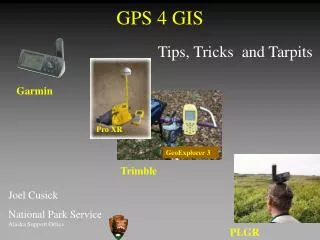
Overview of Goals for Project Focus on three items: • Learn to use a Garmin 62s GPS • Download a track and waypoints from GPS to ArcMap • Practice the cartography styling points we learned in class
Description of Process For this project, I have: • Marked a track with GPS and uploaded it into ArcGIS • Marked waypoints with GPS and uploaded into ArcGIS • Used the satellite world map as a baselayer to give the best view of the trail area
Mapping Waypoints and Track Using GPS This proved to be a great excuse to learn how to use a Garmin GPS. Covered a short stretch of trail from Sterling Point to Horseshoe Bar at Folsom Lake. Used "DNR GPS" from the Minnesota DNR to download waypoints and import into ArcMap. Worked well! Challenging part- realizing that "upload" referred to the GPS, not computer.
ArcGIS Layers Satellite imagery basemap, taken from ArcGIS Online and zoomed into the west side of Folsom Lake Track of path taken on the trail, downloaded with DNR GPS Waypoints of interesctions, named locations, or trail issues Challenge: Discovering what the Caution Exclamation on the waypoint and route layer referred to.
“Learning Experiences” Encountered THE WARNING ICON ArcMap displayed warning icons for waypoint and trackonly layers. The key to this: Go to File Analyze Map. It will show what errors have occurred. In this case, the coordinate systems do not match. The catch: A New Basemap was created. Changing it to a simple layer fixed the issue, as data loaded will generally become the same as the initial data loaded. Warning Icons
What I Learned.... • How to use a Garmin GPS to mark tracks and waypoints. • Atrack is something like a breadcrumb trail that can be followed back to the start. A route is something one marks before heading out, and follows as one hikes. • DNR GPS is awesome. It's free, and makes a simple chart for waypoints, etc from a Garmin GPS to load into ArcMap. • Refreshed the finer points of cartography styling. Satellite imagery of the trail worked well to give more interest to the map.