Download
1 / 13
130 likes | 251 Views
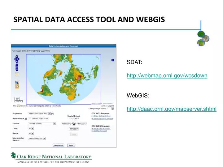
SDAT: http://webmap.ornl.gov/wcsdown WebGIS: http://daac.ornl.gov/mapserver.shtml. Spatial Data Access tool and WEBGIS. Challenges faced by data users. Geospatial data are: voluminous distributed highly heterogeneous Diversity in geospatial data discovery and access methods

E N D
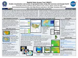
SDAT: http://webmap.ornl.gov/wcsdown WebGIS: http://daac.ornl.gov/mapserver.shtml Spatial Data Access tool and WEBGIS
Challenges faced by data users • Geospatial data are: • voluminous • distributed • highly heterogeneous • Diversity in geospatial data discovery and access methods • Complex geospatial problems need large quantities of geospatial data from multiple sources and locations
Challenges faced by data centers • Data Longevity – data lost because of incompatibility • Growing user community • more and more complexity and diversity • Heterogeneity of data centers’ services creates a barrier for the collaborations among them
New solutions needed! • Data centers need to find new solutions to • meet diverse users’ demands • reduce data loss • make full use of the geospatial data they manage • deliver same data sources to multiple users in multiple ways • We have tapped into the benefits offered by OGC standards
Data in ORNL DAAC • Data Types • Field Campaign Data: LBA, BOREAS, etc. • Land Validation Data: BigFoot, MODIS, etc. • Regional and Global Data: Climate, Soil, Vegetation, etc. • Statistics • Number of data sets: more than 800 • Number of data granules: ~220,000 • Total data volume: ~1.1TB • Variety of data formats: ASCII, binary, etc.
OGC Services • Contain services designed to store and provide access to geospatial data • It is the most important tier to the geospatial data visualization and delivery • Major standards: • Web Coverage Service (WCS) • Web Feature Service (WFS) • Web Map Service (WMS)
The ORNL WCS/WFS/WMS Servers • WCS • Version 1.0.0 • Customized geospatial coverage access: • Spatial/temporal/band subsetting • Reprojection/resampling • Reformatting: GeoTIFF, Arc/Info ASCII Grid, netCDF, NITF, and ERDAS Imagine • WFS • Version 1.0.0 • Read-only • WMS • Version 1.1.1 • Automatic color scheme generation • Popular image formats: PNG, JPEG, and GIF
Applications of the ORNL WCS/WFS/WMS servers • Support many OGC standards-compatible clients • Google Earth, NASA World Wind, OpenLayers, uDig, Quantum GIS, and ArcGIS. • Registered with several geospatial community registries: • GEOSS, NBII, ECHO, and GCMD
Examples of available data sets US Forest Biomass data accessed via uDig Atmospheric Nitrogen Deposition accessed from GEO Portal Global 1km SRTM DEM data accessed from spatial data access tool Amazon monthly rainfall maps for year 1972 accessed through Google Earth
OGC standards-based spatial data visualization and access tool • Help users to realize the benefits brought by the ORNL OGC servers • User friendly Web interface with rich functionalities • Interactive map widget • Time-series animation • Two levels of data organization: • Data set/data granule
Benefits • Combination of data visualization and access: • WCS with WMS • WFS with WMS • WMS-based KMZ files provided • Visualize in Google Earth • Can be integrated seamlessly with other systems currently deployed in ORNL DAAC • Links from Mercury catalog search result pages
WEBGIS • Provides a rich web based GIS environment • Allows for some basic GIS analysis capability • Can be built into a powerful decision support tool • We use a commercial WebGIS application from ESRI (ArcIMS and ArcSDE)