Download
1 / 40
400 likes | 544 Views
WATERSHEDS IN SOIL SURVEY JR. OPEN (integrated channels) vs. CLOSED (poorly integrated channels) HYDROSEQUENCE and/or TOPOSEQUENCE WATERSHED, DRAINAGE BASIN, CATCHMENT. Rationale.

E N D
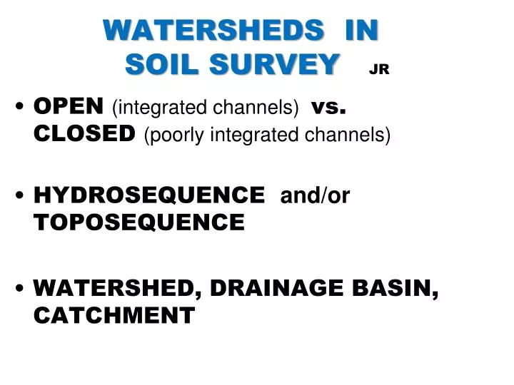
WATERSHEDS IN SOIL SURVEY JR • OPEN (integrated channels) vs. CLOSED (poorly integrated channels) • HYDROSEQUENCE and/or TOPOSEQUENCE • WATERSHED, DRAINAGE BASIN, CATCHMENT
Rationale • Internal landscape (soilscape) “drainage” is an important map-unit property (through vs. on) • Soil survey must consider and answer how water gets from the upland to a stream, pond, or wetland.
Objectives • Participants will be able to: • Recognize and define both open and restricted flow landscapes. • Recognize and define the hydrologic cycle and associated terms. • Explain water flow in landscapes via flow net diagrams. • Construct cross-sectional landscape that include stratigraphy, aquifers and aquitard.
Depressions vs. Watersheds Closed Depressions (restricted flow) vs. Open Depressions (integrated flow) Find the stream. Find the natural pond. Prairie Glacial Terrain Loess Covered Open System Ground Water Watershed can differ from surface water. Which landscape has salt problems and which has erosion problems?
Watersheds : Restricted Flow vs. Integrated Flow Ground Water Watershed & Catchment Classic Watershed & Catchment
DERANGED FLOW PATTERN ( “NONCONTRIBUTING AREA” CONCEPT ) ESTABLISH 2 MAPPING UNITS HERE!!!
Wetland with Deranged Flow (toward observer) Marsh Marigolds indicate ground water Discharge, therefore adjacent higher areas have Throughflow. 5
Saline Endoaquoll Leached Epiaquoll Calcareous Endoaquoll Wetlands are Windows to the Water Table. RECHARGE x FLOWTHROUGH DISCHARGE x 459 x 458 457 see Richardson et al. 1992 EQUIPOTENTIAL LINES 0.25m PONDS WITH NO STREAMS
DISCHARGE FLOWTHROUGH RECHARGE Cgkyz A A A A E Ag Btg Cg Cg Saline Calcareous Leached Saline Calcareous Leached EndoaqollEndoaquollEpiaquoll
Open System (cross-section) Wymore Otoe (WyC2) Pawnee Nodaway seasonal high water table Loess Till Alluvium Seasonal high water table based on soil morphology and field observations. Can you explain?
WATER TABLE and AQUIFERS (True or False ) 1. If the water table is at 60 feet, that’s how deep the well is! FALSE: A well is in an aquifer that must deliver much water in a short time. The water table has to be higher and exists in fine grained material. 2. When evapotranspiration exceeds the rainfall, water does not move to the ground water table. FALSE: Water from rain storms comes in short, high volume events. It infiltrates and is directed by the landscape. Depth of water penetration is a critical factor in soil development. 3. The surface of a semi-permanent pond or a permanent stream is a good measure of the water table at those points. TRUE.
HYDROLOGIC CYCLE CLOUDS ( condensation ) ET PRECIPITATION VAPOR RUNOFF ET ( evapotranspiration ) SOIL WATER WATER GROUND WATER
HORTON’S MODEL ( Divides water 3-ways ) Ei P = Ei + Ho + I +/- ∆Ss I Zone of Erosion No Sheet Erosion Ho (overland flow) Often Deposition
LANDSCAPE WATER FLOW I = infiltration P = precipitation Ho = surface runoff Tf = throughflow(= Tu + Ts) Ro = reflow Dp = deep water flow (ground water) P I Ho Tf TuTs Ro Ro = Reflow ( Return Flow ) Dp Tf can be saturated (Tu) or unsaturated (Ts).
INPUTS = OUTPUTS +/- STORAGEP + Ho + GW d = GW r + So + ET+ Storage Precipitation (P) Evapotranspiration(ET) Runoff (Ho) Surface Outflow (So) Infiltration Recharge Storage Storage Groundwater Discharge (GW d) Groundwater Recharge (GW r)
HILLSLOPE HYDROLOGY FACTS • Before a soil is saturated, only Tuoccurs (no Ho). • Most water flows laterally with slope. • Ei & ET are consumptive water losses in a watershed. • Dp is minor except in coarse sands. • ET is related to antecedent water quantity, vegetation type, wind, temperature, and relative humidity.
LANDSCAPE WATER FLOW P = Ei + Ho + I +/- ∆SsSurface I = Dp + Tf + ET +/- ∆SwInfiltrated Water • Tfmay fully saturate a soil. If throughflow (transient) water reaches the surface it “returns” and flows on it = Reflow (Ro). • Lateral water flow occurs because of porosity, roots, soil structure, desiccation cracks, freeze and thaw fractures, geologic stratigraphy, soil stratigraphy (e.g. Bt-horizons), anisotropy and geostatic pressures.
PHREATOPHYTES KARMAN model Qe/As=(ΔQ/As)+pcp/ra(es2-e2) +ΔΓ(1+rs/ra) Well or Piezometer e.g. PINES ALFALFA SALT CEDAR WILLOW COTTONWOOD SPARTINA GRASS ROOT zone vegetative pumping PLANTS THAT DRAW WATER FROM THE WATER TABLE. THEY CAN CREATE A WATER TABLE DEPRESSION.
ANISOTROPYFOSSTON SOLID WASTE AREA Kh is HORIZONTAL FLOW. Kv is VERTICAL FLOW. VFSL Kh = 1.2 x 10⁻³ SCL Kv = 1.5 x 10⁻⁷ CL Kh/Kv = 8000 FSL Slope is west, where is the largest potential for Contamination? At depth or north, south, or west.
ANISOTROPY Ex.: Aquitard / Aquifer / Aquitard Shale Ksat 0.1m/day SAND Ksat 2m/day Wet Drier Shale Ksat 0.1m/day SALINE SEEPS
Anisotropy Precipitation Inputs Elev. (ft) 332 325 318 Bx geostratigraphy pedostratigraphy EX. Missouri Restrictive Layer after Fig. 36 and 37 p. 56 and 57. fragipan (Gamble, 1993)
PARTIAL AREAof Saturation I = Tu + Ts + Ro + Dp + ET + / - Sw ONLY PART OF WATER- SHED THAT CONTRIBUTES WATER TO THE STREAM. Ro (reflow) Dunn and Black
Overland Flow and Throughflow :Convergent Landscapes Potential hydric soil zone Runoff Infiltration / Percolation Throughflow Pennock Richardson et al.
d2 h d2 h d2 h dH Q = + + Q = K dx2 dy2 dz2 dL FLOWNETS LaPlace’s Equation Darcy’s Law Recharge Zone Discharge Zone water table elevation equipotential lines flow lines
Coarse-textured Lenses. water table elevation • Homogeneous textures produce a uniform flownet. • Coarse textured lens “focus” discharge above the edge of it. • Most flow is within the lens Discharge
Fine-textured Lenses Discharge • Homogeneous textures produce a uniform flownet. • Fine textured lens “focus” discharge below or above it. • Little flow in lens Discharge
Effects of Layering (Anisotrophy) Layering favors lateral flow. K’s Equal K’s Unequal Flow Cross-sections K K 1 1 1 10 1 0.1 Downward movement is governed by the slowest layer and lateral flow is governed by the fastest layer.
Hummocky topography results in many local groundwater-flow systems. • Long, even slopes produce simple flow-systems • Choppy slopes of high relief produce complex flow-systems
Recharge Recharge Discharge HUMID Discharge Discharge Equipotential lines Recharge SUB-HUMID Flowthrough Discharge Recharge SEMI-ARID Recharge Recharge
discharge flowthrough recharge
Mollic Cumulic Cumulic Argiaquic Typic Endoaquent Endoaquoll Endoaquoll Argialboll Calciaquoll Bgk y Soil Process Recharge Flowthrough Discharge Edge Interior Interior Edge Interior OM + X X X Clay Transfer X Sediment + X X X Reworking X X Carbonation X X X X Salinization X X X Ag1 Agy E E Bk 2Cgkyz Agyz Ag2 Btg 2Cgky Jim Arndt
WET (POND) EDGE EFFECT Evaporite Sequence Wetland Edge Non-wetland EVAPORATIVE DISCHARGE ReductionSalinization Calcification Leaching A A A Bw A Bk Bkyzg Sulfides Sulfates CaCO3Removal After Steinwand and Richardson, 1989
Create slope profile: a. From topo map get lateral distance downslope. b. Mark elevation contours along the distance. c. Plot Distance and Elevations on graph paper. (need both a horizontal and vertical scale). d. Draw in surface shape.
Create slope profile: a. From topo map, get lateral distance downslope. b. Mark elevation contours along the distance. c. Plot distance and elevations on graph paper. (need both a horizontal and vertical scale). d. Draw in surface shape. Elev. 1425’ 1400’ 1350’ CI = 10 feet Dotted lines 5 feet Bold lines 50 feet. . 1300’ 1250’ 1200’ 0 200’ 400’ 600’ 800’ Distance
Exercise 1 Appanoose County Soil Ma9 Bellair Twp. Sec 36 933 222 312 211
EXERCISE 1 APPANOOSE COUNTY, IOWA CROSS-SECTION OF SEC. 36 BELLAIR TWP 211 312 222 hydric soil Btg E Bt Btgb SiL Clay 993 Very fine Bt or Btb
Soilscape APPANOOSE Co., IOWA Edina Albolls 211A Seymour Udolls 312B Clarinda Aquolls 222C Recharge Seep Discharge Loess Paleosol Aquitard Gara Udolls 993D Colo Complex Aquolls 13B Till Alluvium