Download
1 / 24
240 likes | 242 Views
Transportation Performance Measures. Aligning Policies and Performance Measures. Mark Yamarone Sr. Director – Long Range Planning LA Metro. About Pasadena. Source: Census Transportation Planning Package, ESRI, Strategic Economics. Land Use Framework.

E N D
Transportation Performance Measures Aligning Policies and Performance Measures Mark Yamarone Sr. Director – Long Range Planning LA Metro
About Pasadena Source: Census Transportation Planning Package, ESRI, Strategic Economics
Land Use Framework Land use decisions made in the 1994 and 2004 General Plan updates Developed a limited growth strategy that protected the historic neighborhoods that ring the Central District Resulted in walkable transit-oriented development (TOD) along the route of the Gold Line LRT service.
Guiding Principles Mobility Elem. Objectives Pasaden General Plan 2015 Target growth to Central District and transit/neighborhood villages Preserve historic character and environment Promote economic vitality A healthy family community A city where people can circulate without cars Cultural, scientific, corporate, entertainment and educational center for the region Community participation Commitment to public education Enhance livability Encourage walking, biking, transit, and other alternatives to motor vehicles Create a supportive climate for economic viability
Previous CEQA Thresholds • Intersection volume to capacity ratios and Level of Service (LOS) are the primary measures. • Volume-based analysis of change in traffic on street segments to assess impact.
Previous Mobility Metrics Land Use Impact Analysis • Intersection Level of Service (LOS) • Street Segment Impacts Transportation System Performance • Average Vehicle Ridership (AVR) – TRO Goal of 1.5 for regulated sites • Annual Transit Ridership • Green City Action Plan – Urban Environmental Accord Indicators • Arterials average travel time & speeds
What’s right with LOS as a CEQA metric? • Familiar • Responds to many people’s “hot button” issues • Established basis for funding and mitigation • Syncs up with other agencies 7
Why consider changes to using LOS? • Can’t effectively evaluate some options • Not-so-good reflection of people’s real experiences • May be producing unintended consequences • Not well-aligned with adopted policies • Not consistent with the vision of Land Use Element Update 8
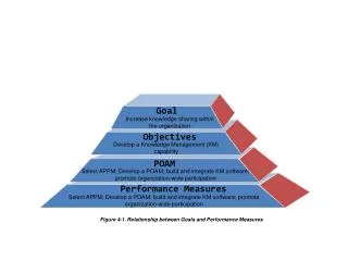
Transportation Performance Measures • The Pasadena Mobility Element Update focused on three main policy objectives, as refined from the 2004 General Plan and extensive community input: • Enhance livability • Encourage walking, biking, transit, and other alternatives to motor vehicles • Create a supportive climate for economic viability
Transportation Performance Measures Goals for the New Performance Measures: • The new measures needed to decrease the emphasis on the efficiency of auto travel relative to other modes. • Needed to address the manner in which people use and experience the transportation system.
Decreasing Emphasis Increasing Emphasis Aligning Metrics and Policies • Evaluating only street operations and traffic volume changes • Individual intersection performance • Level of Service • Mitigating only impacts to auto travel • Adding vehicular capacity via street widening • Reduce Greenhouse Gas • Vehicle Miles of Travel metrics • Elevating priorities for transit, pedestrian and bicycle travel • Enhance conditions for vulnerable users • Network performance • Travel time reliability • Speed management
Accessibility and Environmental Performance Pasadena’s New Metrics VMT per capita Vehicle Trips (VT) per capita Thresholds are existing citywide levels Promote Pedestrian, Bicycle and Transit Mobility
Transportation Impact Analysis Guidelines • Threshold for requiring Transportation Analysis • Adopted CEQA Metrics & Thresholds • Project Review Metrics & Caps (Non-CEQA) • Auto Level of Service (LOS) • Street Segment Analysis • Pedestrian Environmental Quality Index (PEQI) • Bicycle Environmental Quality Index (BEQI)
CEQA Advantages • Relatively high thresholds for study limits the burden on small projects • Streamlines the CEQA process for urban infill and TOD projects • Shifts the focus of analysis from traffic congestion to more holistic environmental impacts (air quality/GHG emission, urban sprawl considerations, etc.) • Allows for congestion to be considered outside the confines of CEQA
Thresholds for Determining Level of Transportation Review of Projects CEQA Analysis Outside of CEQA Analysis
Challenges - General • Learning curve/lack of practical experience • Unfamiliar to community and decision makers • Limited mitigation options • CMP still requires LOS analysis for certain facilities • People are still concerned with traffic congestion
Case Study - Medical Office Project Proposed Medical Offices in the East Pasadena • 224K Sq. Ft Medical Offices • VMT of 32.3 > 22.6 Impact • VT 3.0 > 2.8 Impact • Pedestrian Accessibility Impact Recommended Mix of Land uses to eliminate impacts • 200 Senior Citizen Housing and 200K Sq. Ft of Medical Offices
Recent EIRs Based on Modified Metrics • General Plan Land Use Element and Mobility Element Update FEIR • Rose Bowl Music and Arts Festival FEIR • 500-room Hotel near PCC FEIR • Bike Impact – mitigated through fair share contribution to planned bicycle facility • 150-room Hotel near Civic Center DEIR
Pasadena Travel Demand Model • Built on Southern California Association of Government’s (SCAG) regional model using TransCAD • On average, 10 Pasadena TAZs within 1 SCAG’s TAZ • 349 TAZs covering Pasadena and 139 TAZ’s covering sounding areas • 25 land-use types used in the model • Eight trip purposes used in the model • Staff uses the TransCad -model for +
Lessons Learned • VMT Metrics do not replace LOS 1:1 • Case studies comparing the two are not effective • VMT Metrics not reactive to projects consistent with plans • Align Metrics with adopted City Goals • “Planning for Gridlock” • Limited LOS analysis outside of CEQA effective for transition • Traffic intrusion • Traffic operations • Pedestrian/Bicycle conditions
Lessons Learned Good Fit for Pasadena Implementation Transportation Impact Fee already in place Updated to include bicycle and walking network Investment in forecasting model platform/process Linked to Land Management System Staff development to operate and update • Built-out City with In-Fill Opportunities • Metrics Support General Plan Goals and Policies • Emphasis on getting around without cars