Download
1 / 40
400 likes | 565 Views
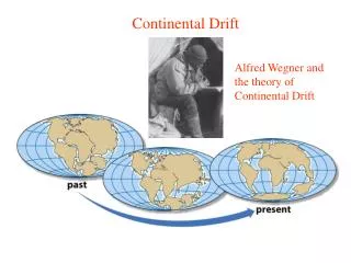
Continental Drift. Lyell proposed movement of continents to account for climate change evident in fossil record BUT did not change shape or position relative to each other. Continental Drift. Tyler proposed crustal changes to account for mountains and island chains. Continental Drift.

E N D
Continental Drift • Lyell proposed movement of continents to account for climate change evident in fossil record • BUT did not change shape or position relative to each other
Continental Drift • Tyler proposed crustal changes to account for mountains and island chains
Continental Drift • Tyler proposed crustal changes to account for mountains and island chains
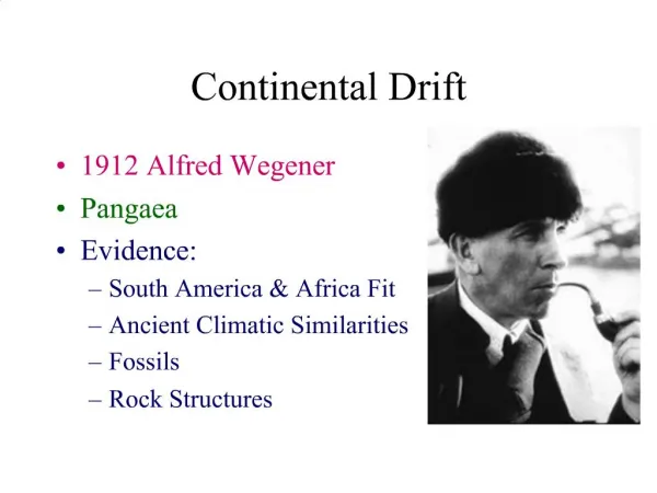
Continental Drift • Wegener • Observations • Alignment of mountains and rock strata matched on opposite sides of Atlantic • Glacial deposits displaced towards North Pole • Coal belt of N. Amer. and Europe suggested tropics
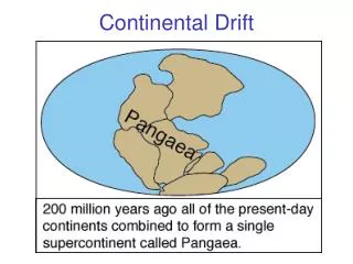
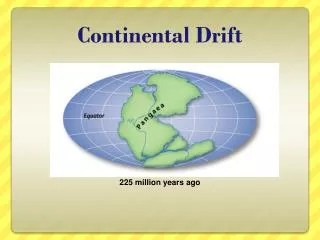
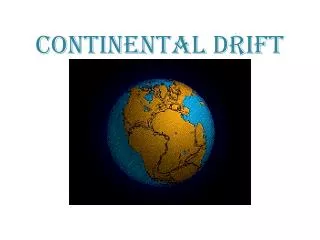
Continental Drift • Wegener’s conclusions • Continental rock, sial (silicon and Al) lighter than ocean floor (basalt), continents float on fluid mantle • Once a supercontinent, Pangaea, that broke into smaller plates • Breakup began as rift valley and widened into ocean
Continental Drift • Continental blocks (plates) retained their shape except where mountain building (can still join the plates now separated) • Movement of plates different • Radioactive heating from mantle causes plate movement
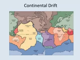
Late Supporting Evidence • Computer mapping fit continental shelf of continents together • Discovery of submarine volcanoes (guyouts) • Ocean floor is basalt and younger than continental rock (max. 150 mya vs. > 1 billion for continental rock) • Midoceanic ridge, continuous 65,000 km system on seafloor • Magnetic anomalies from differential deposition of magnetized rock
Age of islands relative To distance from rift zone
Drift and Life • 600 – 650 mya first multicellular life • 475 – 525 mya Cambrian explosion • 400 – 450 mya first life on land, including vertebrates and plants • ~360 mya first reptiles • 200 - 250 mya first mammals and birds
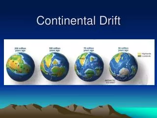
NA, N. Europe & Siberia eventually collide to form Laurasia Gondwanaland drifts north
Permian – time of great terrestrial and marine connectivity but were barriers – Central Pangaean Mtn. range; Pangaean Desert W. Asia and Europe collide – Ural Mtn.; other continents join to form Pangaea; East Asia isolated, Tethys Sea; One great ocean – Pathalassa
Break up of Pangaea • Formation of Pangaea brought together biota formerly isolated • Diversification of Pangaea and Pathalassa probably resulted from breakup (180 mya) by creating isolation • Breakup began when Turgai Sea expanded from Arctic to split Asia and Euramerica • Separation N. America and Europe by shallow “Atlantic Sea”
Break up of Pangaea • Tethys Seaway opened • Gulf of Mexico formed with separation of N. and S. America
N. America and Europe reconnect (Beringea landbridge) NA epicontinental sea
M and I separate; I moves toward Asia (collide ~60 mya); AU separates from Antarctica severing link to S. Amer. Many small plate collisions (65 – 2 mya)
Great American Interchange – reconnected NA and NT ~4 mya (last connected ~160 mya)
Epicontinental (Epeiric) Seas • Changes in continent location and sea levels • Formed barriers on terrestrial landscape • Australia divided into three parts in Cretaceous (50 mya) • North America – several epeiric seas – most recent ended ~65 mya • Europe and Asia separated by Turgai Sea until ~30 mya
Paleoclimate • Relative amount of land/ocean and distributions also influence solar radiation and temperature climate, winds, and currents • Example – warm circum-equitorial currents (Tethys Seaway) replaced by cold currents
Consequences of Plate Tectonics • Profound effects on both terrestrial and aquatic biota • Constant, albeit slow, change • Plates form, expand, merge, separate • Plates eliminated by subduction and consumed • Change shape • These dynamics allowed flow but also isolation through barriers
Effect of lowering sea level on marine diversity (loss of seas
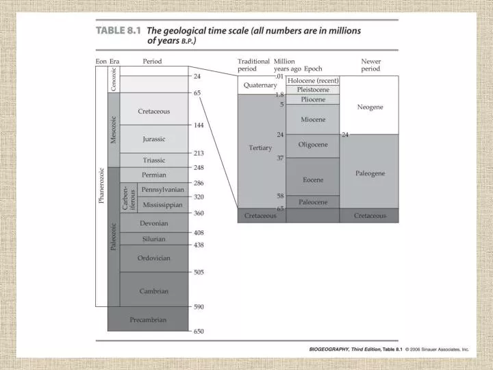
Boxes in this chapter rich with information. • Among most useful are Tables 8.2 and 8.3