Download
1 / 30
300 likes | 436 Views
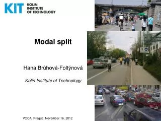
Impacts of planning instruments on suburbanisation and modal split in the Vienna Region Angelika WINKLER Municipal Department 18. Vienna Region Population Development 1991 - 2001. Increase. 0 to 3,9%. 4 to 9,9%. 10% or more. Decline. 0,1 to 9,9%. 10% or more. Airport. Modal Split.

E N D
Impacts of planning instruments on suburbanisation and modal split in the Vienna Region Angelika WINKLERMunicipal Department 18
Vienna RegionPopulation Development 1991 - 2001 Increase 0 to 3,9% 4 to 9,9% 10% or more Decline 0,1 to 9,9% 10% or more Airport
Modal Split Means of transport in Vienna, 2002
Proportion of Environmentally Friendly Transport Systems Commuters Viennese Population 35% 35% 65% 65% Public Transprt, Cycling, Pedestrian Individual Motoriesed Transport
Traffic in the Vienna RegionModal Split of Incoming Commuter Traffic bus rail car
criterea to influence the potential of a venue Free or restricted access by road, number and cost of parking spaces, Public transport Social strucure of local inhabitants Allocation of budgets for urban renewal Location of green spaces and recreation areas as soft factor
Transport and Traffic in Vienna Aim of the Modal Split % 100 share of trips made by private car 90 80 70 75 70 60 64 63 63 50 40 share of trips made by public transport, cycling or walking 30 20 10 0 1970 1990 2001 2010 2020
Vienna Masterplan Transportation 2003Main Emphasis of Action Rails and Roads for Europe! Safe Mobility: Vision Zero! no fatalities S-Bahn (Commuter Rail) plus! attractive public transport linking city and region Out of the Way There! re-use of public space Giant Cycle Traffic! great leap forward in improvement of cycling conditions Impulses to Urban Develoment by Metro! Fast Tramway Tangentials! attractive public transport at the periphery Systematised Mobility! Traffic & Mobility Management Stops only at Stops! systematic right of way for trams and busses Logistics Competence! high-quality freight transport and delivery
Public Transport in Vienna4th Phase of Main Public Transport Network Extension
Public Transport in ViennaCommuter Railway (S-Bahn) Network Mistelbach 2 7 3 1 80 Retz Tulln Gänserndorf Hausfeldstraße 50 Rekawinkel 40 45 15 Baden Flughafen Wolfsthal 60,65 Nickelsdorf Neusiedel/See 1, 3 Wiener Neustadt commuter railway lines local railway line to Baden
Funding - Comuter trains - Park&Ride facilities (in connection with comuting) - U-Bahn extension conventions between federal government and Vienna for a common development of the infrastructure for the stabilization of the efficiency and increase of the attractiveness of the area of Vienna Projects of Vienna for the stabilization of the efficiency and increase of the attractiveness of the area of Vienna - Tram extension
Twin City Concept Vienna - Bratislava Cooperation • international level(„Centrope-Region“), • regional level(„Vienna – Region“ = PGO-Raum) and • between Vienna and the neighbouring comunities;
Regional Highway Ring S 1 (Vösendorf – Korneuburg) A 22 (Korneuburg – Stockerau) S 5 (Stockerau – Jettsdorf) S 33 (Jettsdorf – St. Pölten) A 1 (St. Pölten – Knoten Steinhäusl) A 21 (Knoten Steinhäusl – Vösendorf)
Parking in Vienna 2004 ca. 640 cars per 1000 inhabitants 2020 ca. 780 – 840 cars /1000 inhabitants
Parking in Vienna Cars per districts 1994-2004 14 % 9 % 11 % 16 % 11 % 12 % 5 % 11 % 8 %
Park & Ride 2004 Park & Ride planned (6.770 spaces, in coordination with subway expansion) Park & Ride in operation (4.929 spaces) Parking space management
Parking in ViennaParking Spaces per 100 Residents in the Inner Districts on streets in commercial garages on private ground
Parking Management in Vienna since 1 July 1999 U1 U3 U2 since 1 July 1999 Demand-oriented selective or general extension of parking management 3rd district: since 2 November 1999 U4 Demand-oriented selective or general extension of parking management U6 1st district districts 4-9 2nd and 20th districts Monday - Friday 9am-8pm Monday-Friday 9am-7pm Monday- Friday 9am- 8pm max. parking time: 1.5 hrs max. parking time: 2.0 hrs max. parking time: 2.0 hrs since 1 July 1993 districts 6 - 9 since 1 August 1995 since 1 March 1999 districts 4 - 5 since 2 June 1997 • Annual increases in car traffic, population growth and urban expansion require a new traffic and transport concept • Co-operating with more than 70 local initiatives and NGOs to define fundamental aims for environmentally sound mobility solutions • Systematically integrating the local population’s ideas in planning and administration • Promoting public transport and strict parking space management
Parking in ViennaParking Regulations at the Inner Districts Impacts Reduction of occupancy of on-street parking space even in the late evening and during the night Significant reduction of parking violations Reduction of time spent for searching vacant parking space Reduction of total car traffic volume A significant shift of car commuters to public transport Increasing occupancy of commercial garages Additional funds for promotion of garage construction and improvement of public transport
Effects of Parking Regulations in the Inner DistrictsReduction of Parking Violations
Length of the Network in 2005 1000 km until 2005 This means an increase of the length of the network: 5 times more than 1986 .
Cycling Increasing up to 6 – 8 % coverage of the whole area dense network of cycling lanes good links to public transport terminals (Bike & Ride) especially in urban development zones. additional measures for increasing the comfort
Cycling Counting 3500 16,89% 16,16% 3041 2910 3000 2500
outlook on further extensions of traffic infrastructur and definition of potential areas in Vienna • Subway extensions • Roads with high capacity • Others
Angelika Winkler Contact: 43 1 4000 88841 Wia@m18magwien.gv.at