Download
1 / 48
480 likes | 485 Views
Learn about the motion of the ocean, including surface currents, wind patterns, and the formation of waves. Discover the impact of wind on ocean currents and the different types of waves.

E N D
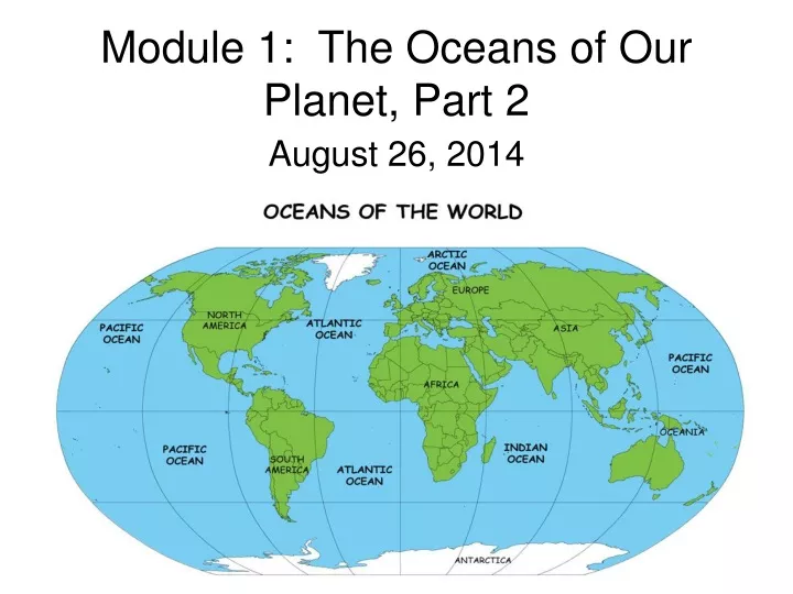
Module 1: The Oceans of Our Planet, Part 2 August 26, 2014
Class Fees Lab Fees --- $15.00 4-H membership fee ---- $1.00 You will need to fill out a Cross county forms if you live outside of Sarasota County.
It’s an Earthquake Song http://youtu.be/sA6oZ4YgKCA
Quiz • Identify all the Oceans • Identify all the Continents • Label where main the Mid-Ocean Ridges are. • Label where the Ocean Trenches are.
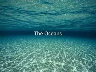
The Motion of the Ocean • The strongest motion in the ocean is at its surface and is made up of surface currents and waves. • Ocean surface currents are in regions where winds regularly blow over the ocean in a reasonable constant direction and velocity, pushing the water along. • Surface currents, then, are large, horizontal movements of water molecules being pushed by the winds above them.
The winds in our atmosphere result from temperature differences caused by heat from the sun. • The heat is the strongest at the equator, and weakest at the North and South poles.
To understand wind patterns, consider cold air near the surface of the earth at the North Pole. The air will move from the North Pole toward the equator, to even out the temperature differences. • As it makes its way there, however, it encounters warmer climates. This warms up the air, causing it to rise.
When the air makes it to the 60 degree N latitude, it becomes so warm that it rises into the upper atmosphere and begins moving back toward the North Pole. • This sets up a loop of winds that travel continuously from the Pole to a latitude of about 60 degrees North and back again.
Now look at the equator. We see the exact opposite effect. As the warm air rises, it starts traveling back to the poles. • At a latitude of about 30 degrees North, it cools down enough to sink and begin traveling back toward the equator. • From the equator there is also a loop of winds that travel to a latitude of about 30 degrees North and then turn around and come back again.
In the middle of these two loops of wind (between 30 degrees and 60 degrees) there is a third loop that occurs as a reaction to these two loops. These winds are represented in brown in Figure 1.14 on page 21.
Coriolis Effect • The winds moving toward the equator curve in a direction opposite of the rotation of the earth. • The way in which the rotation of the earth bends the path of winds and resulting sea currents
Because of the Coriolis effect, these winds bend west (opposite the rotation of the earth) and approach the equator at a 45 degree angle. These winds Are called Trade Winds.
Westerlies • Farther away from the equator the winds near the surface of the earth (between 30 degrees and 60 degrees) are bent opposite the Trade Winds because they are traveling away from the equator instead of toward it. • The Coriolis efffect causes them to bend in the opposite way. These winds are called Westerlies.
Polar Easterlies The northernmost and southernmost winds are called the polar easterlies and are the most variable winds of all. They curve in the same direction as the Trade Winds, since they once again move toward the equator near the surface of the earth.
Think about what you know about how the currents flow…. For example: Can you begin to understand why the gulf stream “current” flows in the direction that it does?
Currents • Now all these major wind fields in the atmosphere push against the ocean surface and create currents. • All the major currents of the open ocean are driven by the wind. • As the wind moves across the water it forces the surface currents to move at a 45 degree angle from the wind direction.
Gyres • Large, mostly circular systems of surface currents driven by the wind. • As water gets “pushed around” all over the world, large surface currents result in a circular pattern.
Modeling Dynamic Surface Ocean Currents –NOAA Model • http://youtu.be/_vAp1c6m8Sk
Ocean Currents Song http://youtu.be/NsdH_NRM-CU
Waves Water molecules move in a circle. See Figure 1.17 (Waves forming at the Shoreline). A boat will move up and down as the waves pass by as the crests of the waves came by. That’s because waves carry energy across the sea surface. They do not actually transport water. As the boat moves up and down with the individual water molecules, the energy contined past.
There are waves of all sizes and shapes rolling into the beach at any given time. If they’re not stopped by anything, waves can travel across entire ocean basins and so the waves at your beach might be from a storm half a world away……..
The most familiar ocean waves are caused by the wind. These are wind-driven waves. This sort of motion is set up anytime two fluids rub together, and remember that the atmosphere is essentially fluid.
Waves caused by underwater disturbances such as earthquakes, landslides, or volcanic eruptions are called tsunamis. These waves are typically tens to hundreds of kilometers long. The gravitational pull of the sun and moon on the earth causes the tides which are actually tidal waves.
crest-the very top of the wave trough-the hollow between two crests wave height-the vertical distance between the top of one wave crest and the bottom of the next trough wavelength-the horizontal distance between any one point on one wave and the corresponding point on the next
Spring and Neap Tide Song • http://youtu.be/KFYf_it461s
Vertical Motion of the Thermoclines: Experiment 1.A Supplies: • Fish Tank filled with water • Pitcher of Cold water • Food dye Introduction: • To observe the upturning of the water when colder water is introduced to the tank.
Proceedure: • Fill tank with cold water ¾ full. • Add food dye to warm water. • Observe the water movement. Observations: Conclusion:
Homework • Class Challenge: Pet Photography • Study for Quiz on Currents • Read Module 1 Pages 20 – 28 • Answer OYO Questions: 1.10 – 1.15 • Answer Study Guide Questions: define j – o and 10 – 17 • Complete Lab Book • Take Module 1 Test