Download
1 / 28
280 likes | 395 Views
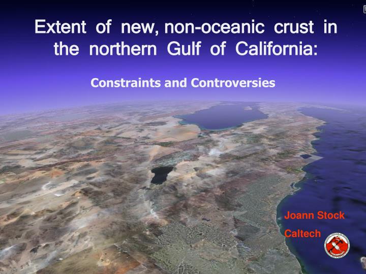
Extent of new, non-oceanic crust in the northern Gulf of California:. Constraints and Controversies. Joann Stock Caltech. Key structural characteristics of the N Gulf of California & Salton Trough. (simplified).

E N D
Extent of new, non-oceanic crust in the northern Gulf of California: Constraints and Controversies Joann Stock Caltech
Key structural characteristics of the N Gulf of California & Salton Trough (simplified) • Similar amounts of net plate displacement (post-6 Ma) from N to S (pole of opening far away, and mainly a transform boundary); ~300 km in northern basins and Guaymas Basin • Oceanic crust present in different amounts in different basins; not simply related to the net amount of extension • Extension is less localized in the N Gulf basins, despite similar amounts of plate boundary displacement to the N and to the S
Q. What is the difference between “oceanic” and “non-oceanic” new crust? • Thickness; density; magnetic anomalies; pattern of active deformation & volcanism. i.e., transitional crust • B. Origin: crustal area formed by some process other than localized seafloor spreading; needs to be accounted for & removed in order to reconstruct the pre-rift configuration
Unusual characteristics of N Gulf Basins • Too thick for typical oceanic crust • Gravity modeling – density too low (not enough basalt in it) • Shallow layers are mostly sediments – not much magma, no pillow basalts • No lineated magnetic anomalies typical of oceanic crust • Lower crustal Vp is slow (compared to oceanic profiles)
Use the geological constraints of the conjugate rifted margins Volcanic & sedimentary stratigraphy of the margins of the Upper Delfin Basin
Volcanic sequences of the region Tuffs of Los Heme 3.3-2.7 Ma Tuffs of the Northern Puertecitos Volcanic Province 6.4-6.1 Ma Tuff of San Felipe 12.5 Ma Before 6.1 Ma, all volcanic rocks deposited on land – no evidence for ocean here
Paleomagnetic remanence directions clockwise rotations of fault blocks in Baja California Vector típico para el mioceno All of the vectors point SW and slightly up; the tuff became magnetized during a field excursion or a field transition of the earth’s magnetic field.
Red & black dots: regions of outcrops of the ca. 12.5 Ma Tuff of San Felipe
Conjugate margins of a single basin system (Upper Delfin) Tiepoints Tiepoints J. Stock
Summary reconstructions: 255 +/- 10 km opening of the Upper Delfin Basin, Gulf of California, since 6.1 Ma (purple color) Almost everything in between the modern coastlines would be post-6.1 Ma new crustal area!! This figure is from Mike Oskin; published in Oskin & Stock GSAB 2003
Rift margin geology tight constraints on timing & amount of rifting Does this result agree with other data sets? J. Stock
Gonzalez-Fernandez et al., JGR 2005 – Proyecto Cortes seismic line (refraction and wide-angle reflection using OBS and on-land stations) Transect across the Upper Delfin Basin – Upper Tiburon basin segment (slightly oblique to opening direction) South Coast Geological Society
Proyecto Cortes transect gravity seismic ray paths Crustal structure model Upper Delfin Basin Upper Tiburon Basin From Gonzalez-Fernandez et al., JGR 2005
Magmatic rift; crust 7-8 km thick Wide, amagmatic; crust 5.5 km thick Segment includes Rivera plate; crust 5 km thick South Coast Geological Society Arrows are continent-ocean transition (from Lizarralde et al., 2007)
MODELS OF TRANSITIONAL CRUST IN RIFT SYSTEMS N. Gulf of California model
Comparison of the geophysical profiles from Gonzalez-Fernandez and Lizarralde New Salton Trough figure (Rymer) Old Salton Trough density interpretation (Fuis et al) J. Stock
Schmitt & Vazquez (EPSL, 2006) model for formation of transitional crust in the Salton Trough
Analogous regions? Northern Ross Sea, Antarctica: Tertiary spreading system between E and W Antarctica (Adare Trough) trends into Northern Basin (NB) Japan Sea – distributed extension connected to ~200 km of dextral offset on Yangsan fault J. Stock
PLATE BOUNDARY SLIP BUDGET vs. GEOLOGICAL OFFSETS Geological offset compared to PAC-NA plate motion since 6 Ma (Oskin &Stock GSAB 2003)
Net percent of extension can be extremely difficult to estimate using seismic stratigraphy in highly extended basins From Reston, Geology 2007 J. Stock
Delfin Basin Tiburon Basin From Aragon-Arreola 2006 PhD thesis (CICESE); interpretation of PEMEX MCS data set • Condensed section on inter-basin high • Old rift sediments preserved at drillable depths (< 3 sec TWTT) • Rift basement accessible to drilling on inter-basin high
Timing & Geometry of Marine Deposition • Earliest marine sedimentary rocks ca. 7 Ma near Santa Rosalia, 6 to 6.5 Ma near San Felipe • Reports of older (middle Miocene) microfossils in cutting from PEMEX drill holes in the N. Gulf (Helenes and Carreno) • PEMEX seismic sections (Aragon-Arreola et al.) show older, abandoned basins to the E in many segments; basins have “jumped” westward
West (Baja California) Some faulting starts around 12 Ma Time of initiation of faulting varies from place to place Rotations about vertical axes are very important in NE Baja California Change from orthogonal (“Protogulf stage”) to oblique transtension ca. 6 Ma in many models (e.g. Umhoefer et al. GSAB 2002) East (Sonora to Sinaloa to Nayarit) Core complexes e.g. 20-17 Ma Sierra Mazatan Regional tilting of pre- and post-12.5 Ma units, in coastal Sonora Faulting < 20 Ma in coastal Sinaloa Normal faulting 17-10 Ma in Nayarit (S. Gulf) (see Ferrari et al. 2005 Bol Soc Geol Mex) Timing of Faulting
Important results • Nearly all of the submarine region of the N Gulf basins may be new crustal area (non-oceanic) • Timing of formation of the “new” crust agrees well with the plate motions but not with some microfossil stratigraphy • The type & amount of “new” crust varies in different segments of the plate boundary -- not systematic • Useful to keep in mind when interpreting other rift systems